Dangerous blizzard conditions over East Coast, risk of 50+ cm by Saturday
Conditions will continue to worsen over parts of Atlantic Canada through Friday, as a major winter storm brings heavy snow and blizzard-like conditions
A major winter storm hitting parts of the East Coast will make for some pretty nasty conditions through the day on Friday, as heavy snow and powerful winds continue to hit.
Near-impossible travel is expected amid the blizzard-like conditions and snow-covered roads. As much as 50+ cm of snow is possible for parts of Newfoundland by the end of the storm, with between 10-25 cm likely for much of Cape Breton.
Things will be quite unpleasant, and drivers are being urged to postpone any non-essential travel until conditions improve.
PHOTOS: Blizzard conditions blast Newfoundland
This storm arrives less than a week after another impactful storm hit Atlantic Canada, knocking out power to hundreds of thousands of homes and businesses across the Maritimes.
While that earlier storm featured unseasonably warm air, the current system roaring over the region has enough cold air to pack a wintry punch. That's after 100-200+ mm of record rains hit the region through Thursday.
Friday: Blizzard conditions continue raging
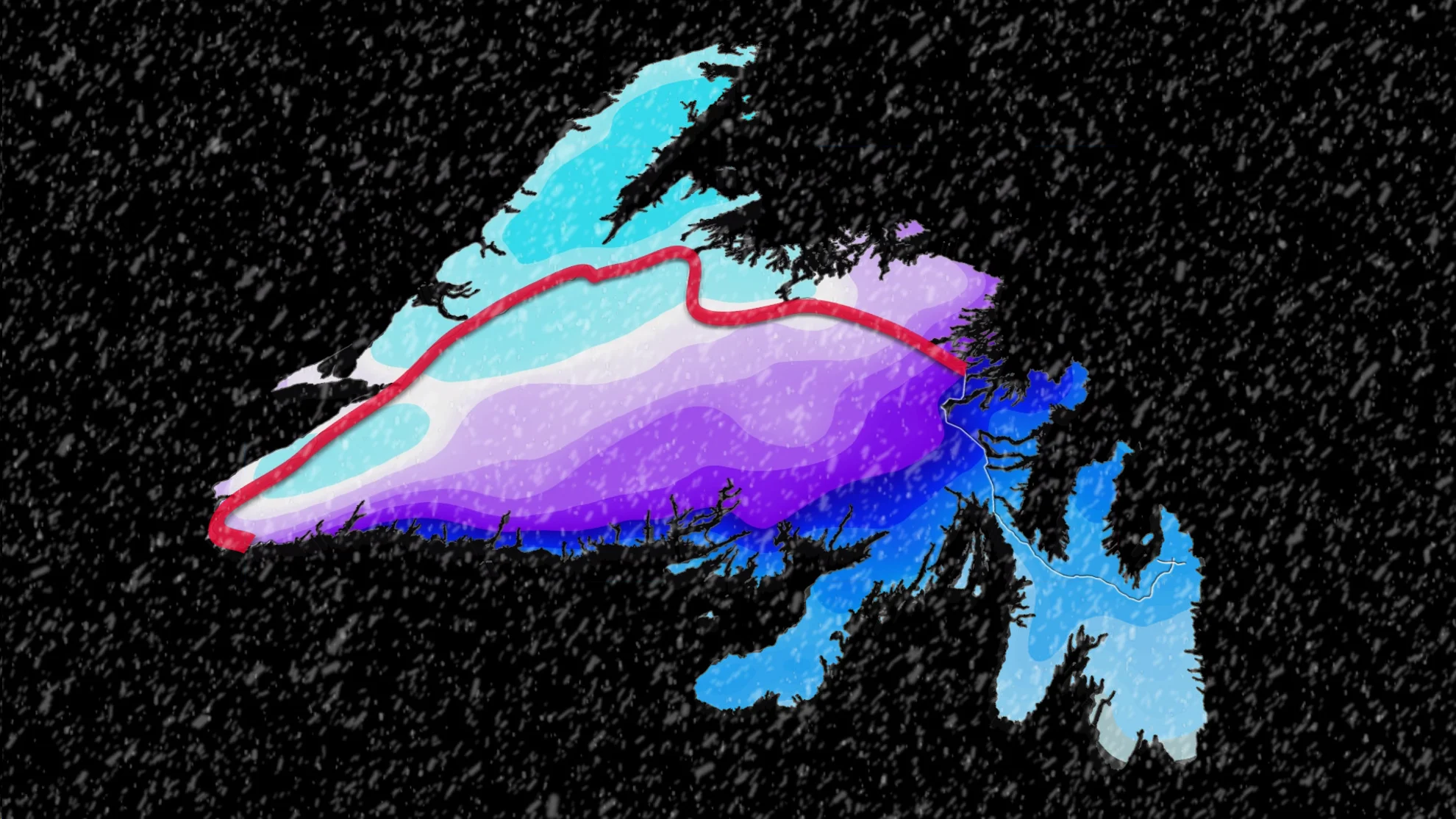
Powerful winds and heavy snowfall will lead to blizzard conditions through the remainder of the storm, with the highest snow totals and longest spell of near-zero visibility focusing on western Newfoundland and Nova Scotia’s Cape Breton.
WINTER 2024: El Niño will play a critical role in the weeks ahead
High snowfall rates will continue Friday before they start to ease for western Newfoundland later in the day. These high snowfall rates will be accompanied by strong wind gusts that will create blizzard conditions for many areas.
Wind gusts will be strongest along coastal areas, with gusts between 80-90 km/h expected. Inland, gusts will be closer to 50-80 km/h -- quite unpleasant for today.

Travel will be especially treacherous along the Trans-Canada Highway from Port aux Basque to Gander with ongoing whiteout conditions hitting there.
As the system moves east throughout the day, conditions will gradually improve for western Newfoundland, before ending late this evening.
Through this event, between 30-60+ cm of snow is on the table for western Newfoundland, with 15-30 cm for central Newfoundland, and less than 5 cm for the Avalon. Between 10-25 cm is expected for much of Cape Breton.
Charlottetown, P.E.I. has the potential to receive a couple of centimetres, as well.

Saturday: Conditions finally improve just before Christmas Eve
By Saturday morning, all precipitation is out of Atlantic Canada, finally ending a five day affair of multiple systems that brought heavy snow, drenching rain, and widespread wind gusts that just didn't let up since Monday.
Burgeo recorded its second wettest day on record, with 150.7 mm recorded on Wednesday and a storm total around 250 mm. For perspective, the wettest day ever recorded was during the remnants of Hurricane Matthew in October of 2016.

Fair weather and milder temperatures are in the cards for Christmas Eve and Christmas Day across the Maritimes, with temperatures in the middle to upper single digits. Readings will remain closer to seasonal across Newfoundland.
Stay with The Weather Network for the latest forecast as you plan your holiday weekend.