Strong winds and hail: Severe thunderstorm threat ends the week in Ontario
Back-to-back days of thunderstorm risk will reach its peak on Friday, with widespread rainfall and severe storm potential spreading across southern Ontario
As we near the final weekend of April, and inch even closer to the summer season, the thunderstorm risk is growing across parts of southern Ontario.
The multi-day threat began on Wednesday, with isolated storm chances reappearing again on Thursday. The peak of the threat will be on Friday, with a greater opportunity for thunderstorms to surface, and a chance for some to reach severe criteria across parts of the region. Strong winds, and large hail will be the main risks involved.
DON'T MISS: Summer sneak peek: Canada's warm season goes on cruise control
It's important to stay alert on the weather watches and warnings in your area, and remember, when 'thunder roars, go indoors'. You should always seek shelter indoors immediately when you hear thunder, as it signifies that lightning is nearby.
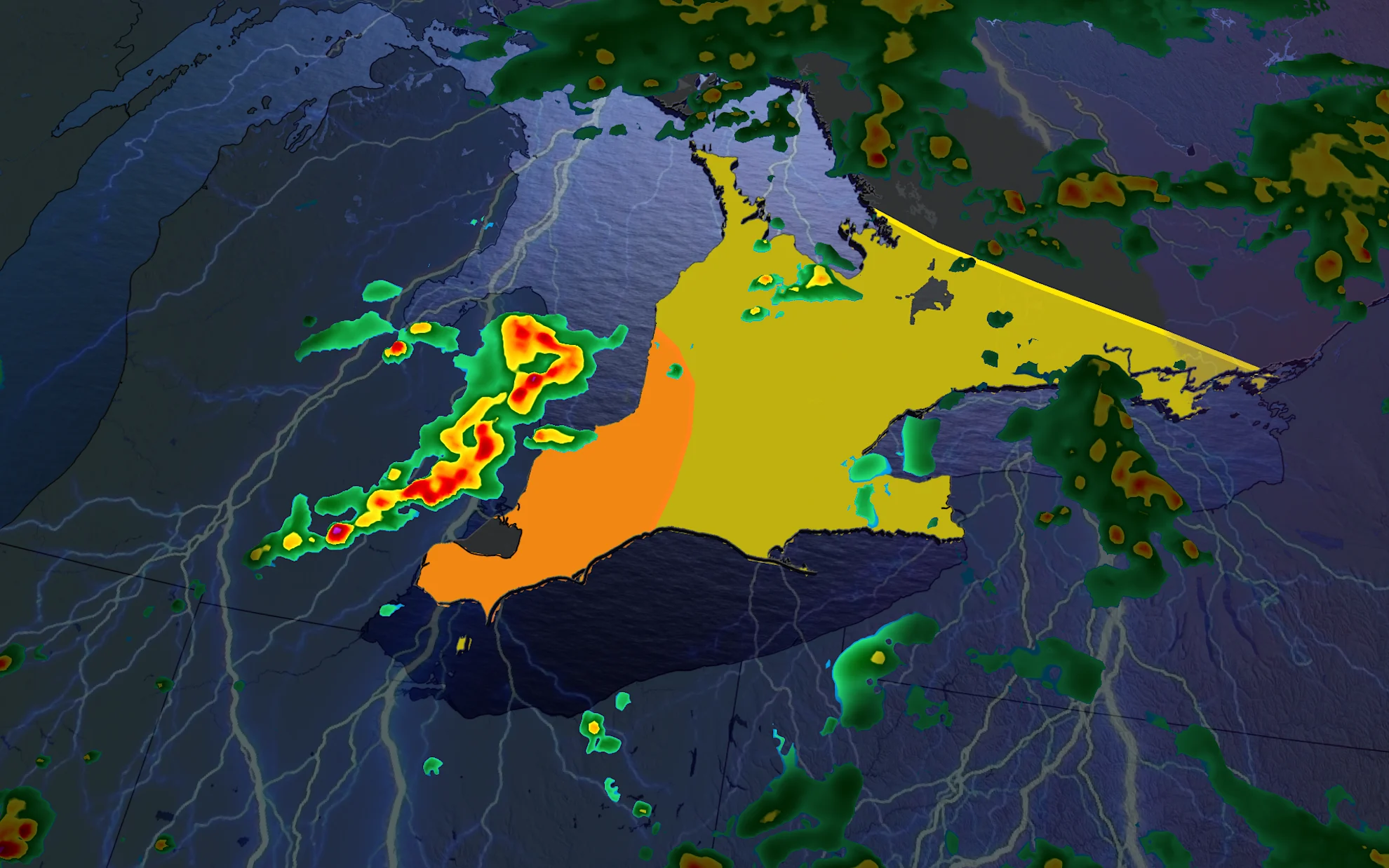
Another thunderstorm risk spans parts of southern Ontario Thursday
A few areas of weak instability could trigger isolated thunderstorms Thursday.

A weakened system from the Prairies will move through Ontario, triggering rain and possibly some thunder, as well. These storms will form off of Lake Huron and Georgian Bay, extending east into the Greater Toronto Area (GTA), and into Ottawa, as well.
It'll be a very warm day across the south with daytime highs in the 20s lifting into the GTA, and even surpassing the 25-degree mark across parts of the southwest.
RELATED: Why lake breezes could be stealing some 20°C spring days in parts of Ontario
Thursday's storm risk, similar to Wednesday's, will be very isolated, and there's some uncertainty in development with weaker storm triggers present.
Severe storm threat for Friday
A strengthening stateside system will move in on Friday, lifting in a large warm, and unstable air mass.

Widespread rain is expected across much of the Great Lakes region, with a thunderstorm potential spanning southern Ontario, including the GTA.
DON'T MISS: Get to know the hidden gems across Canada
Some severe storms are possible by the late afternoon and evening hours as the cold front tracks into Windsor and Sarnia, but there is still some uncertainty at this time.

Large hail and strong wind gusts will be the main threats with storms that develop, with heavy rain spreading across parts of cottage country and into eastern Ontario.
A widespread 10-20 mm of rain is forecast into Saturday, with up to 50 mm in some of the harder-hit areas that see storms.

Be sure to check back for the latest forecast updates and stay alert to the changing conditions in your area if and when storms hit.