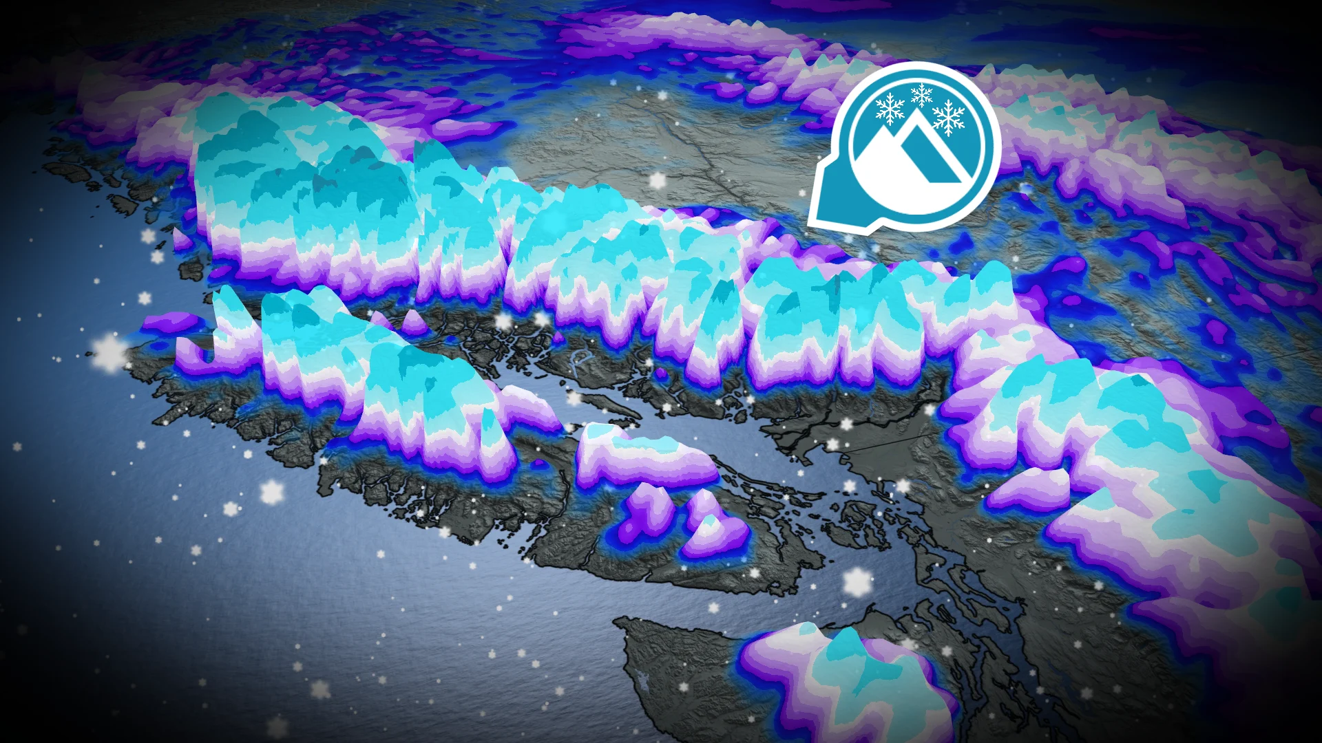
Cooler pattern in B.C. could yield 100+ cm of alpine snow for some
An incoming bout of alpine snow will be good news for B.C. ski resorts ahead of the holiday season, but it will come with travel trouble and a raised avalanche threat
No rest for B.C. as another round of significant alpine snow is coming, likely to result in hazardous winter highway pass travel on Thursday, alongside a raised avalanche threat.
Some of the mountain passes could see 30-100+ cm of snow through Friday, most welcome for ski resorts with the holidays just around the corner. However, motorists should check for updates before travelling as road conditions will be poor and difficult to navigate.
DON'T MISS: New database tracks every Canadian avalanche fatality since 1782
In addition, avalanche risks are elevated. Travel in avalanche terrain is not advised in the coming days.
Avalanche risk raised with new bout of alpine snow
A cooler pattern is taking place, with freezing levels below 1000 metres for the rest of the week, potentially through the holidays, too.
RELATED: Evacuation orders downgraded in Abbotsford; rain, wind warnings persist in B.C.

Significant alpine snowfall is forecast Thursday with the next round of moisture and colder air in place.
Heavy snowfall Thursday morning for the Coast Mountains. Snow will intensify in the Interior as the storm moves east by the afternoon.
A persistent, onshore flow will continue heavy snowfall for the Coast Mountains through Friday, with high totals possible there.

Heavy highway pass snowfall may bring winter travel concerns Coquihalla, Allison and Rogers passes once again.
This week, alpine snow could exceed 100 cm for Whistler and Coast Mountains, and reach 30-50 cm for the Vancouver Island, Kootenays and Columbia Mountain ranges.
As a result expect travel to be challenging. Road closures are possible. Weather in the mountains can change suddenly resulting in hazardous driving conditions.
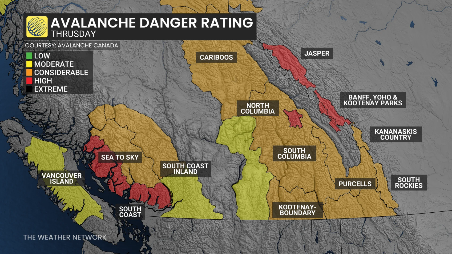
As well, the alpine snow means an increased risk for unstable slabs and avalanches for the Coast Mountains on Thursday.
Active pattern continues through Christmas week
A major pattern change is underway with temperatures trending closer to seasonal, and even on the cool side of seasonal (but not frigid) for the rest of December.
However, the active storm track will continue, but with colder temperatures aloft, the South Coast mountains will see some phenomenal amounts of snow during the next one to two weeks, especially for the alpine regions. But, ski areas will get an abundance of desperately needed snow.