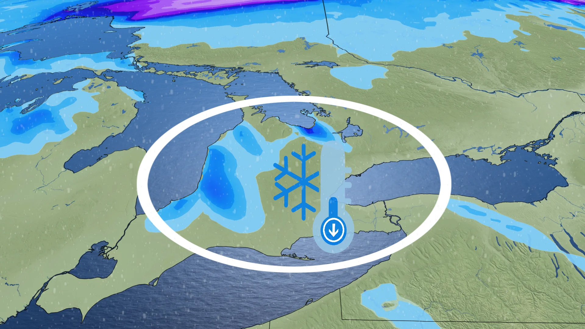
Cold air to ignite lake-effect snow machine in southern Ontario

Similar to its northern counterpart, southern Ontario is set for an abrupt shift in temperatures with a frosty air mass moving in--setting up lake-effect snow for early next week
If you have plans to put up outdoor holiday decorations around your property, this weekend will be the time to do so in southern Ontario.
Next week will be much colder than it has been recently, and it will come as a bit of a shock to the system as daytime highs plummet to the single digits.
SEE ALSO: What this record-breaking jet stream may mean for Canada's winter
With the frosty air mass moving in, that means a round of lake-effect snow bands on Monday and Tuesday for some of the snowbelt regions near Lake Huron and Georgian Bay.
The snowfall event, while expected to be short in duration, may catch many drivers off guard, especially for those who haven't put their winter tires on. Travelling will be hindered in areas that see snow and gusty winds.
Lake-effect snow arrives Monday with cold air
November has been an exceptionally warm month across southern Ontario. Only six of the last 21 days had high temperatures in the single digits, yet these values were still at or even slightly above seasonal.
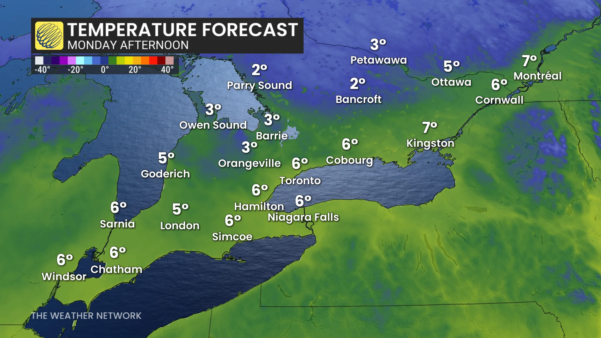
Overnight lows hit zero for the first time this season around mid-November, and that, too, was later than usual. Since then, temperatures shot right back up into the mid-to-upper teens.
DON'T MISS: El Niño, climate change made October the world’s warmest on record
It was nice while it lasted!
A sharp cold front sweeps across southern Ontario Sunday night through Monday.
High temperatures continue to fall through Monday afternoon, with single-digit highs across southern Ontario.
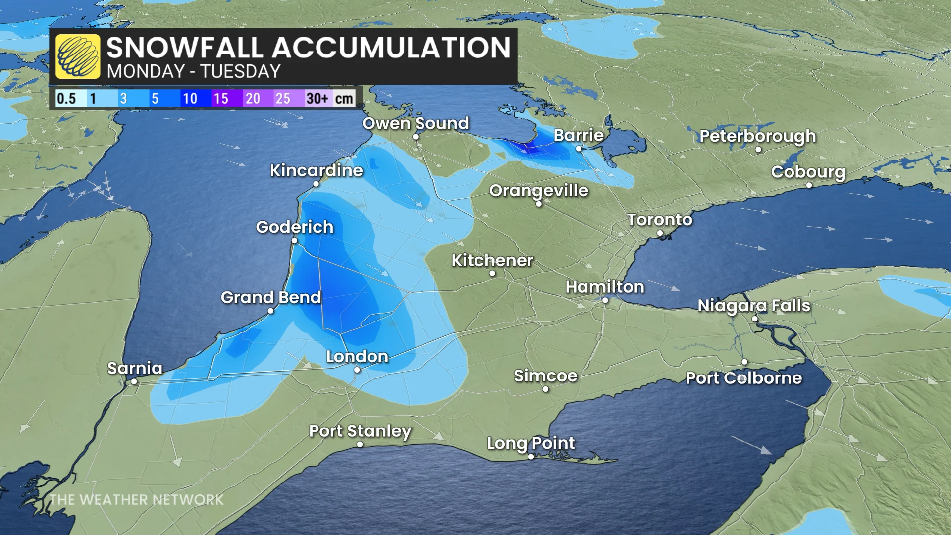
Cooler temperatures and northwesterly winds moving in mean lake-effect snow for the snowbelts.
Areas just downwind of Georgian Bay and Lake Huron can expect lake-effect snow to kick off on Monday evening, persisting through Tuesday. There could be a couple of brief, intense bursts Monday overnight into early Tuesday.
A few flakes are possible in the Greater Toronto Area (GTA) Monday night, but no accumulations are expected.
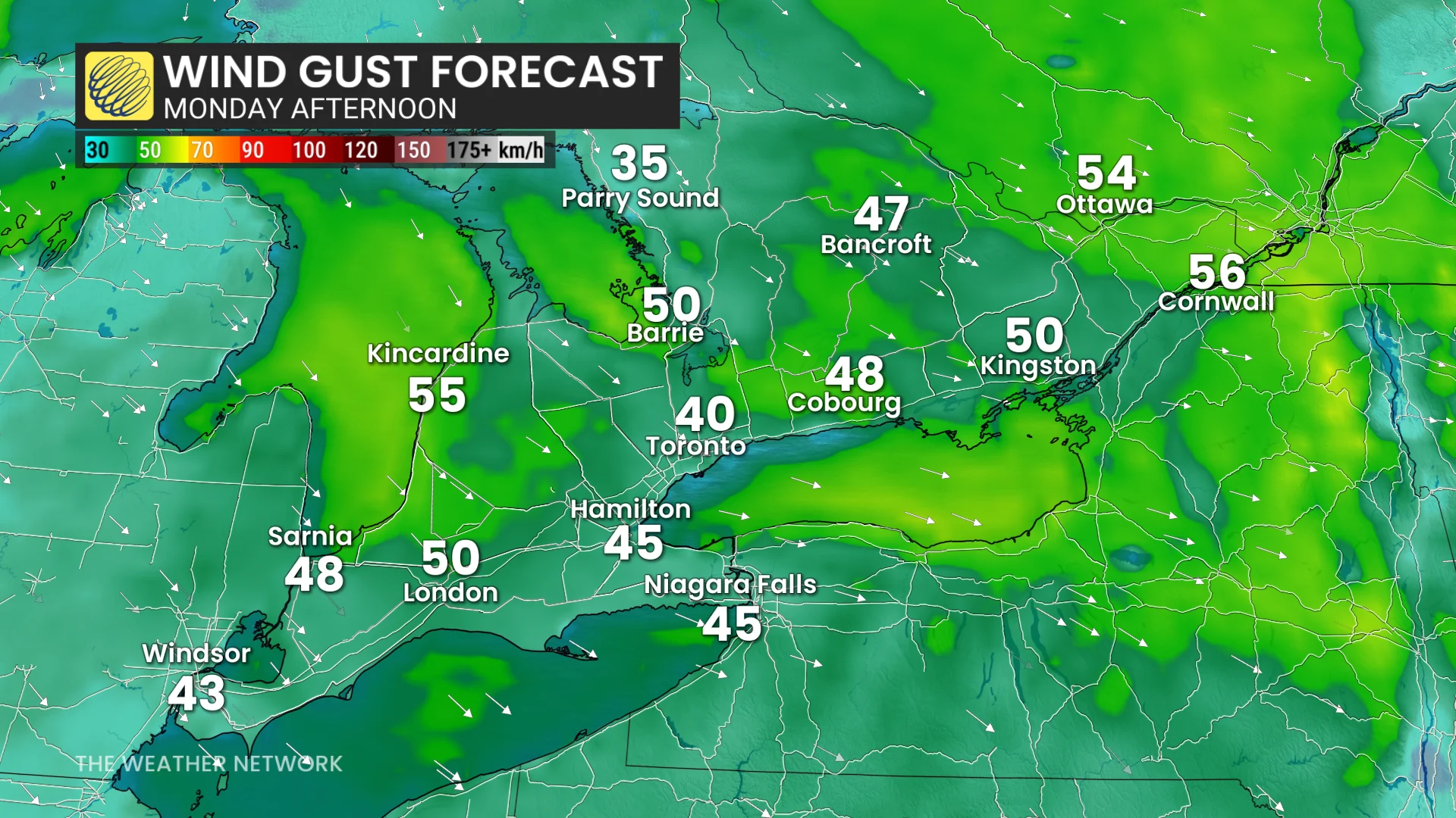
Anyone travelling in the snowbelts should be cautious as they head out, as gusty, northwesterly winds (40-50 km/h) could reduce visibility in snowfall.
By the end of the week and into next weekend, high temperatures will be slightly below seasonal. Toronto’s seasonal high is around 5 or 6 degrees.
Stay with The Weather Network for more information and updates on your forecast across Ontario.