Multiple rounds of snow headed for southern Ontario this week
The air won’t feel very spring-like across Ontario this week even as astronomical spring arrives
The vernal equinox will arrive on Tuesday to find Ontarians wearing their winter coats.
A pattern change in progress over the Great Lakes swept away our spring-like comfort and replaced it with cooler temperatures and several opportunities for snow.
Bands of heavy snow may lead to travel impacts across southern Ontario at times over the next couple of days.

DON'T MISS: Canada's spring gets sidelined as winter fights back for start of the season
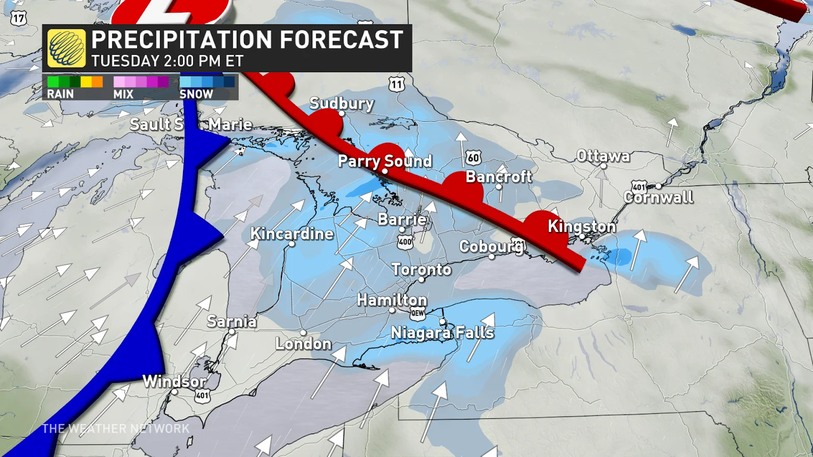
Tuesday: Resurgence of snow expected
Another low-pressure system developing across the northern Great Lakes will fuel a renewed risk for snowfall chances once again Tuesday.
MUST SEE: Is hacking the atmosphere a 'cool' idea to offset global warming?
Bursts of flurries could be widespread across the rest of southern Ontario and the Greater Toronto Area on Tuesday around lunchtime, leading to reduced visibility and potentially slick roads throughout the region.
Those around cottage country have the possibility of locally higher totals, expect changeable driving conditions as visibility could be reduced throughout the day.
Wednesday: another system moves in
Yet another low-pressure system will bring widespread snow chances across southern Ontario on Wednesday.
The GTA could see flurries off and on throughout the morning, with a chance for heavier snowfall to develop across Hamilton and Niagara throughout the afternoon, however there is still some uncertainty with how much could fall.
Lake-effect snow squalls will develop Wednesday evening across the snow belts, possibly impacting northern parts of the GTA as well.
The snow belts could see accumulations of 15-20 cm whereas Niagara could see 5+ cm of snow if heavy snow develops.

There is some uncertainty with the exact snowfall totals these systems could bring as they rely on several local factors including fluctuating temperatures, lake enhancements, and terrain.
Looking ahead, temperatures will remain around seasonal, that’s still cold enough to support the threat for wintry precipitation.
Stay with The Weather Network for the latest on your forecast across Ontario.