Chaotic weather set to throw local cyclists for a loop

Hot, soupy and occasionally stormy. This week could be especially tricky for cyclists across the GTA.
Like the crash chaos at the 2021 Tour de France: the weather will be chaotic and all over the place this week.
This week is a little unique, as there will be two distinct air masses. The first - hot, soupy and occasionally stormy.
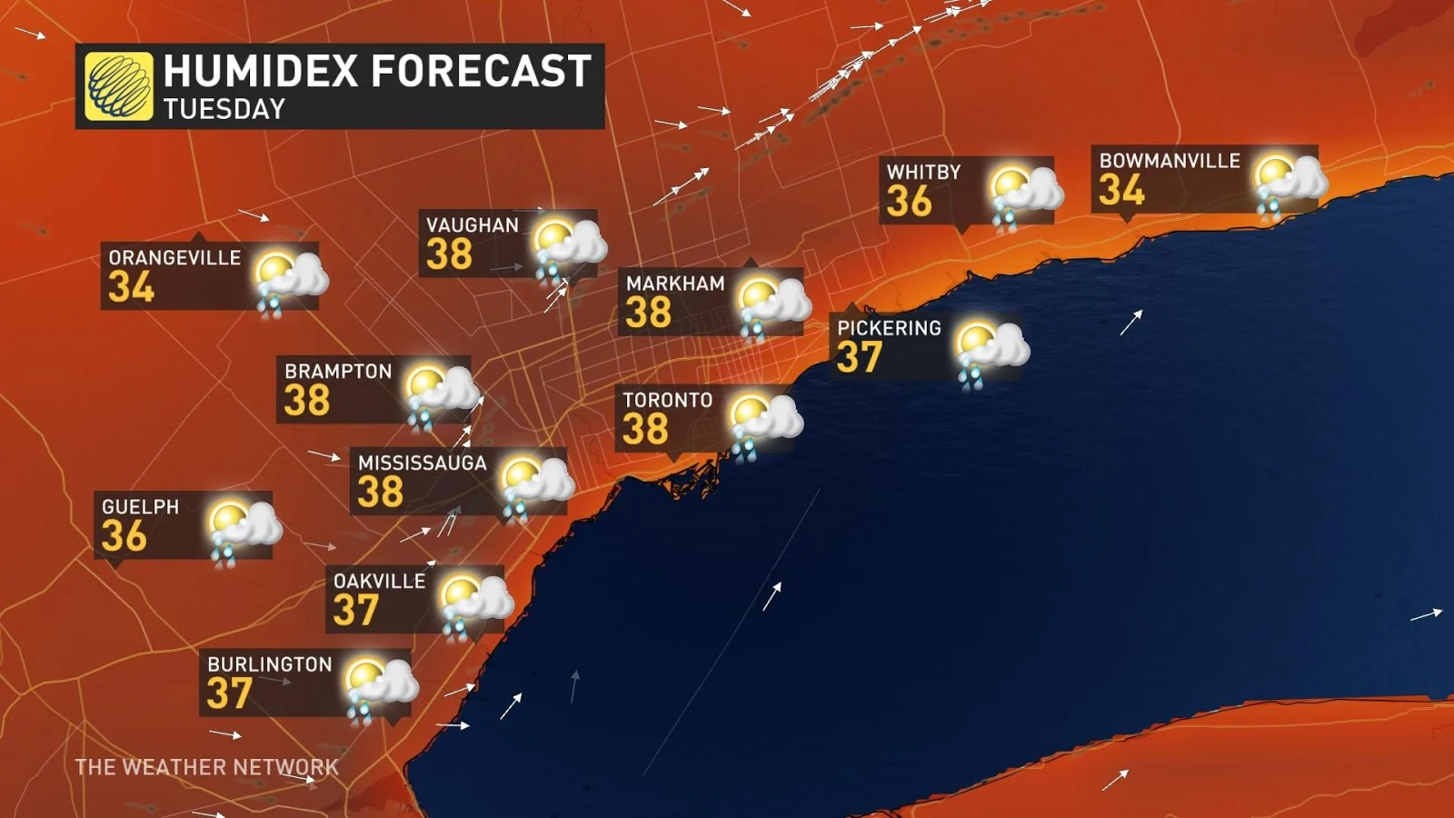
MONDAY AND TUESDAY:
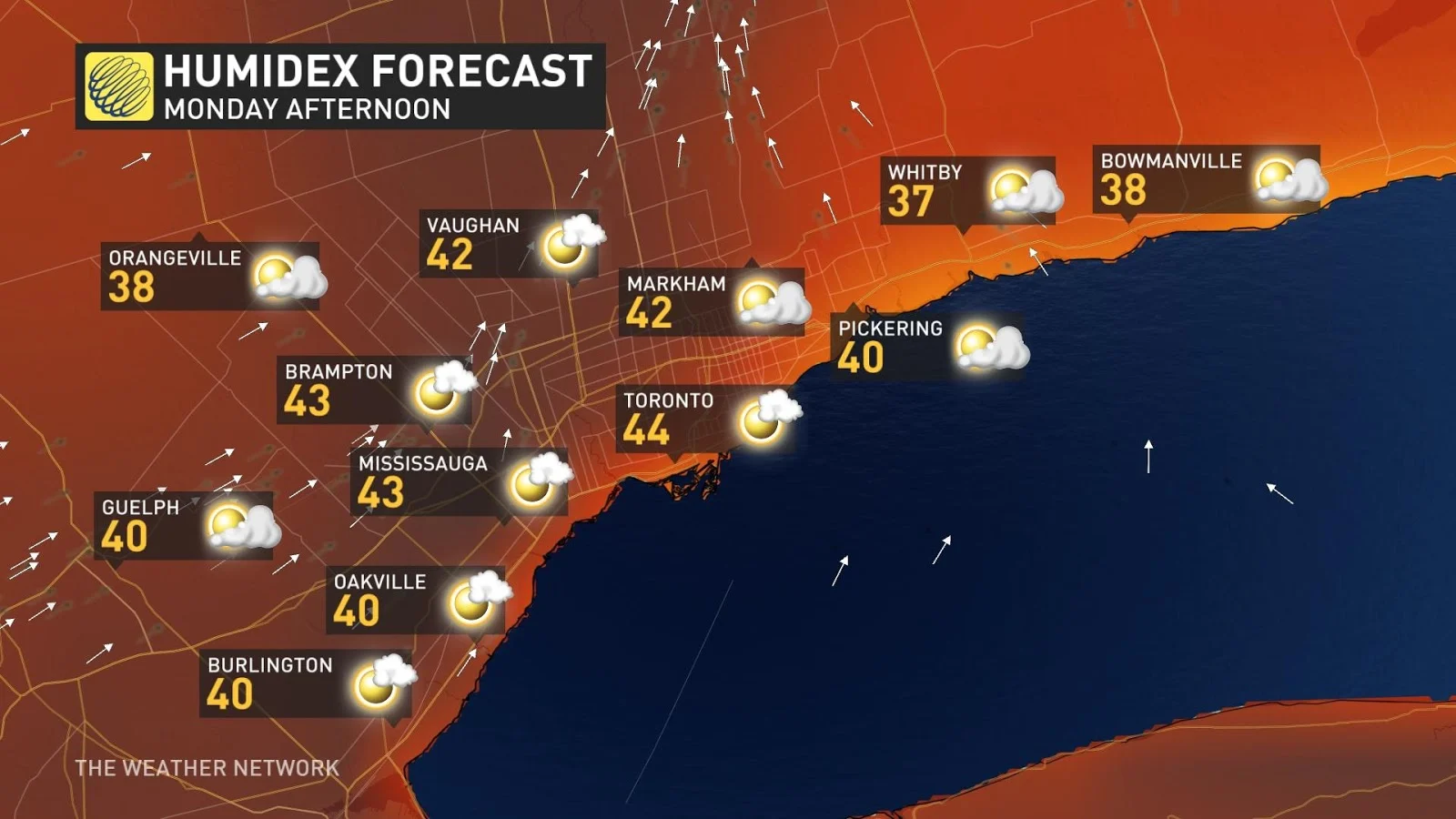
Warm morning temperatures, paired with uncomfortable temperatures and humidex values in the afternoons. Watch for signs of overexertion and bring lots of water.
Risk of thunderstorms on Monday into the evening for eastern sections of the GTA, with a torrential rain risk.
Tuesday: the risk of storms looks reserved for Hamilton and the Niagara area, with storm activity near Lake Ontario, too.
Gusty southwest winds are the theme, sometimes up to 50 km/h through Monday, with lighter westerly winds on Tuesday.
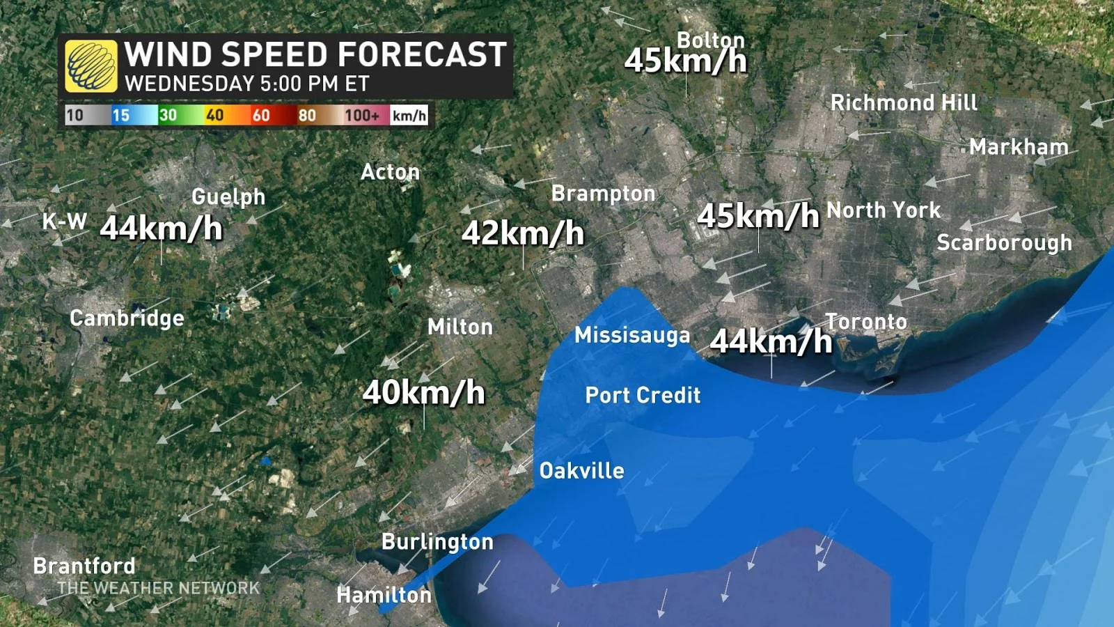
WEDNESDAY:
System day - expecting up to 10 mm of rainfall across Wednesday, that'll come with a couple of bursts of rain. The wind has done an about-face and is blowing in from the east, knocking our temperatures down below seasonal. We'll watch easterly winds gusting up to 30 km/h throughout the afternoon.
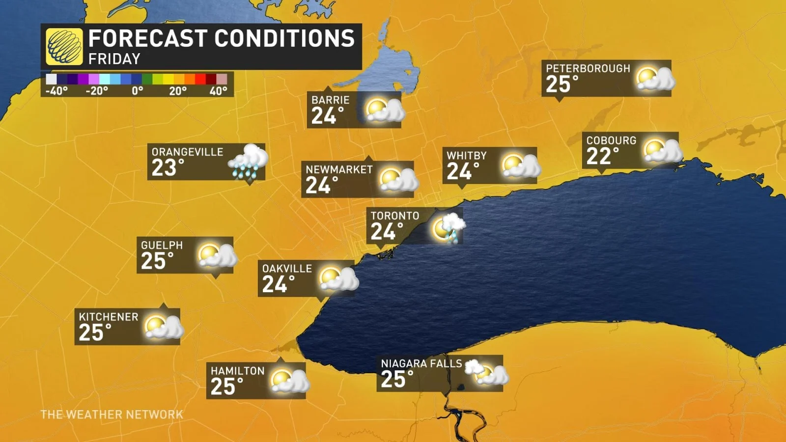
THURSDAY AND FRIDAY:
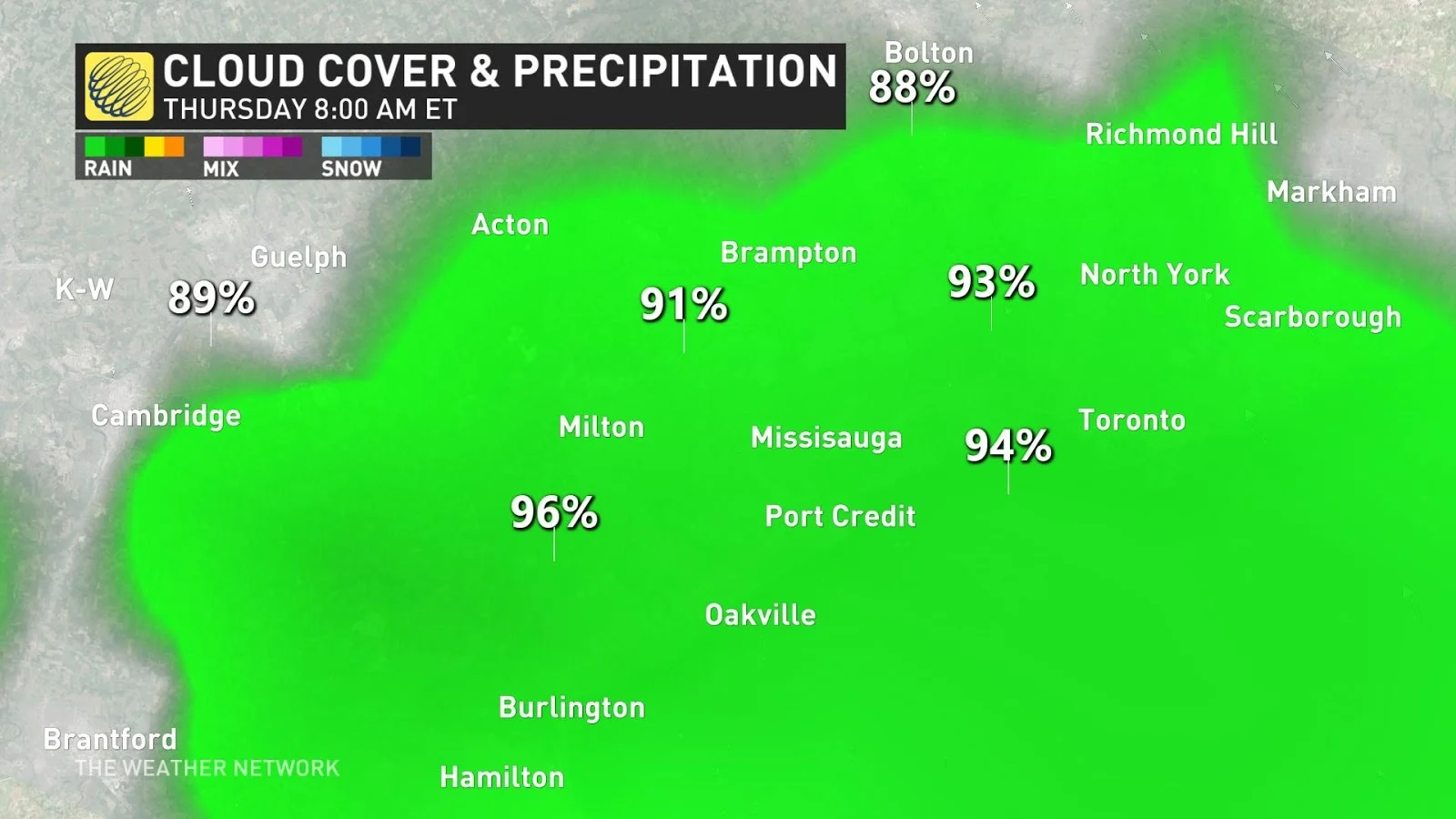
Thursday has the potential to be quite showery as a system stalls near the region, as weather models seem to have taken a turn for the worst. I'm hopeful we will see improving conditions late-day – and by Friday, that active, pesky boundary pushes further east limiting shower activity and bumping temperatures closer to seasonal.