Canada’s weather whiplash calms in June, but it’s not smooth sailing
The month ahead will see shifting heat and building wildfire risks across Canada
Welcome to June! The start of the month marks the kickoff of meteorological summer.
The next three months hold some steamy conditions, boisterous storms, and an ever-present risk for wildfires. But what can we expect through June?
Forecasters see signs that our classic springtime roller-coaster will turn into a somewhat gentler ride into the beginning of the summer season.
DON’T MISS: El Niño may make Canada’s summer simmer instead of sizzle
Heat shifts east with the overall pattern
We rounded out the final days of May with a heat wave over the Prairies that sent temperatures soaring as high as 37.6°C, making for Canada’s hottest temperature so far in 2026.
Warm temperatures are a way of life in June, which features the year’s highest sun angle and longest spells of daylight around the summer solstice.
SEE ALSO: Look up! The two brightest planets converge in the sky in June
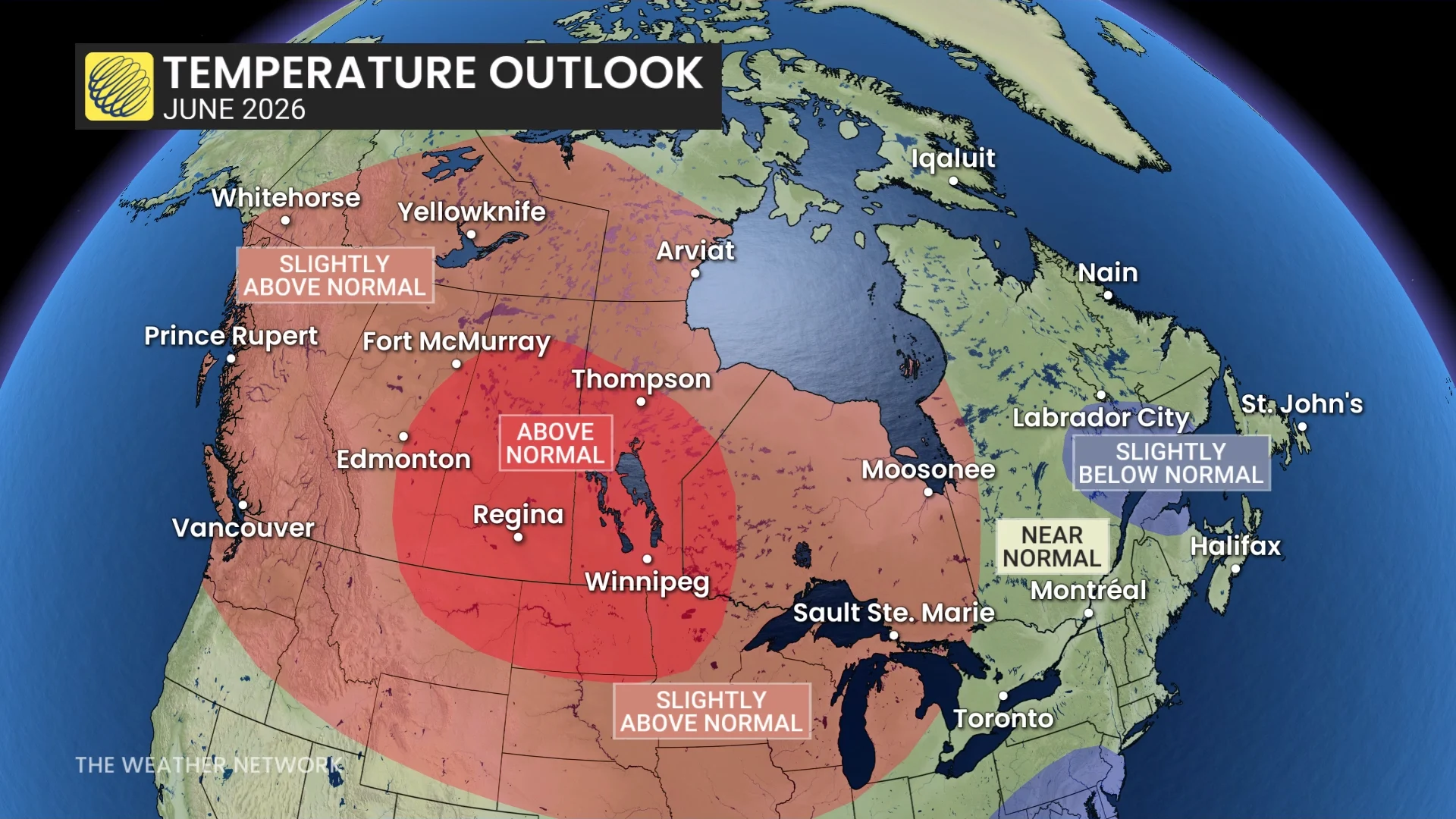
A vast swath of Canada is in for slightly above-seasonal temperatures during the month as a whole. This doesn’t mean we won’t see periods of cooler conditions, especially during the first half of the month in British Columbia and parts of Alberta as troughs bring in unsettled weather from the west.
The focus of toasty temperatures will remain locked on portions of the Prairies through the month ahead. Forecasters see above-seasonal temperatures dominating across the eastern half of the Prairies.
Folks in southern Ontario, Quebec, and Atlantic Canada are on track to see doses of cooler conditions throughout the month, with overall temperatures winding up around normal for this time of year. Keep in mind, though, that cooler readings in June may still be rather comfortable or even require air conditioning as temperature averages continue to climb.
Drought and fire concerns will build for some areas
Folks south of the border will benefit from the active pattern through June, with unsettled conditions frequently visiting the southern half of the U.S. This could be beneficial for the extreme to exceptional drought that’s plagued Florida in recent months.
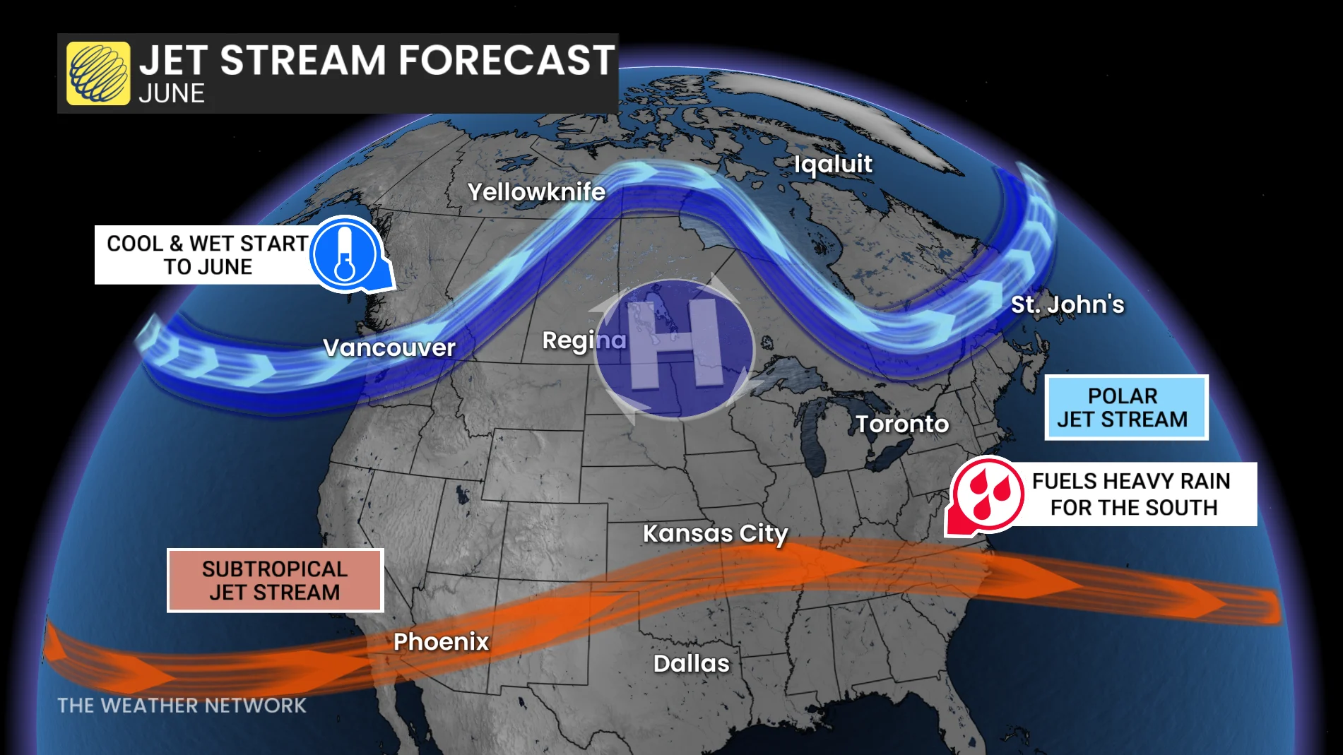
The focus of the active weather remaining south of the border will keep much of Canada on the drier side through much of June.
That’s not to say we’ll lack periods of heavy rainfall in spots. It is the start of summer, after all, and downpours come with the territory. One community can see a deluge while neighbouring towns are left high and dry.
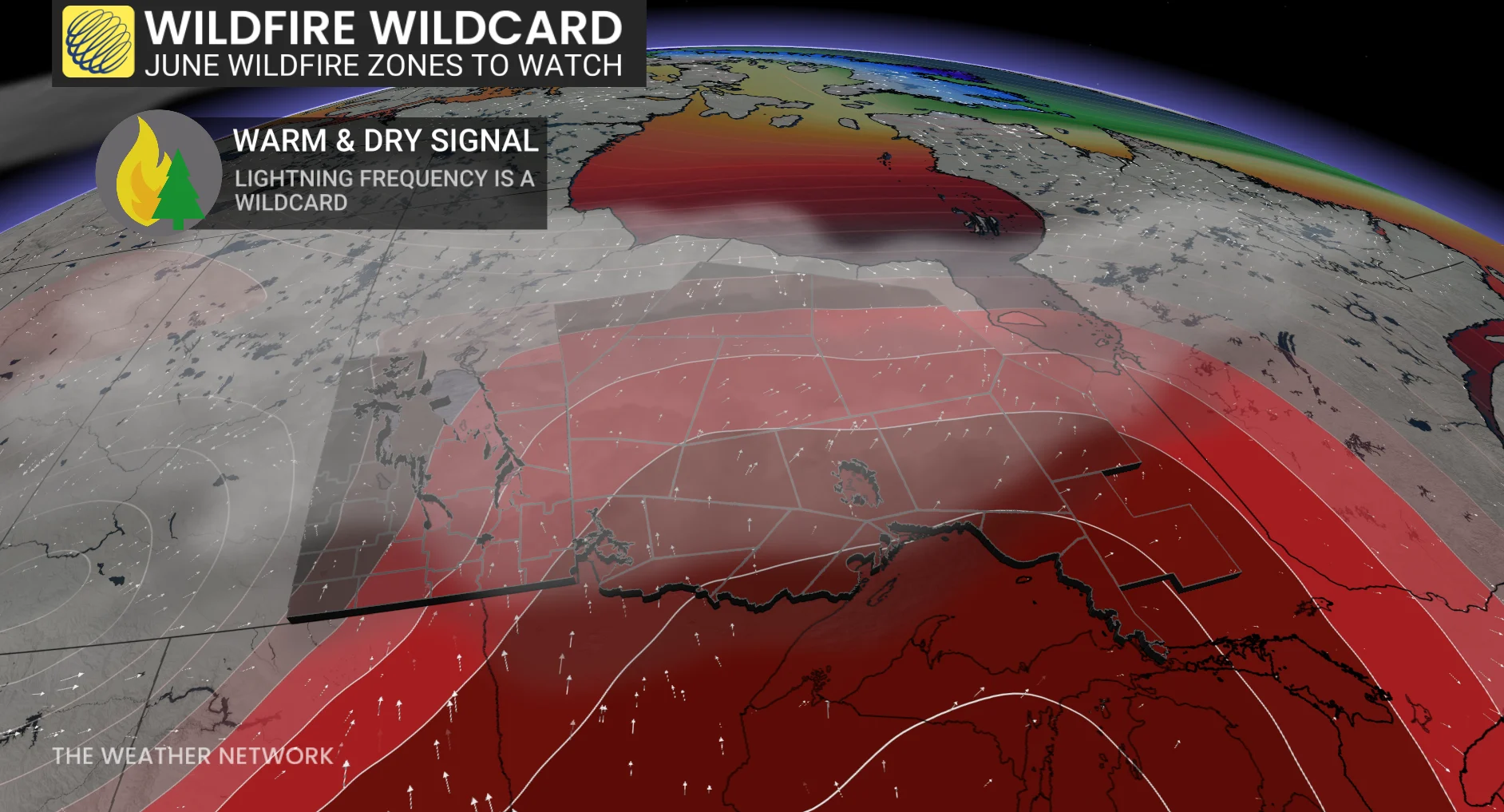
But the overall pattern of hot and dry weather shifting east is particularly unwelcome news for portions of Manitoba and northern Ontario.
We’ll have to closely watch the potential for drought across these regions, as well as increased danger for wildfires to ignite. A growing fire risk will also put areas downwind, particularly in southern Ontario, on alert for poor air quality if any large fires erupt.