
Burst of snow to hit Ontario ahead of potential high impact weekend weather
Rounds of active weather take aim at Ontario this week, with a burst of snow Wednesday followed by a messy, and potentially high impact, weekend storm
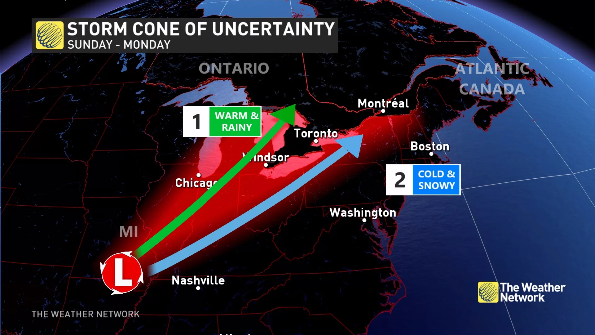
Attention is on a messy and potentially high-impact storm that targets the Great Lakes this weekend. This will be one to watch as it could pack a lot of hazardous weather, including heavy rain, winds and snow.
WINTER 2024: El Niño will play a critical role in the weeks ahead
A Texas Low is expected to rapidly intensify as it moves over the region Sunday and into Monday -- a classic late fall storm that will tap into abundant moisture from the Gulf of Mexico.
However, before we dive a bit deeper into that, there is a quick disturbance that will move through Wednesday night to Thursday morning, bringing a burst of snow, and a quick 2-5 cm. This could complicate your Thursday morning commute.
See more on the details and timing, below.
Wednesday night into Thursday morning
A disturbance will track from northwestern to southern Ontario, bringing some snow to the region.

A quick 2-5 cm of snow is possible along the track, with areas away from the centre of the track seeing less than 3 cm. The disturbance does have the potential for some areas to overachieve, potentially bringing some areas near Georgian Bay and central Ontario above 5 cm.
The snowfall will make for slick roads, so be prepared for tricky travel for the early Thursday morning commute.
Sunday into Monday: Texas low threatens rain, wind and snow
Ingredients are coming together for a windy December storm, with impacts felt through much of Ontario Sunday and Monday. A Texas low will slingshot an abundance of Gulf moisture northwards, allowing for heavy precipitation rates to fall. Precipitation types of rain or snow will highly depend on the storm’s track, which still has uncertainty at this point.
RELATED: How Colorado lows and Texas lows affect our weather in Canada

What we know is to the northwest of the storm's path, heavy snowfall is expected for areas in central and northern Ontario. To the east, very mild air, double-digit temperatures, and rain are expected for southern Ontario -- at least at first.
Once the system moves through, wraparound and lake-effect snow will likely set up in behind, flipping the switch from a fall-like storm to more of a wintry one for Monday.

How this all plays out will be heavily track dependent
The key to this forecast will lay in the storm’s track. Can the switch to cold air happen, and how fast? With the uncertainty with the track of the system, the transition from mild air to cold air could be faster, and could also be a bit further south.
To complicate things even more, it is uncertain how the storm interacts with a clipper that will also be moving through Ontario this weekend. This will have implications on where the storm tracks and therefore where the heaviest snowfall lines up. The track of the system may be anywhere from Lake Superior to Lake Erie.
A more northerly track would widen the warm sector and rainfall over southern Ontario, slowing the switch to cold. But a more southerly track could mean heavy snowfall instead, with the switch to cold air occurring faster.
At this point, neither can be ruled out, so it will be important to continue to check back for the latest forecast updates. Be sure to also plan ahead, and brace for some slow travel Sunday into Monday.
Going somewhere? Check out the current highway conditions before heading out!
Milder lead up to Christmas
A few days of colder weather, and lake-effect flurries, are expected for the middle of next week before temperatures rebound again late next week and into the following week, as well.
While the temperature roller-coaster will continue into the weeks to come, at this point, it looks relatively mild during the week leading up to Christmas.
Be sure to check back for all of the latest weather updates across Ontario.