B.C. on the cusp of heavy rain fuelled by the Pineapple Express
Drenching rains and soaring freezing levels will wash over British Columbia as an atmospheric river arrives to start the week
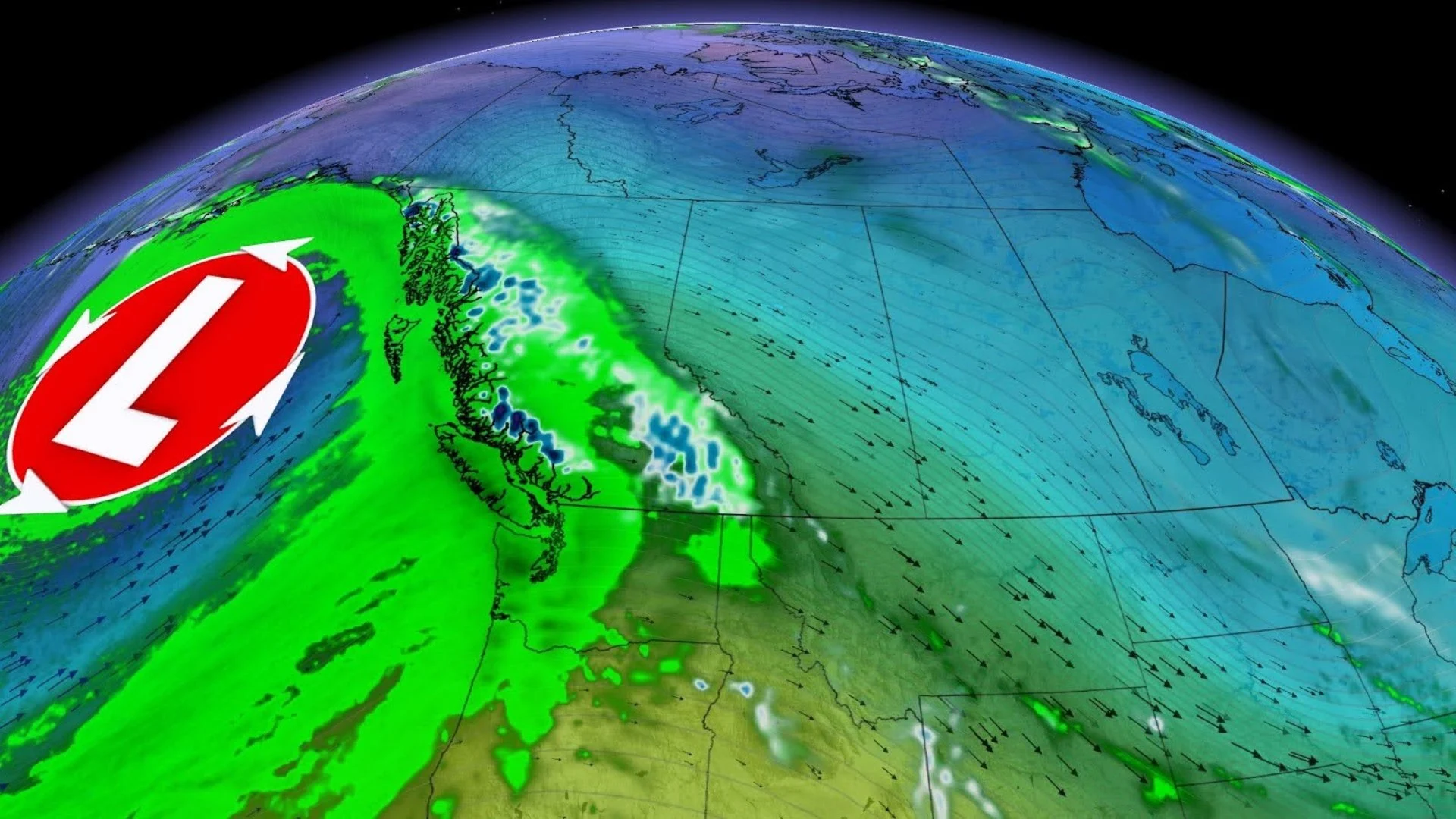
A washout is in the forecast for much of Vancouver Island and the South Coast as a potent system lurking over the northern Pacific steers an atmospheric river into the West Coast.
Widespread heavy rainfall will begin in earnest on Monday and last through Tuesday, while the alpine peaks can expect bountiful and beneficial snows.
This atmospheric river will also contribute to a sudden rise in freezing levels, potentially sparking a flood risk as some areas experience rapid snowmelt and a changeover from snow to rain.
WINTER 2024: El Niño will play a critical role in the weeks ahead
Atmospheric river brings heavy rain into early next week
A developing low-pressure system in the Gulf of Alaska will direct a stream of tropical moisture straight from Hawaii to the West Coast. This atmospheric river qualifies as a “Pineapple Express,” a nickname that derives from the moisture’s island origins.
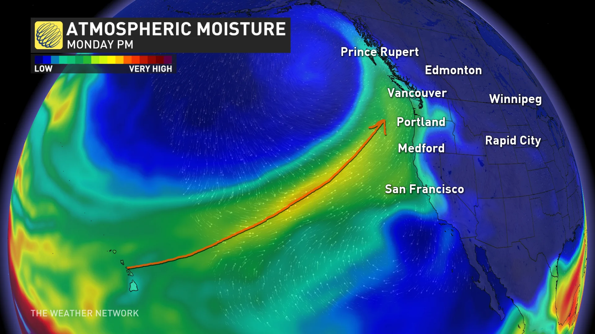
While the bulk of the heaviest rain will fall stateside, we’re still expecting quite the thump of heavy precipitation along the B.C. coast—especially in western Vancouver Island and across the South Coast.
The northern edge of this atmospheric river will begin pumping heavy rain into the coast on Sunday, with the worst arriving in earnest on Monday and Tuesday.
RELATED: Active weekend ahead as a strong, straight jet stream aims for Canada
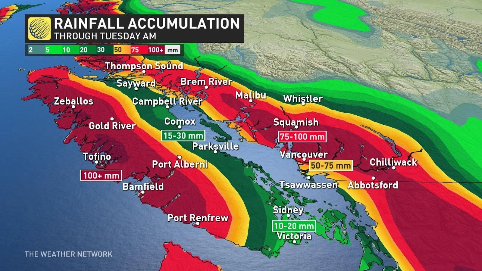
Rainfall totals are expected to easily exceed 100 mm across western Vancouver Island, with much lower totals around Victoria and Comox as a result of the rain-shadow effect.
We’ll see a widespread 75-100 mm of rain throughout the South Coast, including around Metro Vancouver, with lower totals along the immediate coast.
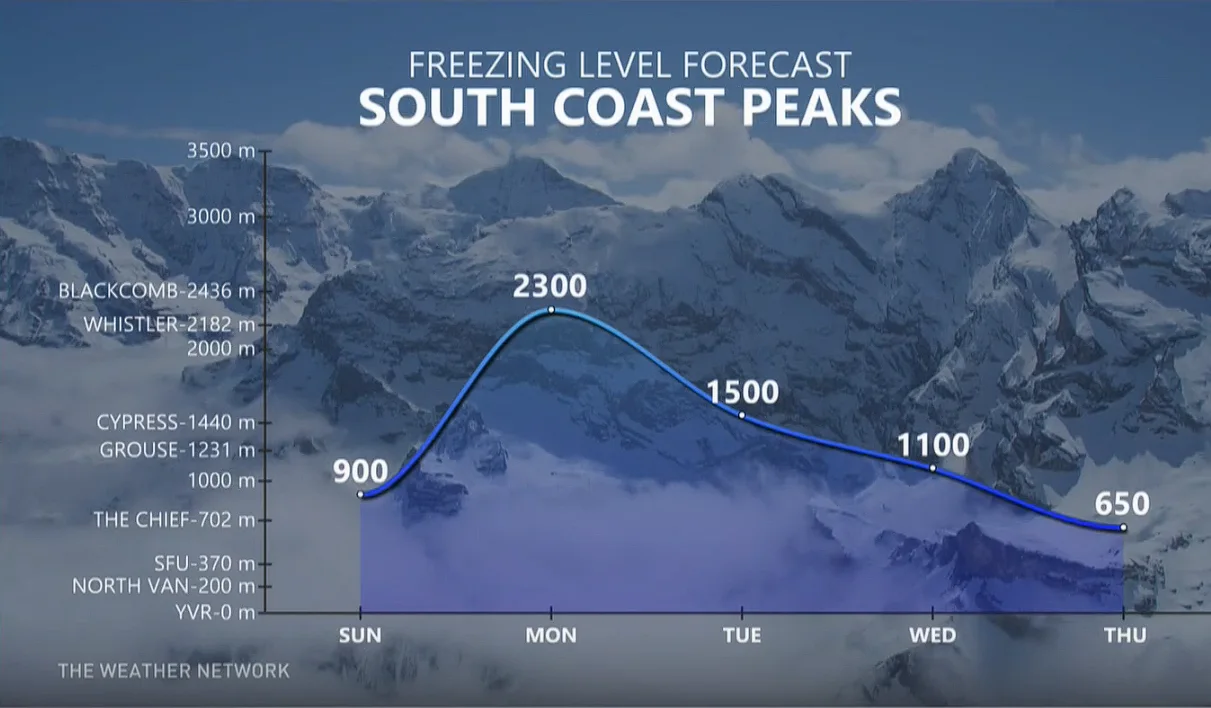
Milder air surging into the coast within the atmospheric river will cause freezing levels to spike late Monday and into Tuesday, climbing as high as 2300 m across the South Coast peaks.
A sudden spike in freezing levels will bring rain and above-freezing temperatures into the alpine regions, which could cause instability in the fresh snowpack along the North Shore and Vancouver Island mountains.
Folks across the region should diligently check avalanche ratings and take appropriate safety measures, staying on top of the ever-present avalanche risk across the province’s terrain.
Due to the snowmelt potential heading into early next week, these regions will also need to watch the potential for rising waters in the days ahead.
Stay with The Weather Network for the latest on conditions across B.C.