Blizzard conditions expected in southern Ontario into early Saturday
Prepare for whiteout conditions in portions of southern Ontario overnight Friday and into Saturday morning
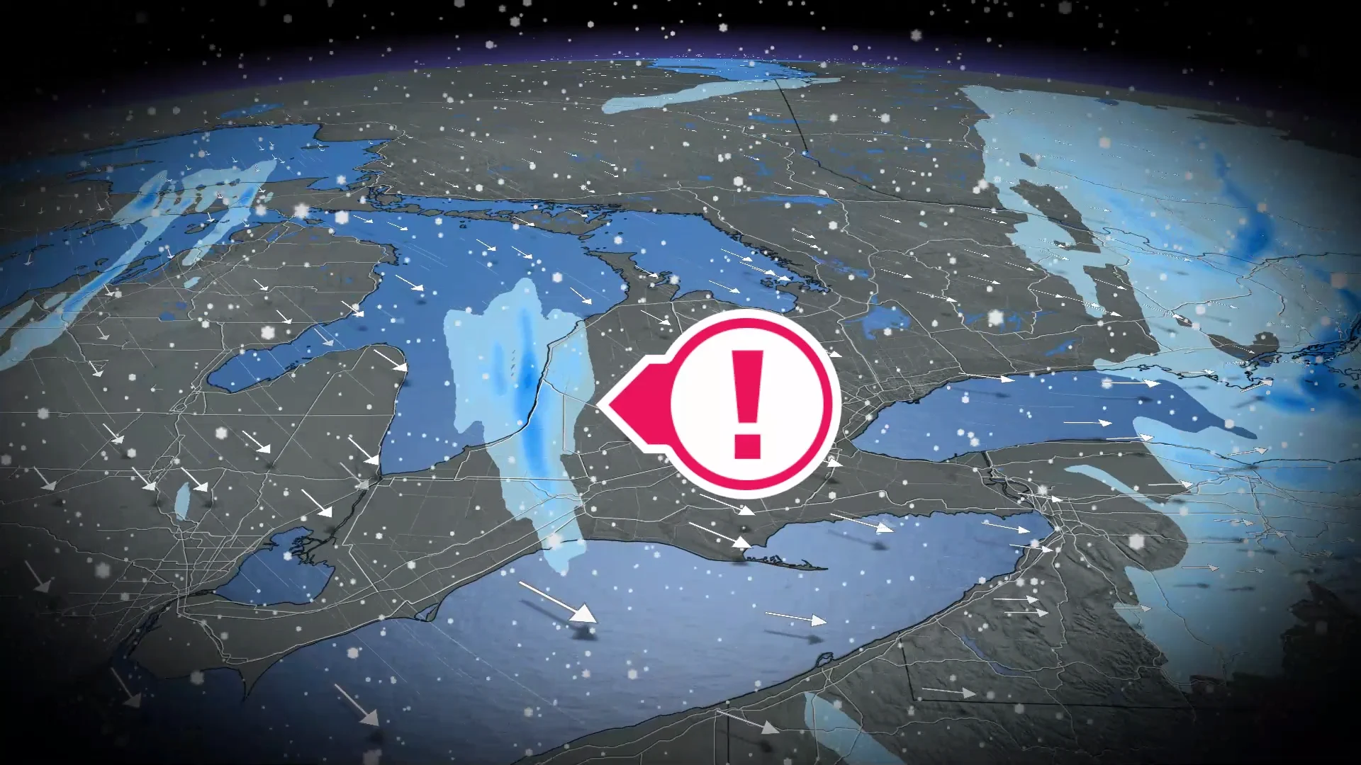
Blizzard warnings and blowing snow advisories are in effect across portions of southern Ontario as snowsqualls and high winds lead to the threat for whiteout conditions.
Expect bitterly cold temperatures to dominate southern Ontario through the weekend, as well, with widespread wind chill values in the -30s expected.
Drivers are urged to exercise caution and plan for potential travel delays and even road closures into Saturday.
DON'T MISS: A major mid-month pattern change will sweep Canada
Dangerous travel through Saturday morning
High winds and frigid air behind the cold front will give rise to lake-effect snow blowing off Lake Huron overnight and possibly into Saturday morning.

Blizzard warnings are in effect for counties south of the lake, including Goderich, Sarnia, and London. Wind gusts of 70-100 km/h are possible, which will lead to whiteout conditions and dangerous to near-impossible driving conditions.
Blowing snow will remain a concern across southern Ontario into the first half of Saturday, as wind gusts up to 50 km/h will whip around the freshly fallen snow.
RELATED: Ontario’s longest cold snap in over a decade: Is the end near?

Bitterly cold temperatures, possible relief next week
Temperatures across southern Ontario will fall as fast as 3°C per hour through the overnight hours Friday into Saturday morning.
Morning low temperatures in the -20s will be common this weekend. We’ll also have to contend with widespread wind chill values in the -30s. Exposed skin can develop frostbite in as little as 10 minutes with wind chill values this low.
If you’re looking for some relief, the forecast may hold some good news heading into next week.

DON'T MISS: Groundhog Day 2026: See the predictions here!
There are some hints that the cold pattern we’ve been locked into will begin to weaken late next week.
While there’s no guarantee that we’ll climb out of the cold air, the blocking pattern in the atmosphere that’s been responsible for our continuous bursts of frigid air looks to break down.
This will allow near- to possibly above-seasonal temperatures to make their way toward the province. Keep in mind that a seasonal temperature in Toronto this time of year is about -1°C, so even an above-seasonal temperature is still cold.
The downside to this break from the Arctic air is that the jet stream will track directly over parts of Ontario, potentially setting up an active storm track with the whole spectrum of wintry precipitation, potentially including freezing rain.
Stay with The Weather Network for all the latest on conditions across Ontario.