
Ontario and Quebec face spring-winter impacts from duo systems
Winter and spring will clash in Ontario and Quebec this weekend, with the former having the last say as Sunday will predominately feature snow entering the picture with colder air in place
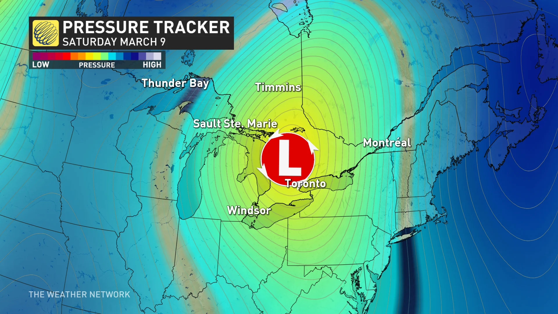
Central Canada will be getting a one-two punch of rapid weather this weekend as two systems are expected to bring a taste of spring and a snap back into winter to conclude it.
While most areas will start off as rain, with warmer air in place, snowfall swiftly follows in behind the second low, leaving more of a wintry impact as the systems exit both provinces.
SPRING 2024: Get an in-depth look at the Spring Forecast, tips to plan for it, and much more!
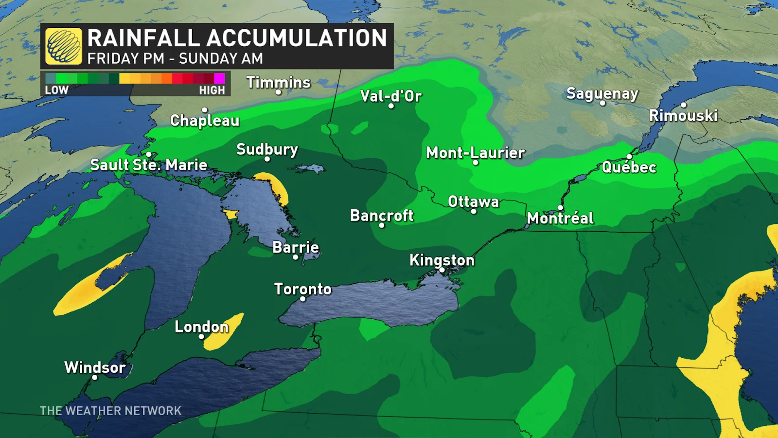
Early projections show rainfall totals could be considerable in parts of the Ontario, with 30-40 mm possible, but amounts are subject to change. Needless to say, localized flooding will be a threat.
Saturday: The multiple-system event begins
The back-to-back systems will really feel like they are combined as there is not much of a break between the two rounds.
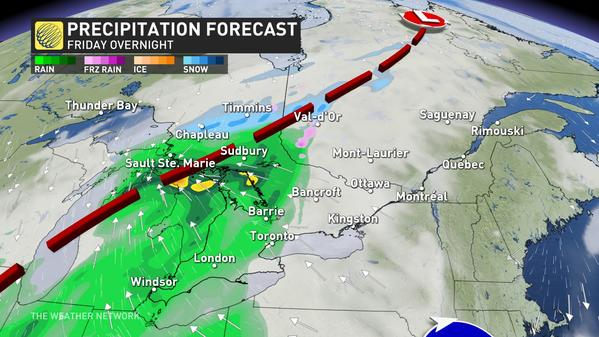
The rainfall will begin when the first system tracks into central Ontario early Saturday morning. The second system will then track across lakes Erie and Ontario, extending the precipitation throughout the weekend.
Widespread rain is on tap for southern Ontario on Saturday, with some snow in the northeastern sections.
There is a chance for southern Quebec to begin to see snow begin Saturday overnight, but it comes with a high uncertainty.
There is the risk of localized flooding with the heavy rainfall in southern Ontario. Stay away from watercourses and be aware of ponding on the roads, as well.
DON'T MISS: Bald eagle nest found in Toronto for the 1st time ever
Sunday: Cold air, snow replaces warmth and rain
As colder air moves into the region, rain will transition to snow on Sunday. Flurries are expected in Ontario's snowbelt regions and cottage country, potentially extending farther south.
For areas along the St. Lawrence River, in eastern Ontario and Quebec, a transition to rain will occur on Sunday. The changeover includes the Ottawa Valley and and Eastern Townships. Rain transitions back to snow Sunday overnight.
The higher elevations in Ontario, as well as central Quebec, precipitation will remain as snow.
Take caution as road will be slippery during the precipitation transition and with wet snow.
People can expect localized ponding and pooling with heavy rain in southern Ontario.

Looking ahead, conditions will turn briefly cooler, near seasonal, for early next week, then trending warmer with well-above-seasonal temperatures for a few days ahead of another system late week or weekend.
A much colder pattern is expected to develop around the official first day of spring, and continue through the end of March and into early April.
Thumbnail courtesy of Unsplash.
Keep checking back for more forecast updates for both Ontario and Quebec.