Next storm targets the East Coast with extended icy, snowy, messy weather
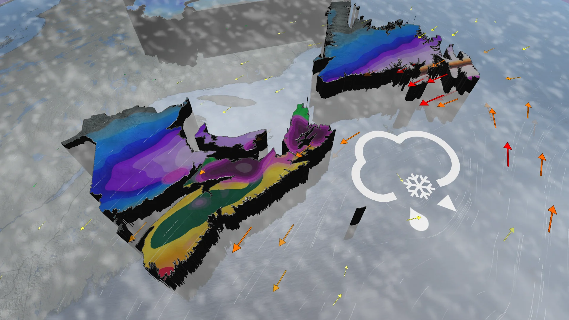
Special weather statements span the Maritimes and parts of Newfoundland as the next winter storm is about to make its mark on Atlantic Canada, bringing everything from heavy snow and rain to ice pellets and freezing rain
Winter and spring will be battling it out this week in Atlantic Canada, with back-to-back systems set to push through with a myriad of impacts from both seasons.
SPRING 2024: Get an in-depth look at the Spring Forecast, tips to plan for it, and much more!
With the more disruptive storm coming Wednesday evening, cold and warm air will clash with an abundance of moisture, resulting in very messy winter weather.
Special weather statements are in place across the Maritimes and Newfoundland. Some areas could see eight to 12 hours, or more, of ice pellets and freezing rain, while others are on tap to see 30-50+ mm of rainfall or 40-50 cm of snowfall.
In fact, similar storms in the past have caused hazardous driving conditions, traffic delays and scattered power outages. Plan ahead if you're doing any travelling and ensure electronic devices are charged.
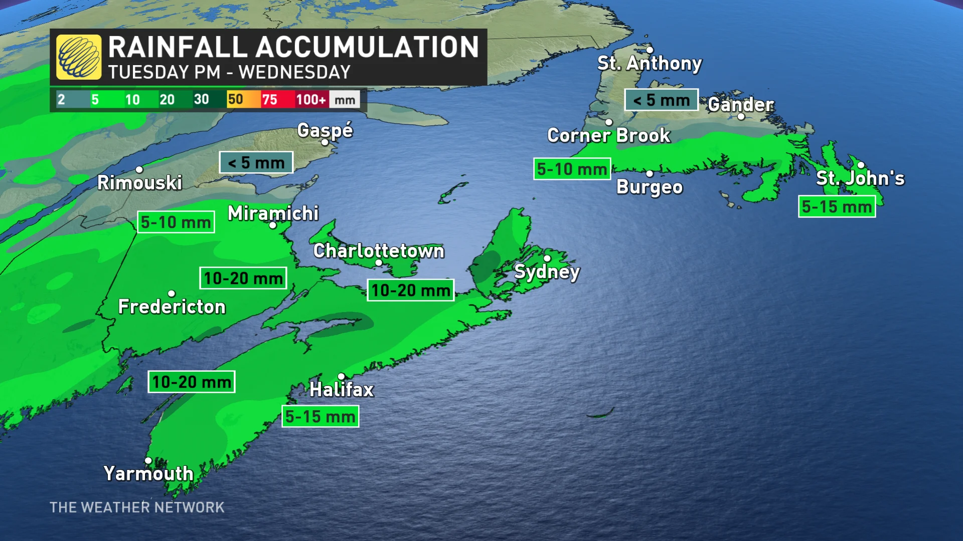
Wednesday morning: Rain moves into Newfoundland
Impacts from the first system will see rain continue in the Maritimes through Wednesday morning, then clearing up in the afternoon. There won't be much of a break before the next low moves in.
Southern Newfoundland will see rain move in Wednesday morning before it clears out in the evening, ahead of the more impactful storm.
Wednesday evening through Friday: Threat for travel and power troubles with wintry mix
The next, and more impactful, system is forecast to develop along the U.S. Southeast on Wednesday night, tracking south of Atlantic Canada.
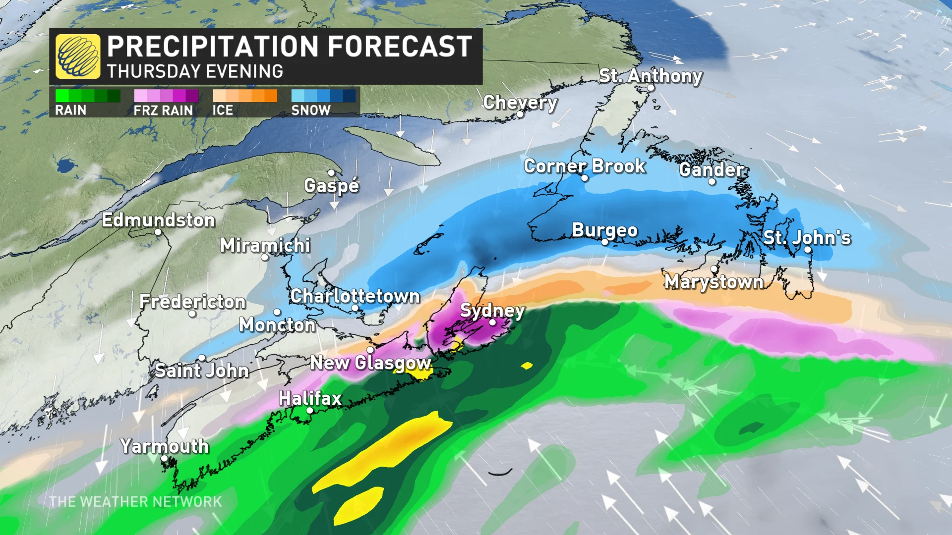
Milder temperatures will be in place as the precipitation starts across the Maritimes, though with the potential for some snow to fall on the northern edge of the system.
Through Thursday, colder temperatures will then shift south, with most of the rain transitioning to snow across parts of New Brunswick.
When the transition occurs, there's also an elevated chance for prolonged, wintry cocktail of ice pellets and freezing rain. These conditions are possible along southern New Brunswick and P.E.I., extending into northern parts of Nova Scotia to start, then sinking into the rest of the latter by Thursday overnight.
Icing could last through Thursday, potentially lingering for eight to 12 or more hours for most. Rainfall will stick around for southern Nova Scotia, heavy at times, totalling 30-50+mm. Localized flooding will be a concern.
Temperatures will remain slightly cooler in Newfoundland with this system, which will mean the precipitation will begin as snow, with a chance of ice pellets along the southern Avalon or Burin peninsulas Thursday overnight into Friday morning. It could persist for eight to 12 hours, or more.

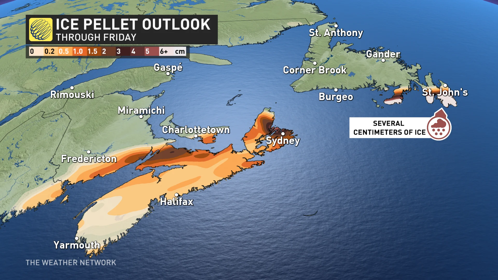
Ice pellet totals may measure several centimetres. St. John’s is on the cusp of either heavy snow or a large amount of ice pellets.
Snowfall totals will be significant for central regions of Newfoundland, staying in the snow sector, meaning 40-50 cm is possible.
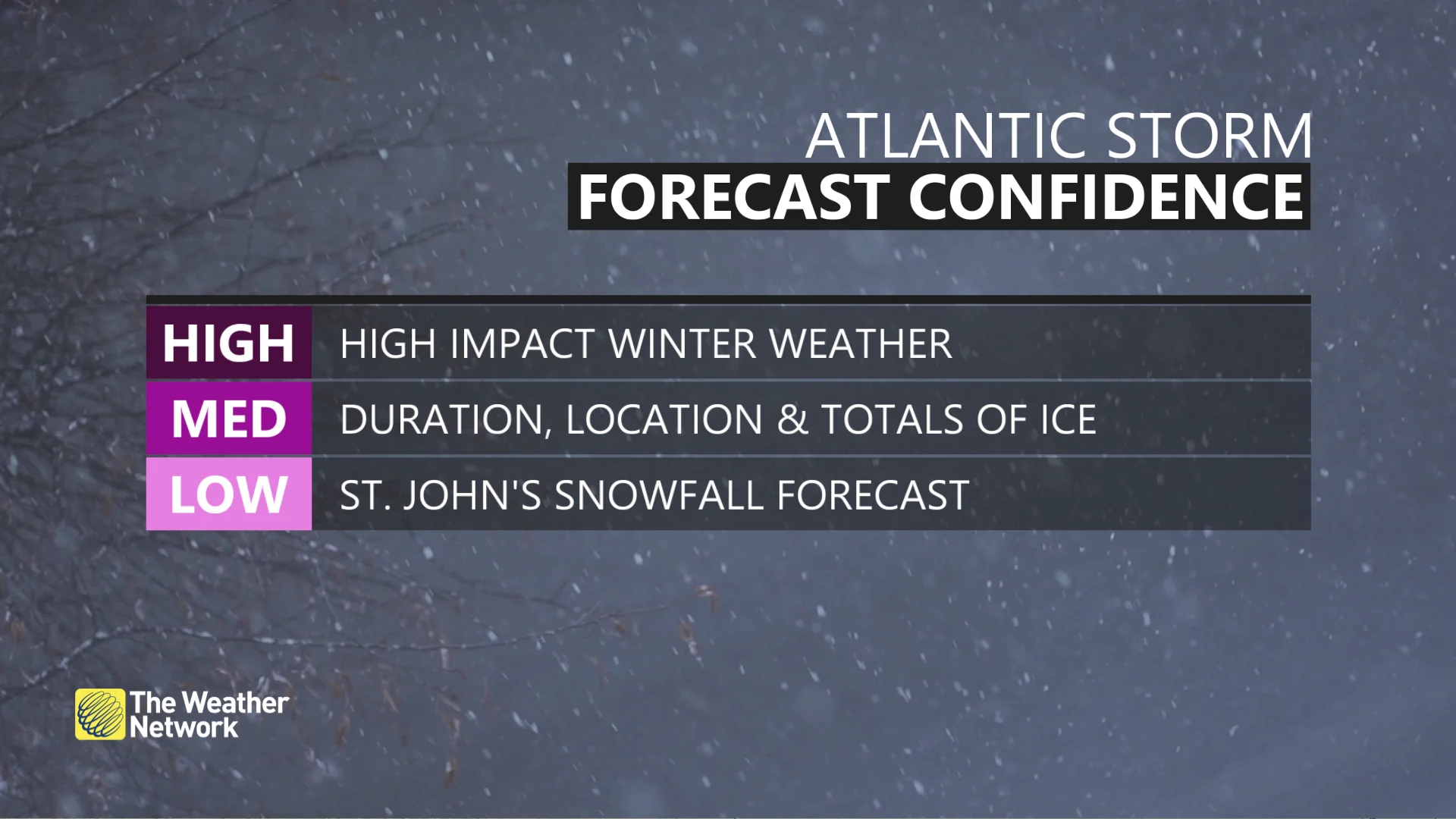
"Confidence is medium on the exact location of the mixed precipitation. Forecasters will continue to calculate how efficient the ice accretion is with this setup, so be sure to check back," said Rachel Modestino, a meteorologist with The Weather Network.
Travel impacts are likely for areas seeing several hours of mixed precipitation. There's also a heightened threat for localized power outages and closures of roads, businesses and schools to occur.
On Friday, precipitation changes to snowfall for southern Nova Scotia as temperatures cool in behind the system.
The duration of the event will also dictate the amount of snow possible, especially for Newfoundland, as some computer models have the snow lingering into Saturday morning.

Depending on the duration, hardest-hit areas in the Maritimes could see 10-25 cm of snow while areas in Newfoundland could see 20-40+ cm.
An active pattern is expected late this weekend and into next week, with more snow and icy conditions likely with colder air staying locked in place.
Be sure to check back for the latest weather updates across Atlantic Canada.