B.C. storm begins to yield after packing a windy, rainy and snowy punch

Parts of the B.C. coast saw intense wind gusts, heavy rain and alpine snow from a weekend storm, leading to scattered power outages
Another powerful low hit the B.C. coast this weekend, once again bringing multiple weather hazards to the province.
Fall storms are not out of the ordinary for B.C., but this season so far has been a rough one.
SEE ALSO: Historic El Niño nears its peak, months of impacts yet to come
The Nov. 14-15 fall storm, which brought a wind gust as high as 156 km/h to Solander Island, led to thousands of customers being left in the dark as power outages occurred.
The highest number of the electricity cuts are being scattered across northern Vancouver Island and the Sunshine Coast.
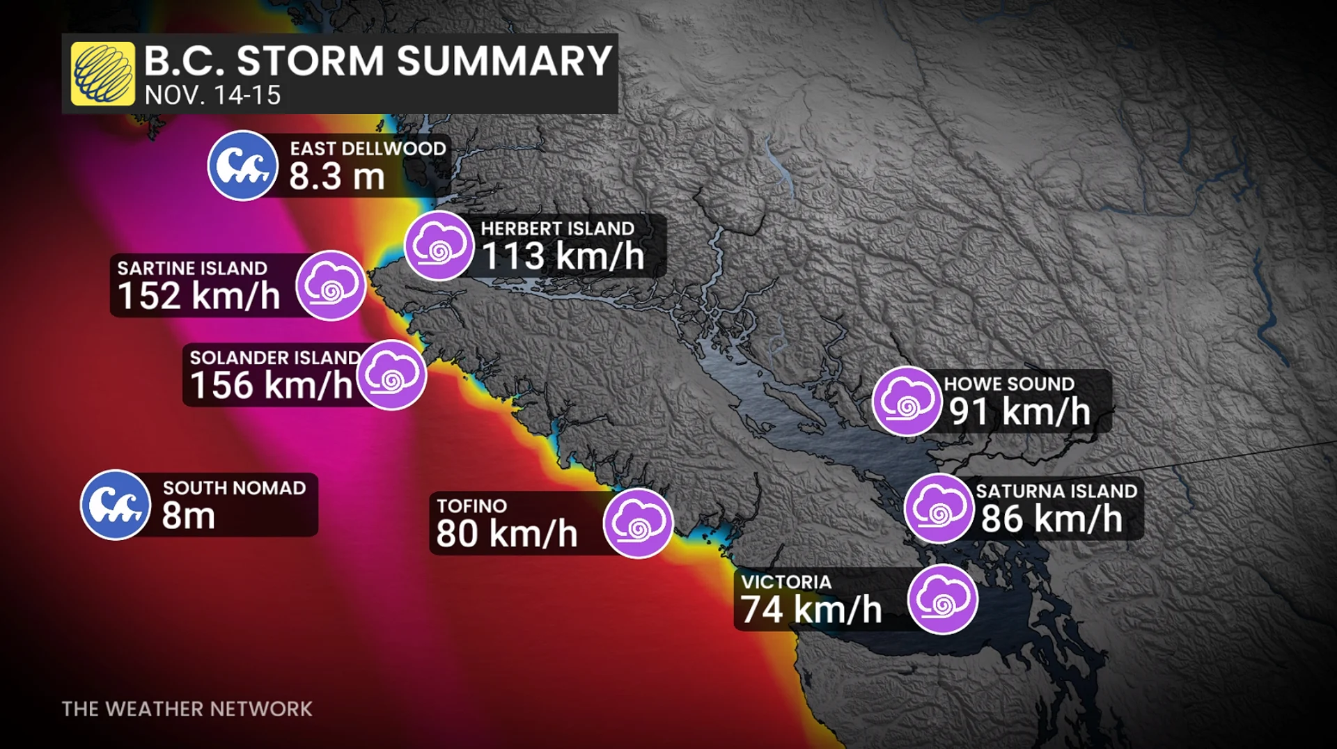
The good news is that winds will be easing throughout Sunday, with 30-60 km/h gusts along the coast.
Heavy rain will persist across western Vancouver Islandand, the Sea to Sky and North Shore Mountains. Additional rainfall of 30-50 mm is forecast for higher terrain across the Sunshine Coast, western Vancouver Island and Sea to Sky.
Meanwhile, higher-elevation snow will be ongoing across the Coast Mountains, in elevations above 1600 metres.
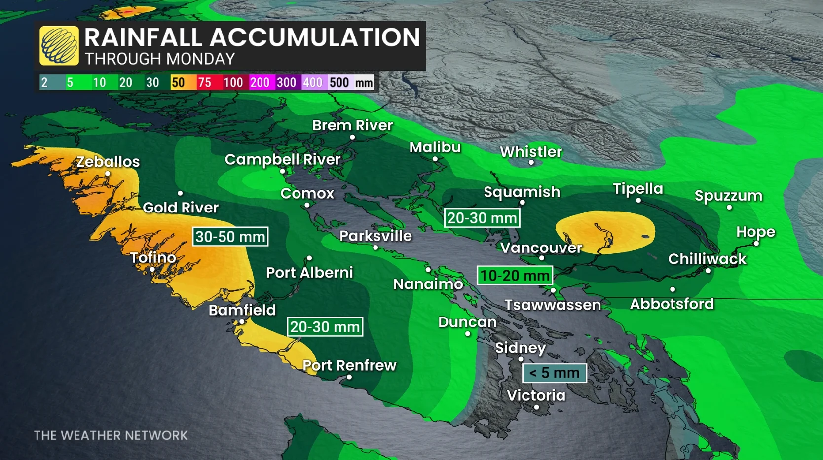
Monday will feature pockets of heavy showers across Vancouver Island, while the Lower Mainland is mostly dry.
The long range will be near seasonal in terms of temperatures, with a substantial break in storm activity as the active track shifts farther south.
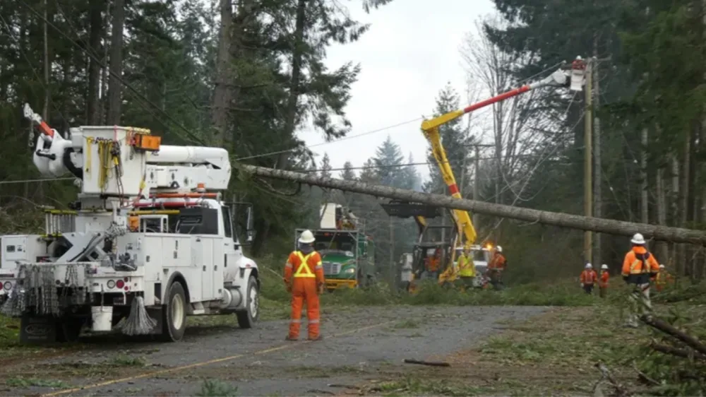
Thumbnail is file photo from December 2018, courtesy of BC Hydro/X.
Stay with The Weather Network for the latest updates and information on your weather in B.C.