August 2019 was globally the second warmest August on record

Data from the Copernicus Climate Change Service has confirmed it was 0.53°C warmer globally than the average of all Augusts for the 1981-2010 reference period.
August 2019 will go down in history as the second warmest August since precise satellite temperature data has been available.
Data from the Copernicus Climate Change Service system confirmed it was 0.53°C warmer globally than the average of all Augusts for the 1981-2010 reference period. Until now, the warmest August of them all was measured in 2016, with a temperature 0.04°C higher than this August 2019.
Data also shows that we are on our way to completing the warmest five-year period, since 2015, 2016, 2017, 2018 and now 2019 could become the warmest period registered. On the other hand -- and although there are still 4 months left in the year -- experts anticipate that 2019 will be one of the five warmest years in history, with a very good chance of even climbing on to the podium as the warmest.
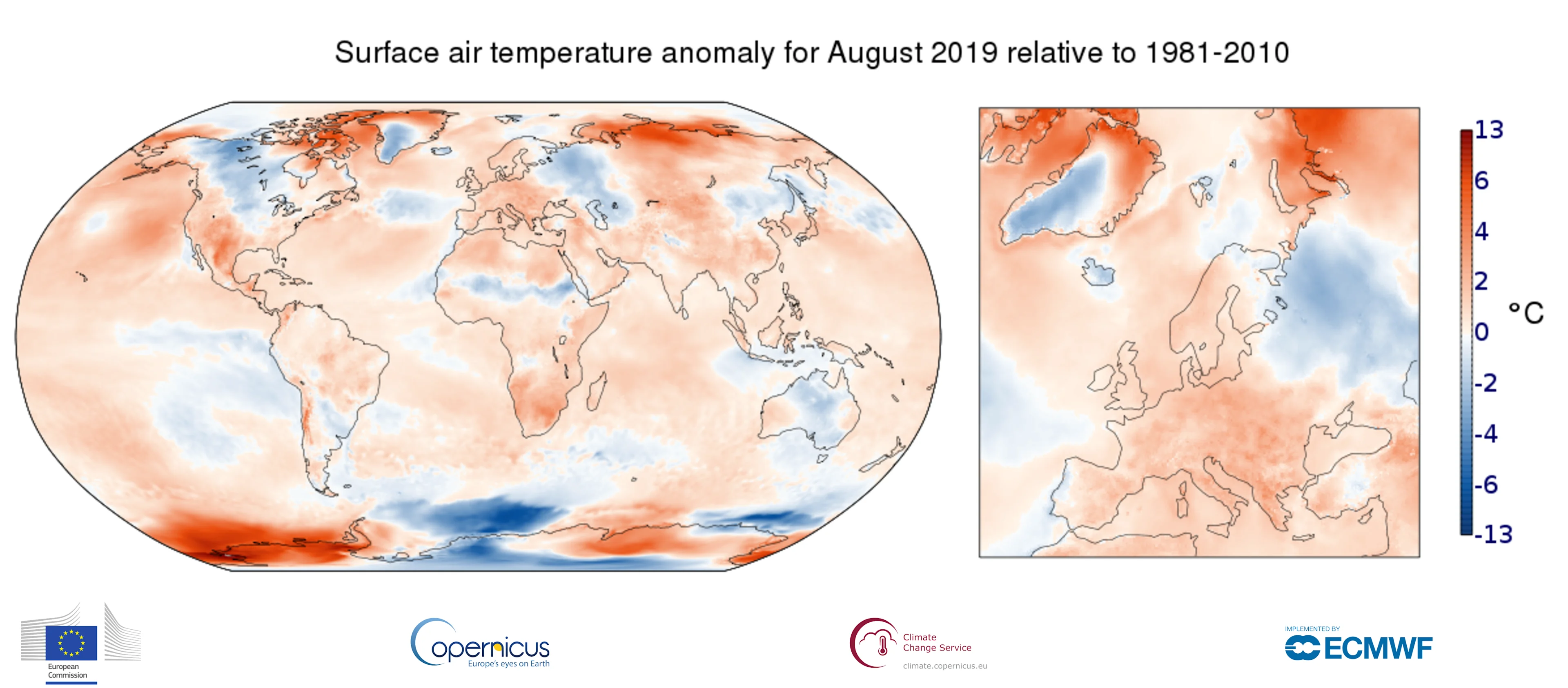
(Graphic: Surface air temperature anomaly for August 2019 relative to the August average for the period 1981-2010. Data source: ERA5. Credit: ECMWF, Copernicus Climate Change Service)
Across much of Europe, the average temperature in August was higher than the average of the 1981-2010 period. The exception, with negative temperature anomalies, was western Portugal and a swath extending from far eastern Scandinavia, to western Russia. Overall, the most positive temperature anomalies were measured in southern and eastern Europe.
SEE ALSO: How oceans play a major role in weather and climate extremes
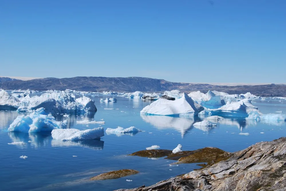
Europe has been one of the warmest continents during the summer months (with a few exceptions), with most of the continent seeing positive temperature anomalies. Besides impacting millions in everyday life, the excess heat that has affected a wide area from Scandinavia to northern Russia and Greenland has also favoured the rapid ice melt in the Arctic and in a good number of European glaciers.
On top of that, the high heat and the low relative humidity have kept devastating forest fires alive, as they continue to burn thousands of hectares across the Arctic.

(Graphic: National Snow and Ice Data Center data for Arctic Sea Ice)
Outside of Europe, high positive temperature anomalies stand out in areas of Siberia, northeastern Canada, Baffin Island, Alaska, the southwestern United States, southern Africa and western Antarctica. Other areas with positive values include the entire southern United States, Mexico, Central Asia and northern Chile. Not too many areas have experienced negative temperature anomalies. Apart from those already mentioned in Europe, other areas that stand out are northern and central Canada, southern Greenland, Central Antarctica Australia, and the African Sahel, where much needed Intertropical Convergence Zone (ITCZ) rains, also brought cooler temperatures.
As for the air over the oceans, most show temperatures above average. Temperatures were especially high over the oceans of the Arctic and Antarctic regions.
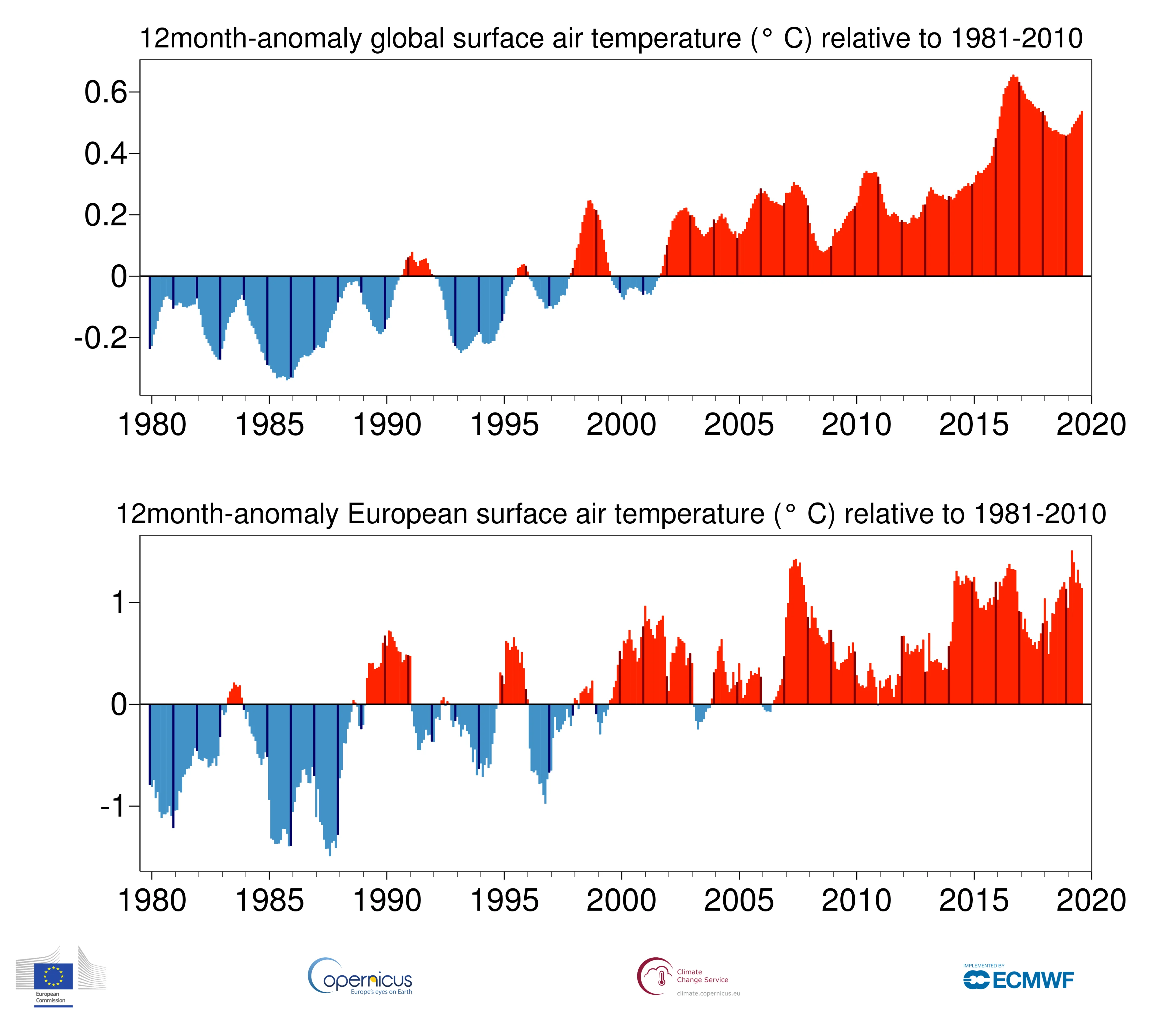
(Graphic: Monthly global-mean and European-mean surface air temperature anomalies relative to 1981-2010, from January 1979 to August 2019. The darker colored bars denote the August values. Data source: ERA5. Credit: ECMWF, Copernicus Climate Change Service)
BOTH POSITIVE AND NEGATIVE ANOMALIES FOR CANADA
Overall, a large part of Canada experienced a negative or cooler temperature average for the month of August. A great deal of the cooling was related to a mid-month incursion of colder Arctic air driven by a southerly displaced jet-stream, which plunged well into the northern United States. Despite the cooler anomaly signal, most of British Columbia, Nunavut, Ontario, Quebec, New Brunswick, Nova Scotia, Newfoundland and Labrador, remained on the positive anomaly side. The warmest temperature anomalies occur across Baffin Island, Victoria Island and Queen Elizabeth Islands.
FUTURE WARMING
Heat waves are becoming more frequent and contribute to the rising number of warm months. Climate forecasts from some of the world's leading research institution predicted this would happen years ago. Not only do these calculations confirm what was forecast years back, but now we also know that in the future, these episodes of intense heat will become more intense and will extend for longer periods.
On September 23rd, governments from around the world will meet in New York for the Climate Action Summit organized by the United Nations. Hopefully, the data we see published each month related to higher and higher temperatures will open a debate that will lead to the implementation of urgent measures to help prevent the planet from continuing to warm up at the current rate.