April oddball mix of snow, ice and thundershowers lingers in B.C.

Low-elevation snow is a rarity for B.C. in the middle of April, but we’ll see one more chance of it Tuesday before conditions improve.
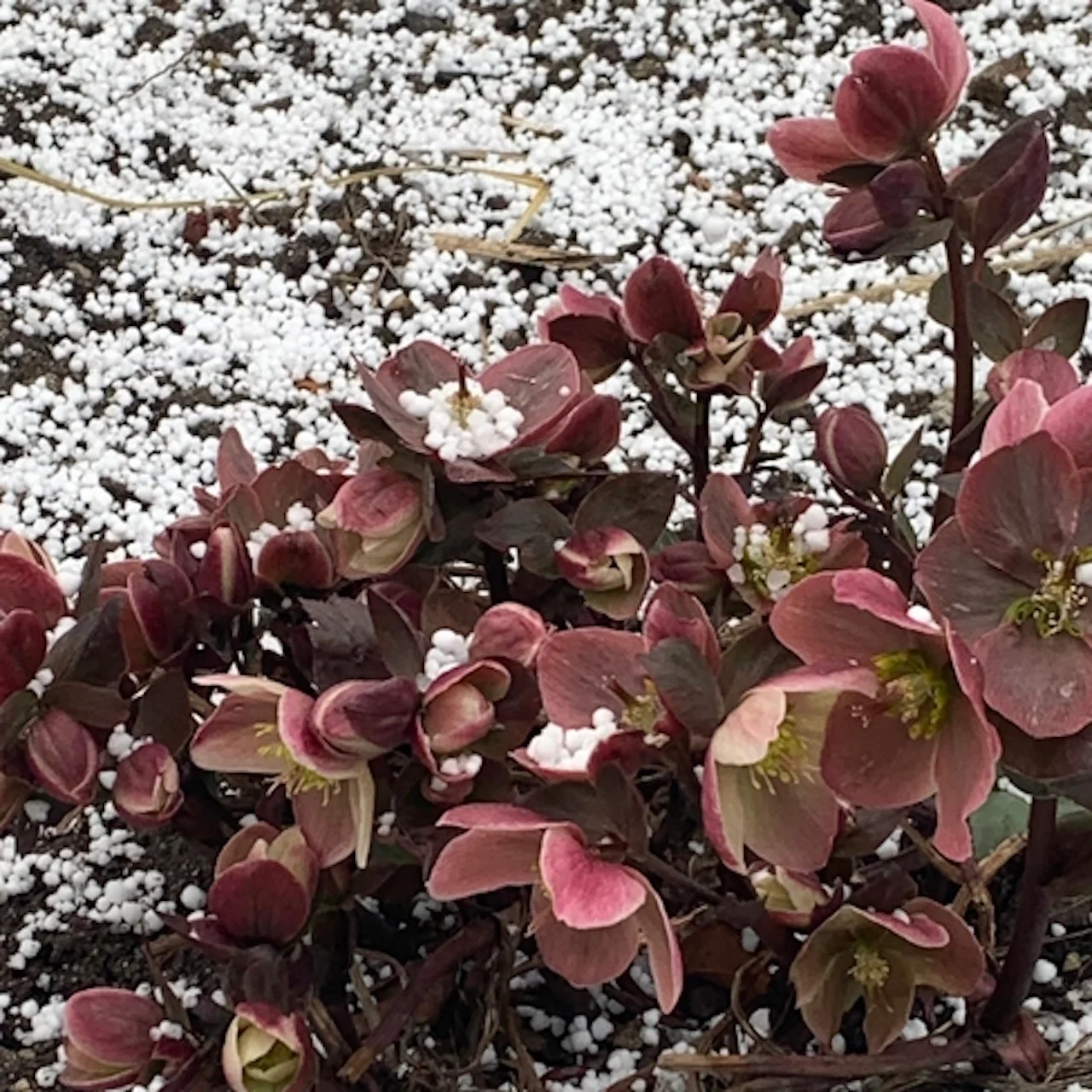
The last few days in B.C. have been atypical of April weather for the province, with everything from low-elevation snow to ice and thundersnow being thrown at the sea-level communities along the coast. It appears it may be winding down, with a final shot of the wacky weather through Tuesday. Metro Vancouver may even get some wet snow, depending on how heavy the precipitation falls. In addition to the snow, rumbles of thunder and hail can't be ruled out, either, Tuesday. More on what to expect Tuesday and the week ahead, below.
PHOTOS: Unusual April snow is spring wake-up call for B.C. residents
TUESDAY: A THIRD CHANCE OF SNOW CHANCE ARRIVES FOR B.C.
The last few days have brought some peculiar weather to B.C., everything from wet snow to thundersnow. It isn't finished with the South Coast, yet, with more low-elevation snow through Tuesday morning. Snowfall warnings are in place for parts of Metro Vancouver and Vancouver Island.

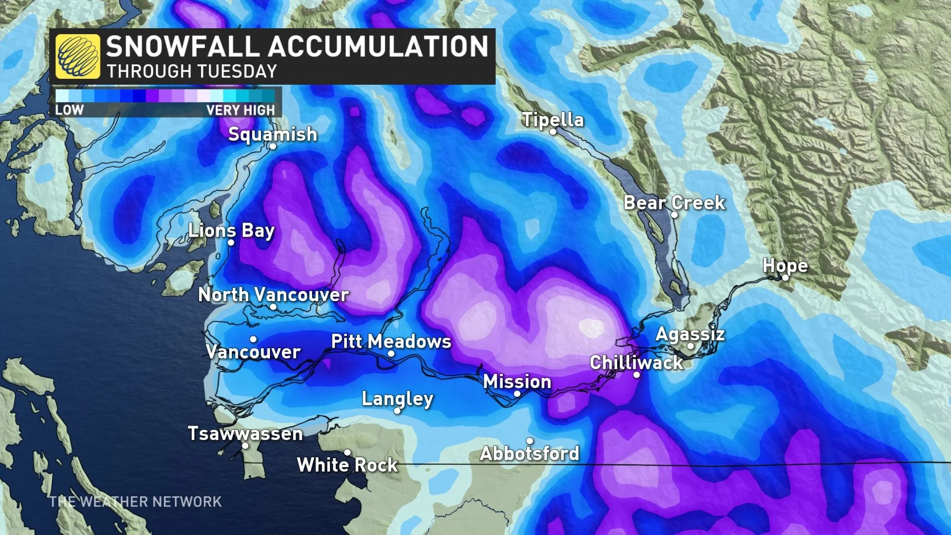
Our third opportunity for snow will arrive Monday overnight as a cold upper-level trough heads toward Vancouver Island. It’s usually difficult for snow to accumulate in the middle of April due to the higher sun angle, but snow lovers keep lucking out with these nighttime snowfalls.
Metro Vancouver could be thrown into the snow mix, as well. If precipitation comes down heavy enough it will be in the form of wet snow. Arguably, the best shot for some localized accumulation for Metro Vancouver from the past few days. Eastern Vancouver Island may locally pick up a few centimetres, as well.
Areas in the snowfall warnings may locally pick up 5-10 cm of snow, so travel will be tricky.
Not only will this upper-level trough bring another chance for snow, but the sharp temperature contrast between the lower and upper levels will lead to some convection. Rumbles of thunder and some small hail can’t be ruled out on Tuesday.
"The very cold air aloft with the strong April sun attempting to heat the surface will bring a daily risk for scattered rain and snow showers, and a risk for graupel," says Dr. Doug Gillham, a meteorologist at The Weather Network.
Precipitation, including snow, will be on and off Tuesday morning, subsiding by the afternoon.
Colder than seasonal temperatures will dominate this week and into the weekend, but no major storms are expected. A more active pattern is expected to develop next week with a developing trough off the coast. No consistent warm weather is in sight.
WATCH: RARE THUNDERSNOW AND GRAUPEL HIT PARTS OF B.C. AMID POTENT STORM
Thumbnail courtesy of Linda Willms, taken in West Kelowna, B.C.
Be sure to check back for the latest weather updates across B.C.