Another 300+ mm rain possible as more storms target B.C. this week

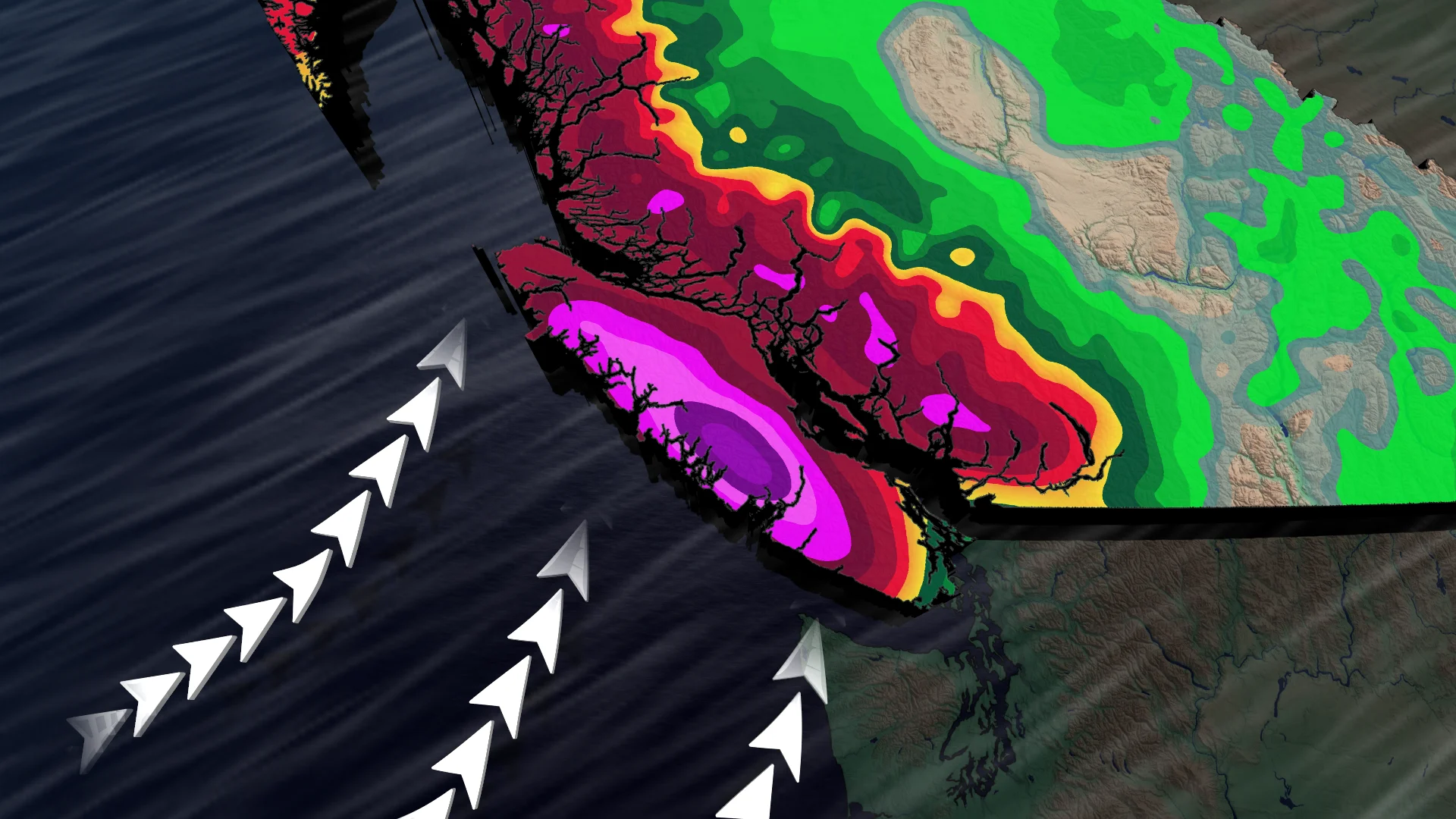
British Columbia's South Coast could see another 100-300+ mm rainfall as new systems target the region through the midweek.
It was a rough weekend across British Columbia, as multiple stormy systems brought heavy rains and strong winds, causing ferry cancellations and a landslide. Unfortunately, the week ahead isn't forecast to be much better.
A powerful windstorm also hit the province early Sunday, knocking out power for tens of thousands of BC Hydro customers.
SEE ALSO: What this record-breaking jet stream may mean for Canada's winter
The strongest gust reached 152 km/h on Sartine Island, followed by a gust of 148 km/h on Solander Island. Strong winds also hit inland communities, including Prince George, where gusts reached 80 km/h, and Abbotsford, which recorded 72 km/h.
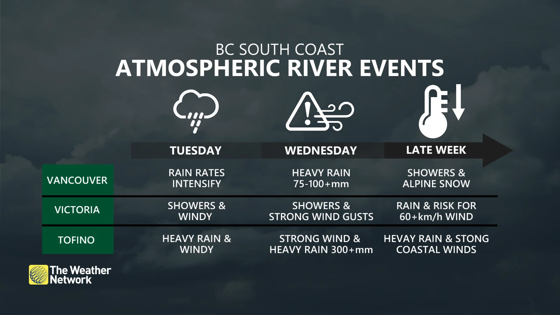
Showers will make a return on Monday, but it's Tuesday and Wednesday that forecasters are closely watching as the rain dramatically picks up thanks to yet another atmospheric river event accompanied by several frontal systems.
Strong atmospheric river brings additional 300+ mm of rain to B.C. coast
This next atmospheric river is forecast to be a strong one, rated AR-4, which means we will see prolonged heavy rains and impacts to the already-soaked West Coast.
Heavy rainfall is expected to begin by Tuesday afternoon and last through Wednesday morning. Western Vancouver Island and the North Shore will especially feel the brunt of the rainfall, with 100-300+ mm of rainfall possible.
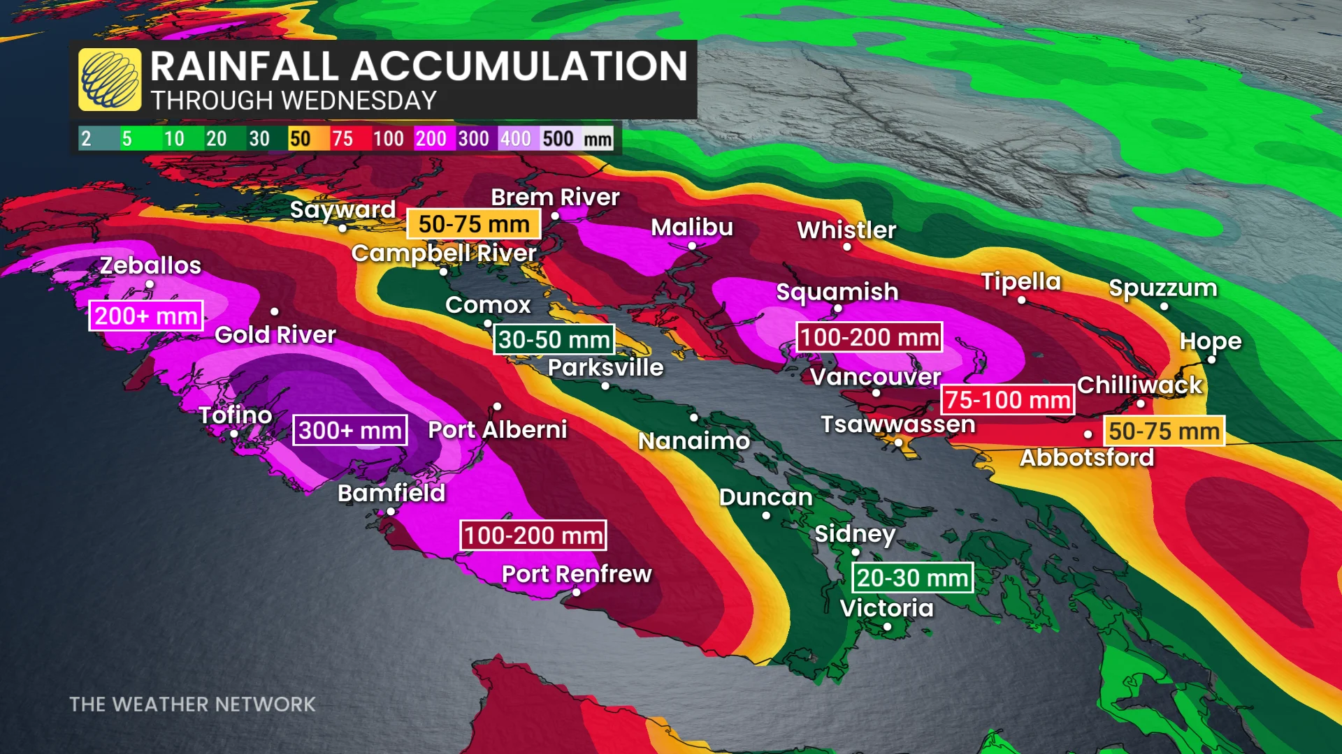
The rest of the Lower Mainland could see 50-75+ mm of rainfall by Wednesday morning.
DON'T MISS: Extreme temperature anomaly set to build over Northern Canada
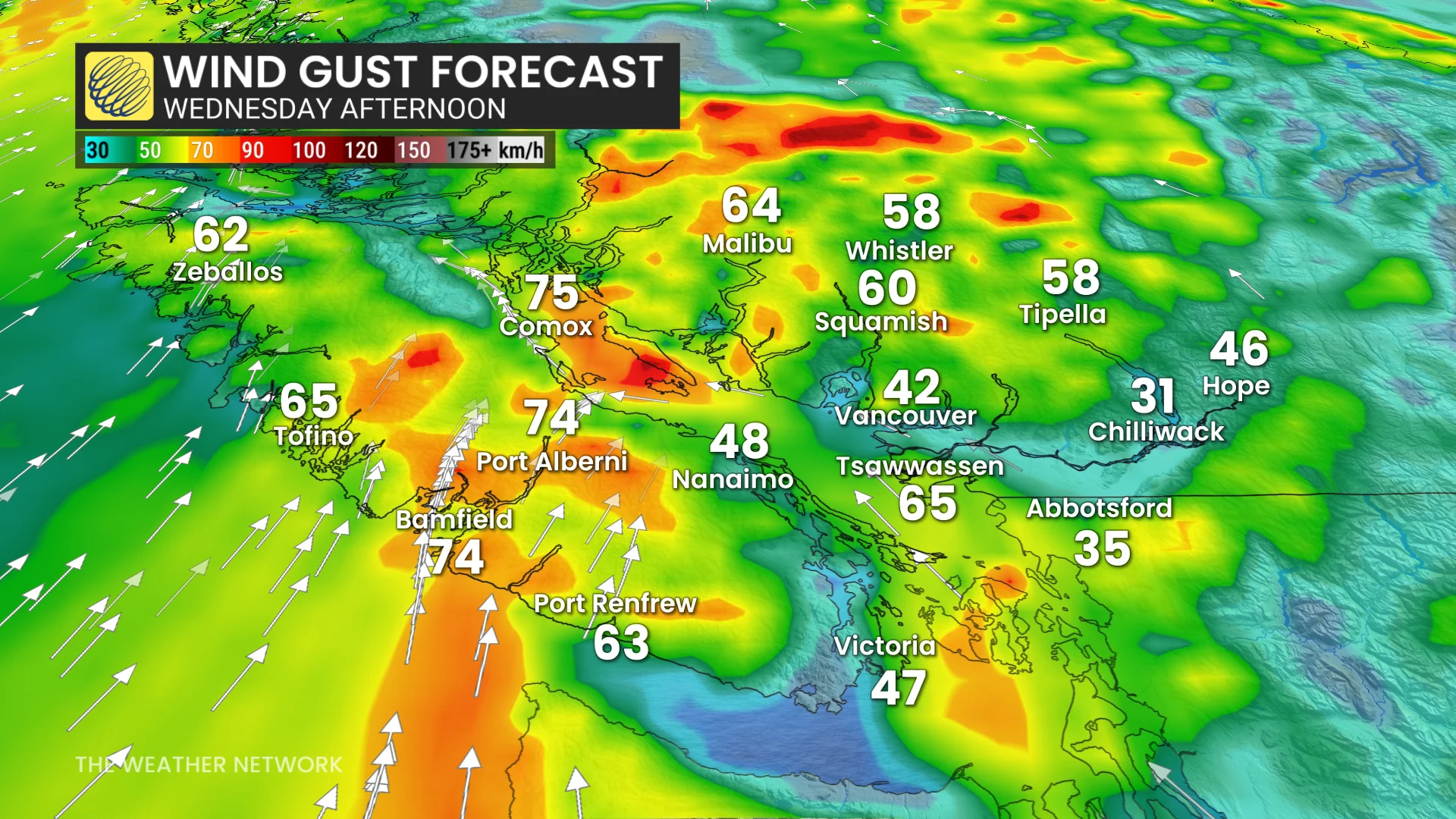
The wind will also once again pick up, gusting to 60-70+ km/h along the coast and into the Strait of Georgia. Slightly lower gusts of 40-60 km/h are forecast for the Greater Victoria region, Tsawassen, and the North Shore.
Week may end on another stormy note
Looking ahead, forecasters are watching a concerningly strong low-pressure system over Alaska that is expected to sink south into the South Coast by Friday. This could bring even more moisture and another wind event to the region for the weekend.
Freezing levels are also forecast to fall back to around 1,200 metres by the weekend, which could result in significant alpine snow impacting travel through the mountain passes.
Stay with The Weather Network for all the latest on conditions across British Columbia.