Alberta sees weather rewind as April warmth replaced by chill, snow
Alberta bids adieu to the spring warmth in a hurry as a cold front will help send the province back into wintry territory this week, with a hefty amount of snowfall for some areas
It was nice while it lasted, Alberta. Spring will be hitting the snooze button starting Wednesday as a cold front wipes away all of the recent warmth the province had been enjoying.
Thanks to a strong ridge of high pressure, parts of the province were forecast to see temperatures hit the upper teens and even the lower 20s on Tuesday. There was the potential for new temperature records in some locales.
REALITY CHECK: Snowfall is normal in April for Canada. Here are the averages
All of that is over for now, or will be soon, unfortunately, as the ridge of high pressure gets swapped with a cold front and upsloping snowfall. Several days of accumulating snow is expected, even lingering through the weekend.
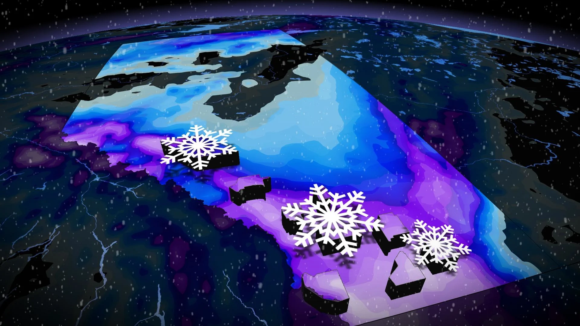
Some areas along the foothills could see 30-40 cm of snow through Friday, with Calgary sitting in the 10-15 cm range. Expect difficult travel throughout the duration.
Wednesday: Goodbye, warmth, and hello, snow and colder temperatures

Snowfall will first move in Wednesday in the northern foothills, with precipitation falling as rain in areas extending east.
System and upsloping snow will then fill into the southern foothills by early Thursday morning as some regions in the southeastern section seeing rain to start.
Colder temperatures mean a transition into all snow across the south, falling heavy at times by the late morning and afternoon hours on Thursday.

DON'T MISS: How to experience the eclipse, and score some cool glasses, in Calgary
Snowfall totals will be steeply higher west of Calgary, especially along the foothills.
As much as 30-40 cm of snowfall is expected for areas along the foothills through Friday. Calgary won't see quite as much, but will still get a hefty dose for April, sitting in the 10-15 cm range.
Expect difficult travel throughout the duration, especially along the southern QE2 and Trans-Canada Highway.
MUST SEE: How the tropics help produce big springtime snows on the Prairies
Thursday through Friday: Another round of moisture
The snow will briefly lighten in intensity Thursday evening before another round of moisture fills in through the overnight period.

On Friday, snowfall will affect the southern and central sections, and areas along the Saskatchewan border.
However, the snow will be beneficial for the ongoing drought conditions, so if there is any consolation prize with the wintry weather, that is it.
There will be more precipitation to come, too.
Periods of rain and wet snow are expected this weekend for southern Alberta, including the southern Rockies, so more of the much-needed moisture will be of great news for agriculture in a region that has long-term drought conditions.
There is uncertainty with snowfall totals for additional weekend rounds. Some banding could lead to locally higher totals.
Stay with The Weather Network on all platforms for all the latest on your forecast across Alberta.


