Active storm track in Ontario will bring multiple chances of winter weather
Monday's messy mix of winter weather in southern Ontario was just the appetizer for what's to come, with multiple systems targeting the region with more snowfall, and the risk of freezing rain, rain and ice in the coming days
The week got off to a messy start in southern Ontario with a mix of rain and frozen precipitation for some areas, and there could be more of it to come in the days to come.
Folks will need to be alert this week as additional shots of messy winter weather, including the chance of freezing rain and ice, is forecast to arrive by Wednesday night. However, there is some uncertainty regarding the exact track and precipitation totals right now.
DON’T MISS: La Niña and the polar vortex team up to delay spring in Canada
Southern Ontario is in the midst of a pattern change this month, becoming the battleground between air masses. Abundant arctic air will be available, pushing back on warm air to the south. As a result, the setup creates a favourable, active storm track for U.S.-based systems to move through.

Stay up-to-date with the latest weather alerts in your area, and be sure to always check highway conditions before heading out.
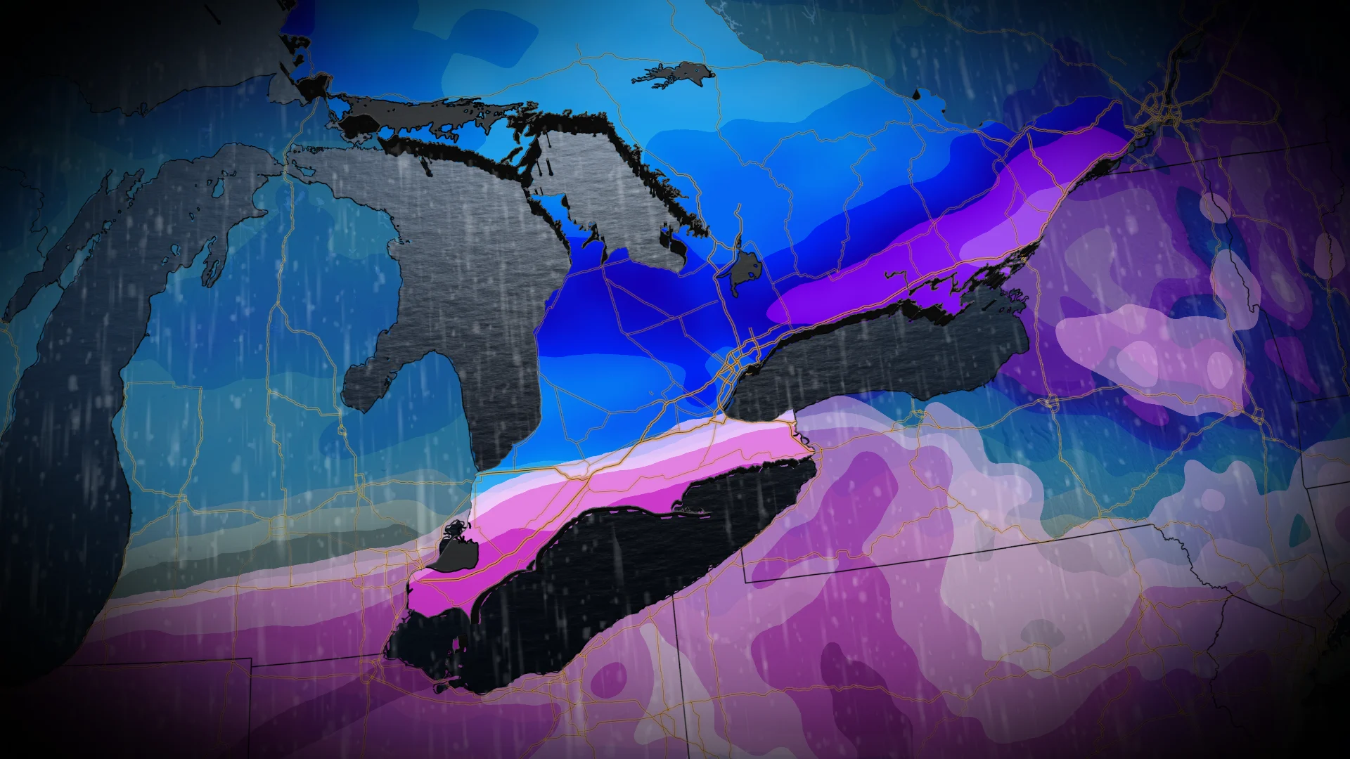
Wednesday and Thursday: Uncertain track, but snow, freezing rain possible
More than half of Canada's groundhogs saw their shadows on Sunday, indicating six more weeks of winter, and that outcome certainly lines up with what is in store for Ontario this week.

The next major system to watch will arrive Wednesday night and continue into Thursday, only to be followed by another low on the weekend.
The first of several messy storms in the coming days will move into southern Ontario by Wednesday overnight.
Precipitation could start out as freezing rain, which may spread from the southwest along the Highway 401 corridor into Hamilton by Thursday morning.

The poor timing of the precipitation will certainly cause commuting troubles by early Thursday morning, along with the risk of localized power outages due to the chance of ice accretion.
Meanwhile, north of the 401 corridor, snow will extend into the snowbelt regions Thursday morning and then reaching eastern Ontario by the afternoon
However, there is an uncertainty with the exact storm track and precipitation totals at this time. Scenarios from the uncertain track could see the precipitation outcome as either icy and rainy, or icy and snowy

At this time, the cold scenario is slightly favoured, as opposed to the icy and rainy option.
Beyond that, fair and colder conditions for Friday, but then a Colorado low is expected to track just south of the region on Saturday with similar ice and snow risks, but there is a higher track uncertainty. A changeover to ice pellets and freezing rain is possible for southern parts of the region, possibly even changing to rain across southwestern sections.
Colder-than-normal temperatures are expected to dominate next week and beyond. The pattern should stay active, but it is too early to know if that will mean substantial snow or if the storm track will be too far south of the region for much of the week.
WATCH: La Niña, polar vortex cast a wintry shadow over Canada's February outlook
Stay tuned to The Weather Network for the latest forecast updates for Ontario.