Territory temperatures spring to top of global anomaly pack
We may be counting down the last few days before the official start of spring, but it seems like the new season couldn't wait to get started across northwestern Canada.
In fact, soaring temperatures from the Yukon to Hudson Bay have landed northern Canada in the top spot when it comes to above-average temperature anomalies around the globe over the past few weeks.
Spring is here! Check theweathernetwork.com on Wednesday, March 20 to see what the season has ahead, plus get an EXCLUSIVE sneak peek at Summer 2019!
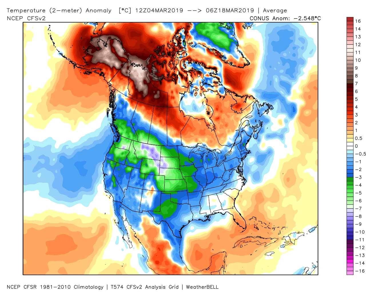
Image courtesy WeatherBell.
The map above shows how far above or below the average temperatures were for the past 14 days. While much of the United States and southern Canada fall in the blues -- indicating temperatures have been on the chilly side -- the map reveals how much of the northwest has seen temperatures running close to 10 degrees warmer than expected the past two weeks.
While the temperature anomaly in and of itself doesn't necessarily mean highs have been balmy -- it is a value compared to the average, after all, so if the average was well below zero, 10 degrees warmer could still be quite chilly -- parts of the Northwest Territories, along with northern British Columbia and Alberta, crushed temperature records over the weekend, with highs in the double digits.
SEE ALSO: Melting ice looks like wriggling worms
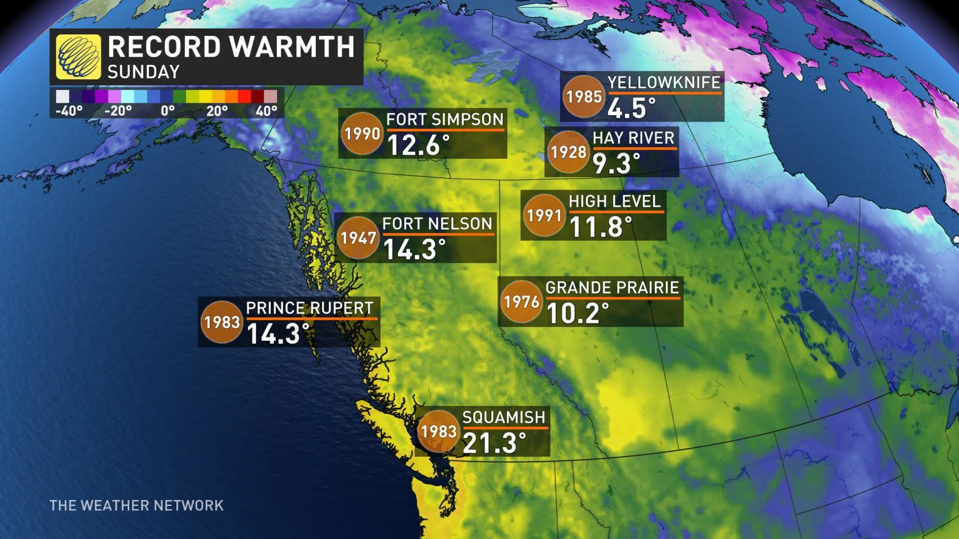
Spurring the unusually-strong warmth is a massive ridge of high pressure across western Canada, part of the atmospheric blocking pattern that's kept eastern Canada and much of the U.S. on the cool side over the same time period. Most long range model guidance shows that blocking pattern holding on until at least early next week, providing ample time for additional records to fall as highs creep into the 20s for parts of British Columbia, and even into Alberta.


