Warnings blanket the Prairies as significant winter storm rolls in

A potent winter storm is charging through the Prairies with copious snowfall, blustery winds and even freezing rain this week, potentially bringing Edmonton its largest snowfall in several years.
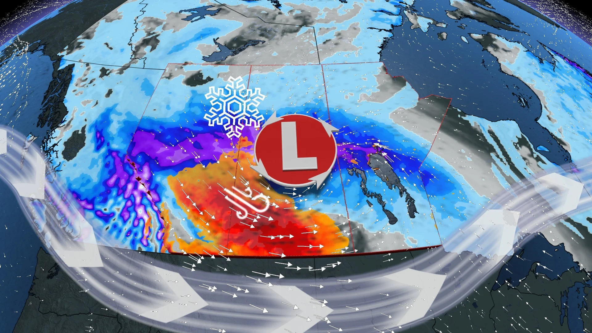
The Prairies are set to get another taste of winter this week, with snow, strong winds and freezing rain set to continue pusing east across the region Tuesday and Wednesday. A mighty low trekking into the region from B.C. will also be impactful, but more so in wintry fashion -- delivering a swath of 10-30+ cm of snow, intense wind gusts of 60-100+ km/h and a brief period of freezing rain for some areas. Expect significant travel impacts Tuesday and Wednesday, so motorists should exercise caution before venturing out on the roads. More on the timing and details, below.
SEE ALSO: Think twice if you're still debating on whether to use winter tires
THIS WEEK: SIGNIFICANT WINTER STORM BATTERS THE CENTRAL PRAIRIES
A bout of wicked wintry weather is now unfolding on the Prairies. Courtesy of the same low-pressure system unleashed epic rainfall and damaging winds to British Columbia in recent days has now set the stage for far-reaching accumulating snowfall to coat a large swath of the central Prairies.
Several different types of winter weather alerts are in effect, with snowfall and winter storm warnings following along and north of the Yellowhead through Alberta and Saskatchewan, as well as freezing rain and snowfall warnings in Manitoba.

Snow has already pushed into Alberta and Saskatchewan, and will reach Manitoba Monday overnight and then spread east across the three provinces Tuesday.
Snowfall amounts of 10-20 cm are expected for the city of Edmonton and Saskatoon, with 15-30+ cm of snow forecast for central regions of Saskatchewan, Manitoba and through the Alberta Rockies.
Much lighter accumulations are likely on the southern Prairies with Calgary and Regina potentially in for a dusting of 5 cm of snow or less.
As well, a narrow line of freezing rain will be possible just south of the major band of snow overnight Monday into Tuesday morning for central Alberta and Saskatchewn.

Making the snow worse will be the winds, with intense gusts developing Monday night into Tuesday, reaching 60-100+ km/h across southern Alberta and Saskatchewan.
Travel is not recommended on Tuesday across central and southern Saskatchewan, and parts of central Alberta, as rapidly accumulating and blowing snow will create whiteout conditions.
Conditions will begin to improve in Alberta by Wednesday morning, and in Saskatchewan and Manitoba by Thursday morning, then Thursday night in northwestern Ontario.
Beyond the system, a more notable blast of Arctic air will dive south from the Yukon and N.W.T. on the weekend. It will first enter into the western Prairies and then quickly spread east across the eastern section.
Be sure to check back for the latest updates on this Prairies snowstorm.