Monumental storm will loosen severe grip on B.C., cleanup to follow

Tuesday will finally give British Columbians a break from the extreme rainfall that accumulated to as much as 100-200 mm range for much of southern B.C., triggering mudslides, river flooding and evacuations. Winds, however, will continue to be an issue into the morning.
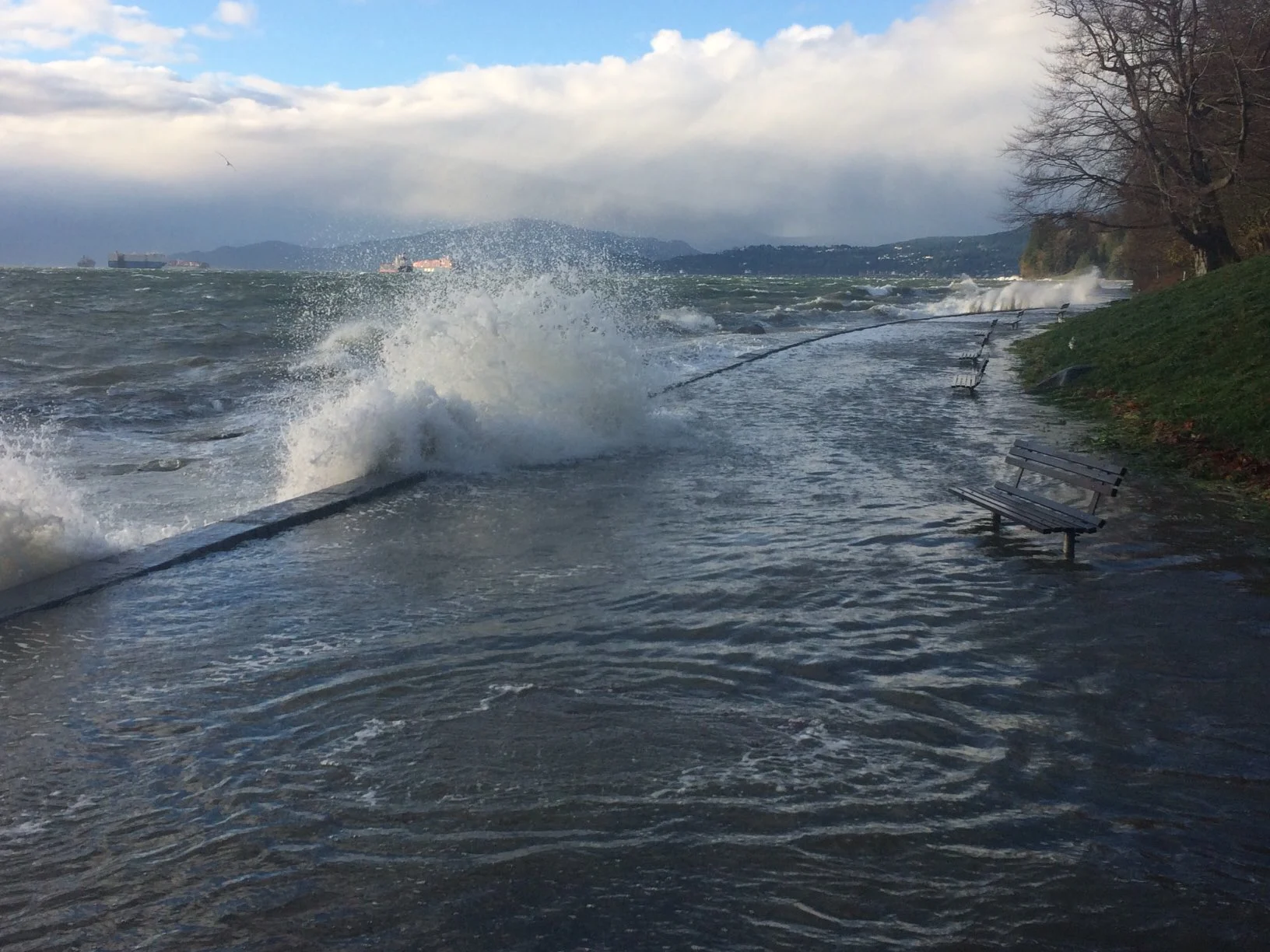
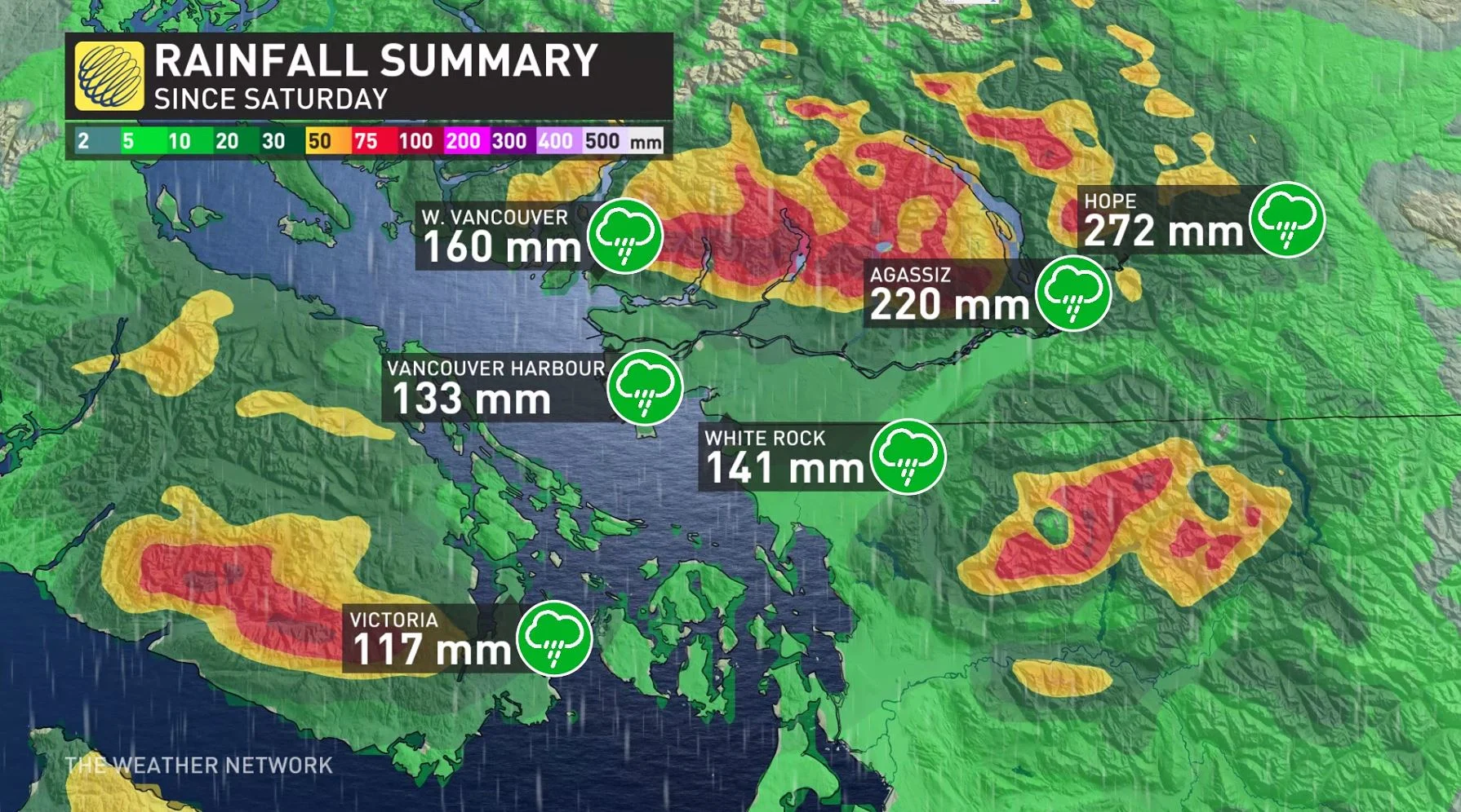
This 'pineapple express' that hit B.C. over the last few days surely came loaded with juice, unleashing widespread rainfall amounts of 100-200 mm for southern areas, resulting in floods and mudslides that closed roads and prompted evacuation alerts and orders for many communities Monday. Finally, the province will see a break from the rain Tuesday, with some potent winds lingering into the morning, but the cleanup and impacts will be far from over. At the height of the storm Monday evening, more than 100,000 customers were without power at one point, according to BC Hydro. For a look at impacts, and what's left to come, see below.
TUESDAY: RAINS SUBSIDE, BLUSTERY WINDS LINGER, ICY ROADS FROM TEMPERATURE DROP
After a relentless atmospheric river targeted B.C. multiple days with excessive rainfall, enhanced by tropical Pacific moisture, the province will finally catch a break from the precipitation Tuesdy after winding down Monday afternoon.
READ MORE: City of Merritt ordered to evacuate due to flooding of wastewater treatment plant
The prolonged event has been especially impactful, with some areas receiving more than 200 mm through Monday. Parts of Metro Vancouver picked up 160 mm, and even Victoria, often sheltered by Vancouver Island's rain shadow, has picked up around 117 mm, which is on the higher end for the city in terms of events.
But that doesn't mean Tuesday will be a quiet day for B.C.
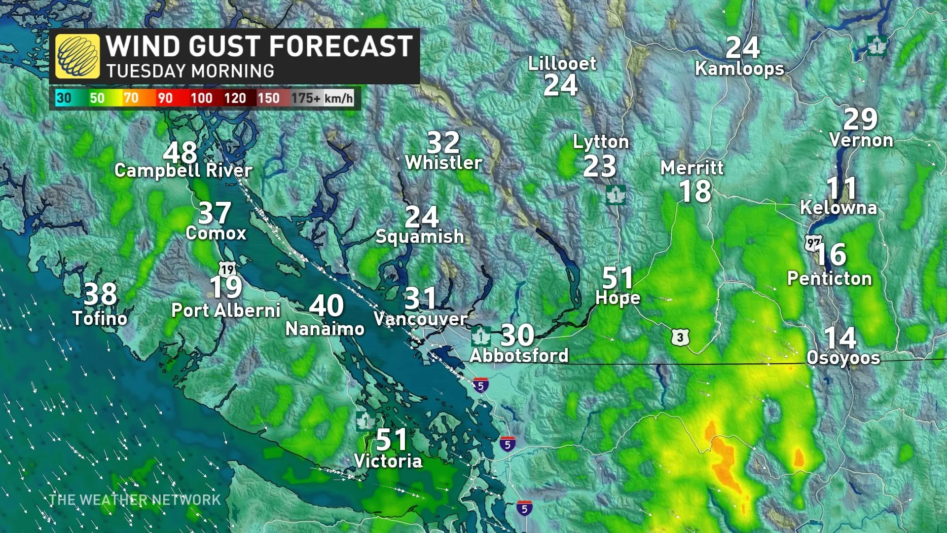
The winds will continue to be intense through Monday overnight, though not as destructive as during the day, lingering into Tuesday morning before subsiding. Gusts of 40-60 km/h will continue for the South Coast, 50-70+ km/h through the southern Interior.
As for the mountains, low freezing levels will bring icy conditions to all highway passes, especially the Coquihalla, through Monday overnight. Snow will quickly accumulate overnight Monday with up to 25 cm possible in some of the passes by midday Tuesday. Strong and gusty southwesterly winds may also reduce visibility due to blowing snow.
Another issue will be slick and slippery roads as temperatures will drop considerably by Tuesday morning. Daytime highs Tuesday afternoon will plummet into the single digits for the coastal and Interior regions. Motorists will need to be cautious when heading out on the roads.
IMPACTS: MUDSLIDES, FLOODING, EVACUATIONS
This was a large amount of rain even under normal circumstances, but the heaviest amounts fell at elevations where some snowfall has already accumulated. Local runoff, then, was boosted by melting snow.
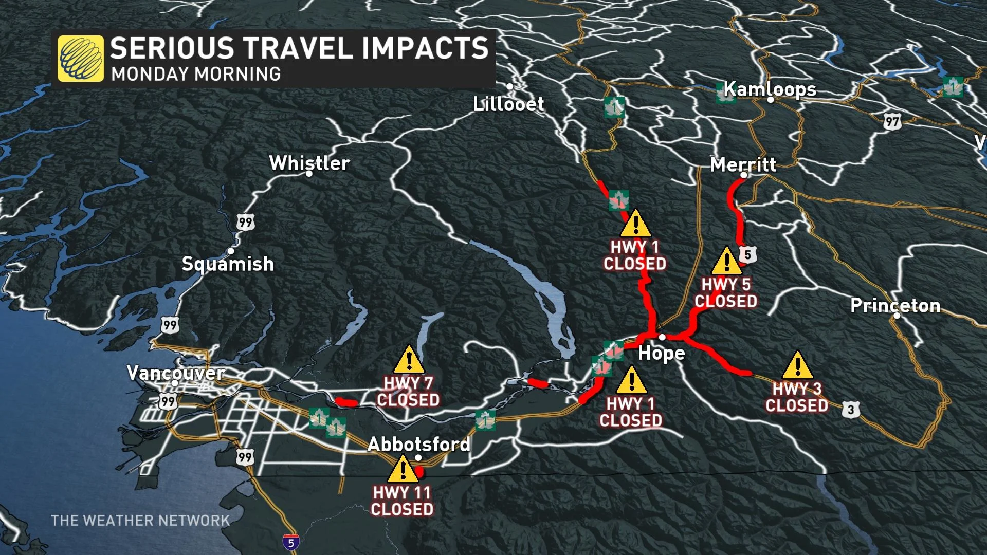
One of the worst results of that is increased mud and rockslide risk, and indeed, many have been reported across the province. Highway 1 is closed in multiple directions, as are numerous other roads. Travel is not recommended if you can avoid it.
Meanwhile, rescue efforts by helicopter are lifting hundreds of people to safety after they were trapped along a southern B.C. highway from landslides caused by extreme weather,CBC reported. As many as 275 people, among them 50 children, have been trapped on the stretch of highway since Sunday evening, the City of Vancouver and Canada Task Force 1, the locally based urban search and rescue team, said in a joint release.
On Thursday night, a mudslide near Agassiz was reported to have stranded several motorists, with ongoing efforts to extricate them.
That runoff made its way into local streams, and flood warnings were issued for several parts of the Interior.
On Monday, evacuation orders – meaning residents in the affected areas must leave at once – were in effect for parts of the Fraser Valley and Okanagan–Similkameen regional districts. An evacuation alert – meaning residents must prepare to evacuate if asked – was issued for parts of Princeton and Abbotsford.
In Merrit, the evacuation became citywide after flooding caused the complete failure of the municipality's wastewater treatment plant and what city officials are calling an "immediate danger to public health and safety."
Officials also said residents with friends or family outside of the community should make plans to stay with them and evacuate to that location.
Meanwhile, power outages are continuing, with BC Hydro reporting more than 80,000 customers are in the dark as of Monday evening
ON-LOCATION UPDATE: LANDSLIDES AND FLOODING TRAP B.C. RESIDENTS, RESCUE CREWS FIGHT WEATHER CONDITIONS
Thumbnail courtesy of John Soos/Twitter.
Check back for updates as we continue to monitor the situation. This article contains files from CBC News.