30-50 mm: Atlantic Canada faces windy, soggy (or even snowy) storm

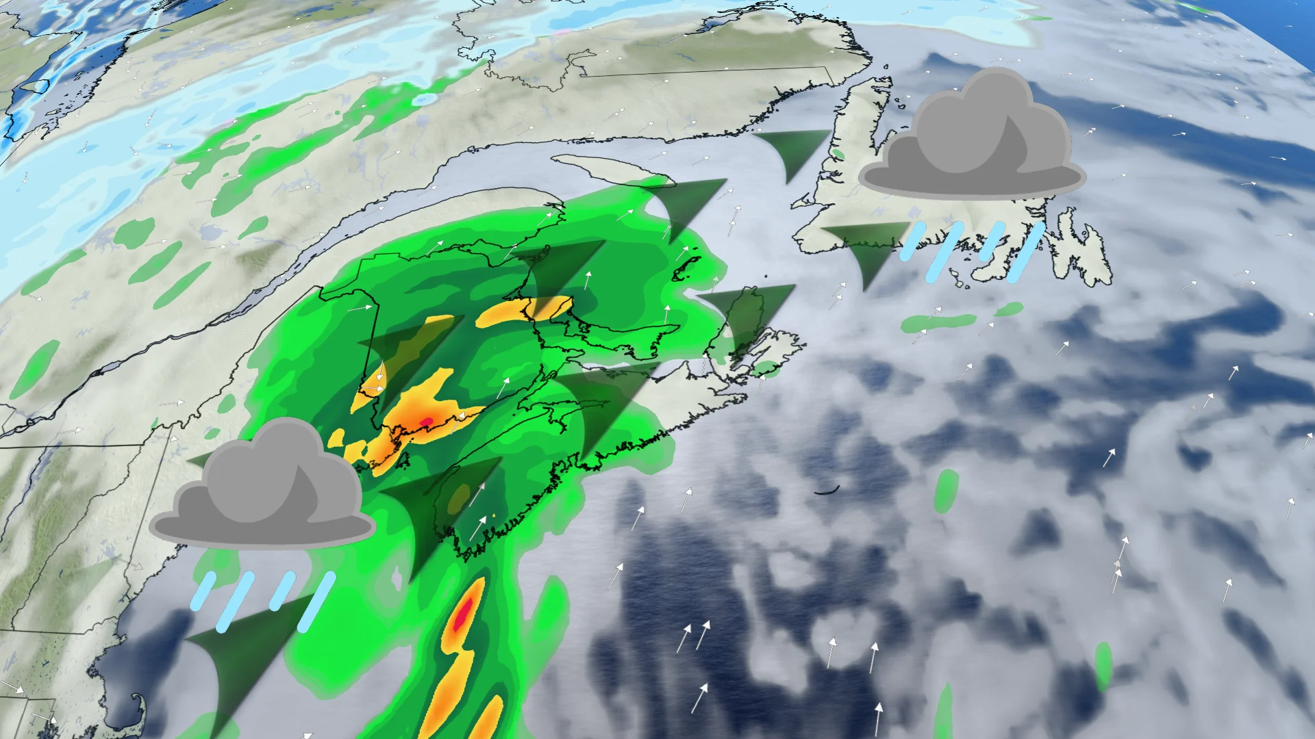
A low-pressure system bringing drenching rains to Florida will slide up the U.S. East Coast, reaching Atlantic Canada by Monday, bringing heavy rain and strong winds--and even heavy snow for parts of the region
A strong low-pressure system brought heavy rain to the Bahamas and Cuba earlier this week and is now travelling northward, tapping into heavy moisture and warm sea surface temperatures on its way, and will likely impact Atlantic Canada by Monday.
The U.S. National Hurricane Center (NHC) currently has a 10 per cent probability that this system will develop into a subtropical cyclone over the weekend.
SEE ALSO: Impactful weather interruptions will mark November's end across Canada
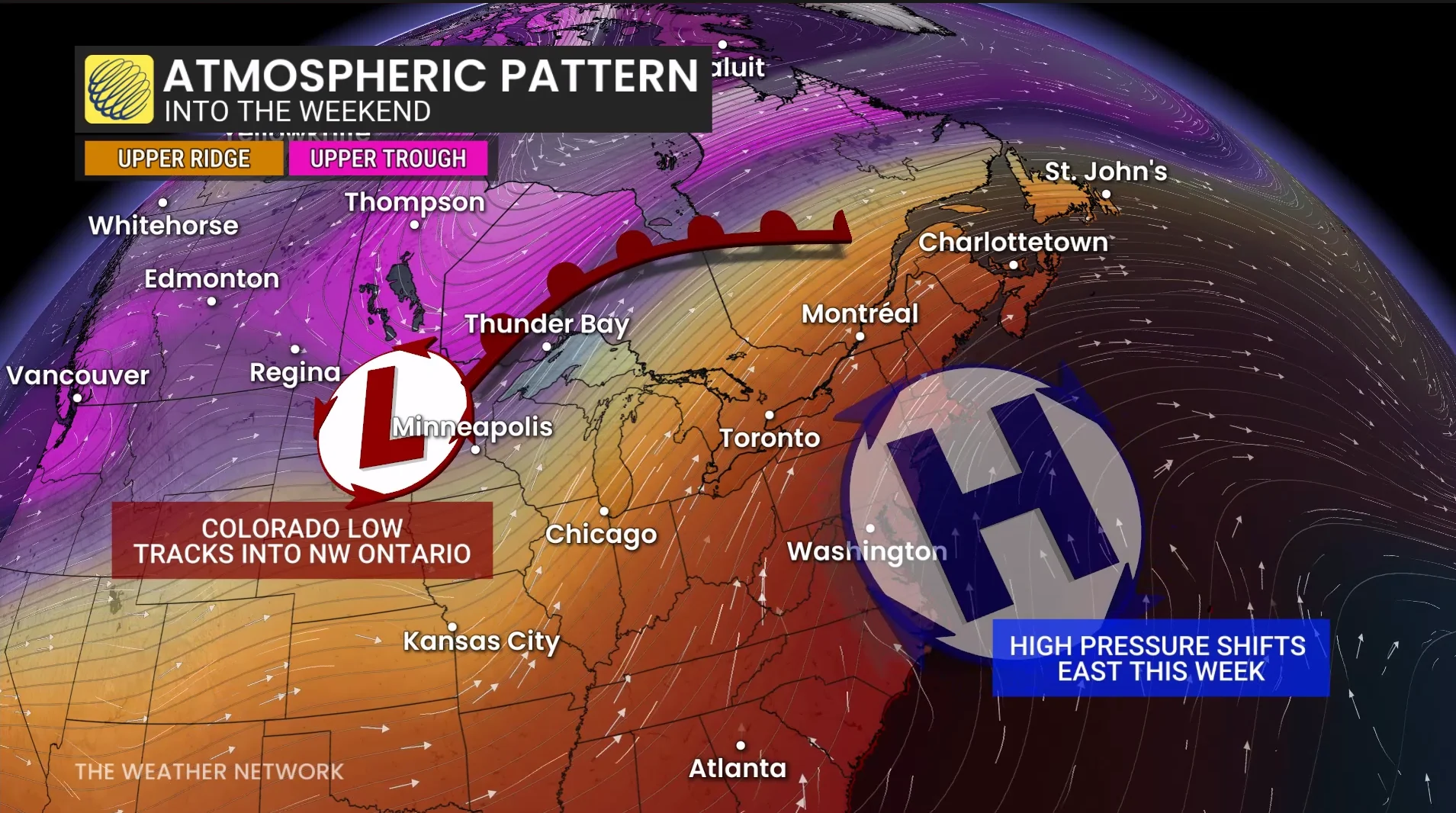
Regardless of whether or not the system takes on tropical or subtropical characteristics as it churns up the Eastern Seaboard, it will bring heavy rain, heavy snow, high surf, and strong winds will likely be the trend over the coming days.
Impacts to Atlantic Canada
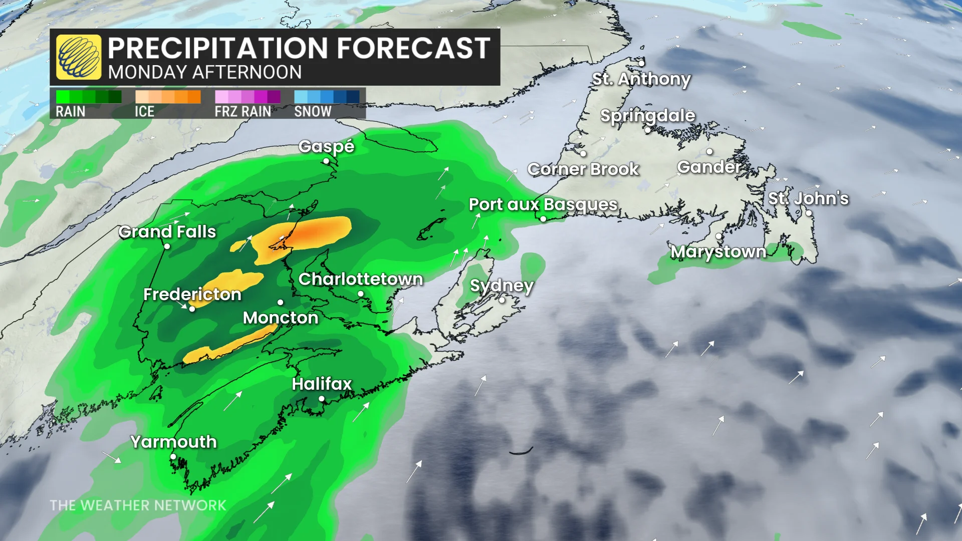
By pre-dawn Monday, rain begins across the Maritimes and continues to be heavy at times through the day. The low is forecast to track up through New Brunswick, spreading the swath of heaviest rainfall across the province.
DON'T MISS: The mysterious Newfoundland flamingoes that inspired a Netflix show
Preliminary accumulation of 30-50 mm of rainfall from Saint John to Fredericton, stretching to Grand Falls and across to the Arcadian Peninsula. Most of P.E.I. and Nova Scotia will see 10-20 mm.
This is expected to be a quick-moving rain event for the Maritimes, as by Monday night, the rain is done.
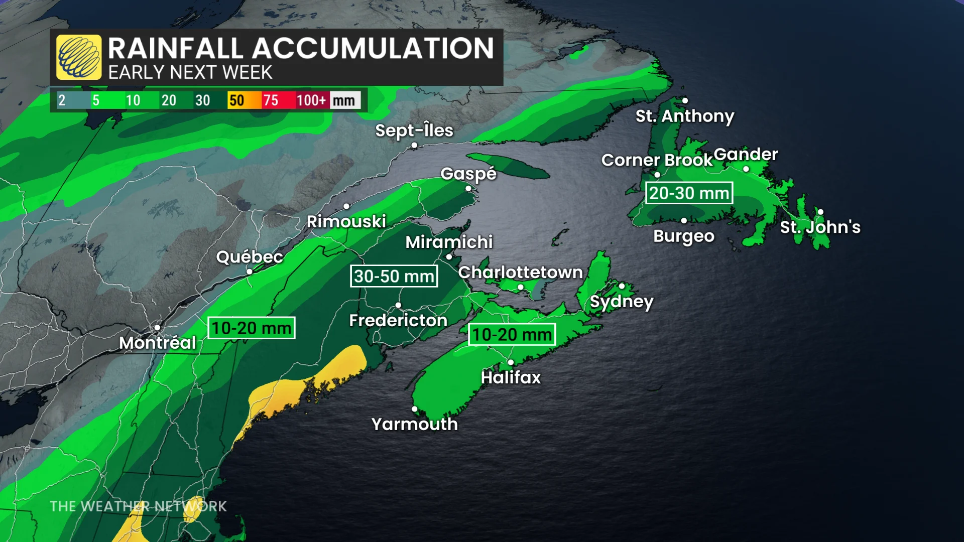
Rain spreads west to east across Newfoundland Monday night through Tuesday. 20-30 mm across the west, 10-20 mm on the Avalon Peninusla, with less to the north and more to the south.
The Avalon remains dry until Monday night.
By Tuesday afternoon, the rain will be done in Newfoundland.
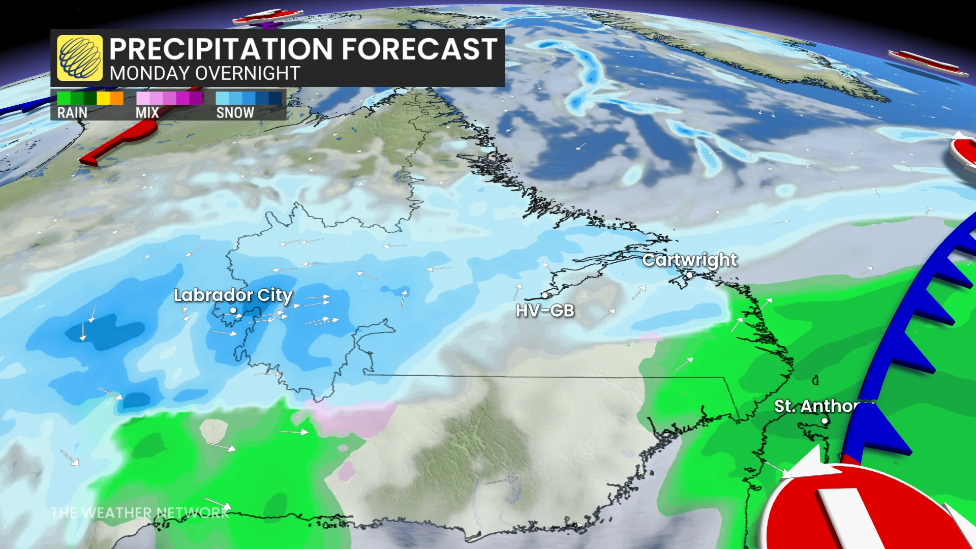
A combination of a low-pressure system tracking eastward across Quebec-Labrador and the East Coast system will spread heavy snowfall in Labrador from Sunday-Tuesday. Happy Valley-Goose Bay and Labrador City likely to get 15-30 cm of snow.
Areas along the Quebec-southern Labrador border will see rain change to snow.
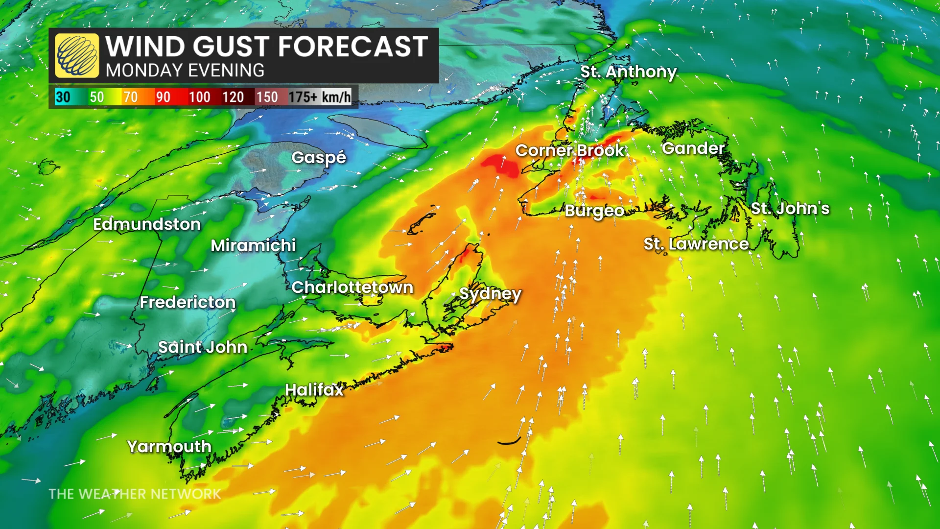
Wind gusts will also be an issue. Strong wind gusts ramp up in the Maritimes Monday afternoon, reaching 70+ km/h. Monday evening gusts will hit 70-90 km/h in coastal areas of eastern Nova Scotia and western Newfoundland.
Stay with The Weather Network for more information and updates on your forecast across Atlantic Canada.