Squall line threatens to unleash 100 km/h winds for eastern Prairies, NW Ontario

Hold on to your hats! An unusually strong August system will bring powerful winds to parts of Manitoba and northwestern Ontario Wednesday
5:54 P.M. CDT - Severe thunderstorms prompted tornado warnings in northwestern Ontario Wednesday evening. Environment and Climate Change Canada has since dropped the warnings.
EXPIRED TORNADO WARNINGS (ONTARIO):
Atikokan
Shebandowan
Quetico Park
Keep reading below for Wednesday's full forecast:
Ingredients are coming together for a windy and stormy Wednesday in parts of Saskatchewan, Manitoba and northwestern Ontario, where severe weather will be possible into the evening.
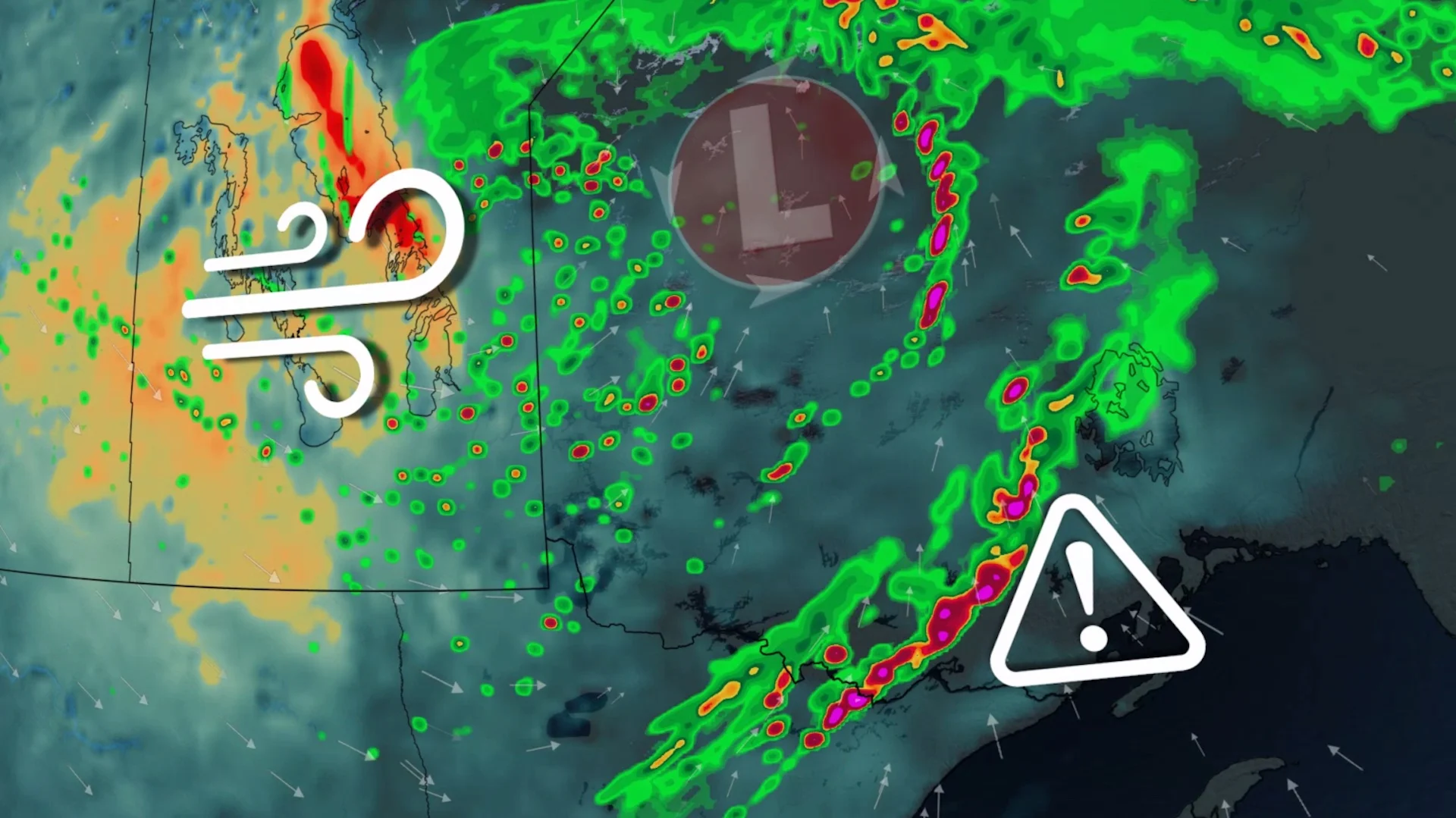
The potentially damaging winds will be the result of a deep low, with pressure potentially dropping down to 981 millibars by the time it tracks into northwestern Ontario -- unusually strong for August.
Wednesday
Areas: Saskatchewan, Manitoba, and northwestern Ontario
Timing: Wednesday
Weather: The low-pressure system culprit is expected to be strong for summer standards. It can drop down to a low of 981 millibars by the time it tracks into northwestern Ontario, which is unusually strong for August. Residents will feel the effects of this summer storm with gusty winds along the cold front, as well as wrapping behind the system.

Conditions are expected to be widespread, but also may be damaging for some.
Weather begins to get interesting by Wednesday afternoon and evening. Wind gusts will ramp up in the Interlake region, reaching upwards of 90 km/h over the exposed lakes and immediately on the southeastern shores. Meanwhile, a squall line develops along the cold front in Ontario, risking similar gusts and possibly severe thunderstorms.
Expect this line of thunderstorms to move fast and furiously onto the Thunder Bay and Lake Superior shores as the sun begins to set.
Forecasters will continue monitoring further risks for small hail, heavy showers and embedded rotation within the squall line for Ontarians.

Residences, cabin-goers, and campers should be aware of rapidly changing weather conditions by Wednesday evening. Be on the lookout for a shelf cloud and winds ramping up to prepare to take shelter.
Prepare
Make sure to keep up-to-date on your local forecast information and alerts. If you are outdoors in an area with a severe weather threat, make sure you have a safety plan in place in case you need to get to shelter.
If a severe thunderstorm approaches your location, remain mindful of trees or tree limbs that loom near your home. Trees falling into buildings are a significant source of injury during strong storms. Try to avoid rooms where trees may cause damage during high winds.
The greatest danger in any thunderstorm is lightning. If you can hear thunder, you’re close enough to be struck by lightning.
DON'T MISS: Watch? Warning? How we communicate severe weather in Canada
Be sure to check back for the latest weather updates across Manitoba and northwestern Ontario.