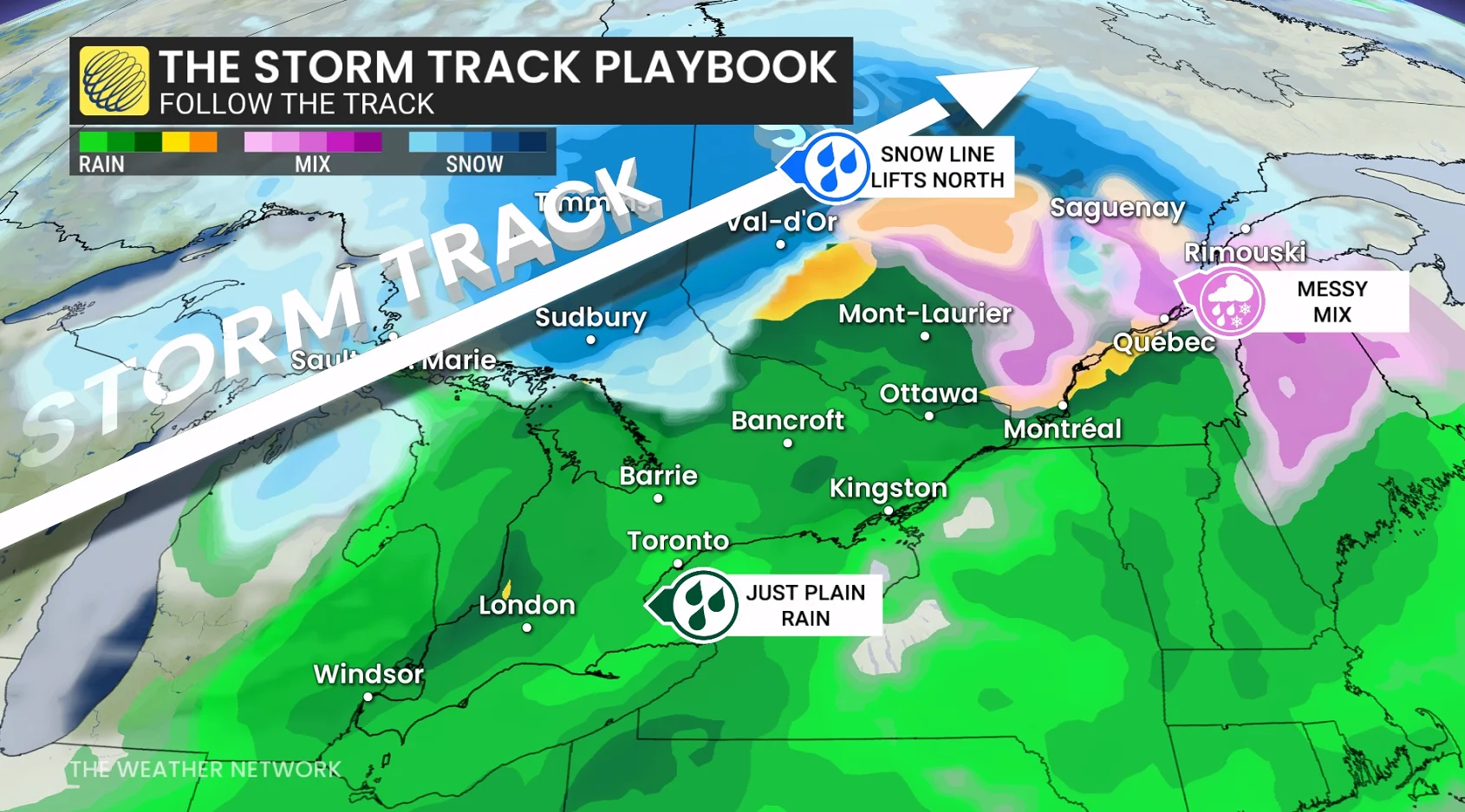
A winter storm’s track can make or break your forecast
A few kilometres one way or the other can make the difference between rain, snow, and ice
Winter weather forecasts are a high-stakes ordeal for communities in the path of a significant storm. Each type of wintry precipitation can have major impacts on travel and power outages.
It’s often the path of a storm itself that determines what type of precipitation you encounter, and a small shift of just a few kilometres one way or the other can make all the difference.
DON'T MISS: Freezing rain and ice pellets are dangerous winter hazards
Precipitation types are a significant sticking point
Significant bouts of wintry weather are common across Canada beginning in autumn and continuing well into the spring season, burying communities in knee-deep snows or a disruptive crust of ice.

Temperatures throughout different layers of the atmosphere decide what type of wintry precipitation you encounter during a storm. Ice pellets and freezing rain occur when snowflakes fall through a pocket of above-freezing air a few hundred metres above ground level.
Blustery winds within a dynamic storm can cause big temperature swings over short distances. A shift as small as 1°C can completely change what type of precipitation you experience.
WATCH BELOW: Bust a common weather mixup, freezing rain vs ice pellets
Storm track is key to forecasting rain, snow, and ice
The track of a storm affects whether your town will see rain, snow, ice pellets, freezing rain, or a sloppy wintry mix.
Generally, cold air wraps around the northern and western side of lows, while warm air draws into the eastern and southern quadrants of these sprawling systems.

RELATED: How an intense snowstorm can match the ferocity of a thunderstorm
As a result, we typically see snow to the north of a low, a batch of rain to the storm’s south, with a headache-inducing wintry mix for communities around and east of the centre of the storm.
The transition zone between rain, ice, and snow can measure just a few kilometres across, allowing neighbouring towns to witness completely different conditions.
This is where we have to pay attention to a storm’s precise track. A slight nudge to the north, for instance, would move the transition zone to the north as well. This could force communities that expected snow to endure an unwelcome period of ice instead.

On the other hand, a low-pressure system that jogs just a bit farther south than expected could bring a ‘surprise’ bout of snow, freezing rain, and ice pellets to communities that were expecting plain old rain.
While storm track is key just about anywhere in Canada, the path a system takes often affects precipitation types across southern sections of the country, especially in Ontario, Quebec, and Atlantic Canada.
Meteorologists strive to provide you with the most accurate forecast possible. Some forecasts are more uncertain than others. Experts do their best to convey this uncertainty when wintry weather is involved. It’s always important to pay attention to the forecast details when a significant bout of snowy or icy weather is on your horizon.
Header image created using graphics and imagery from Canva.
