The 2004 Peterborough flood was disastrous. AI aims to prevent a repeat

Detailed information about a city’s infrastructure is becoming an essential component for cities as they aim to improve climate resiliency.
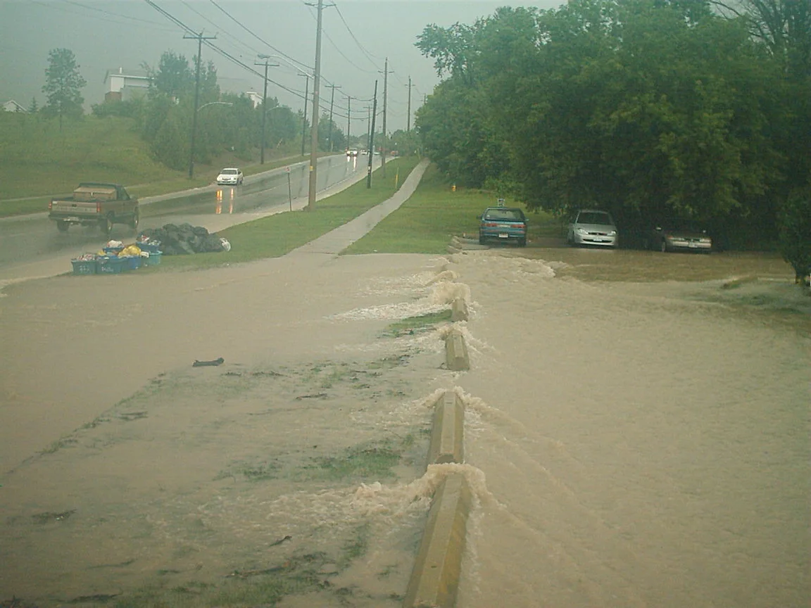
Up to 220 mm of rain poured down on Peterborough from July 14-15 in 2004 when a storm stalled over the city. The precipitation was roughly a quarter of what the city normally sees in an entire year. The city’s drainage system quickly became overwhelmed, the downtown area was submerged, and streets turned into rivers.
The roof of a senior’s residence partially collapsed and forced 200 people to evacuate and up to $100 million in damages was caused to infrastructure and property.
“A lot of people didn't expect that something like this could ever happen and didn't know that they were at risk of flooding from an event like this,” Ian Boland, Senior Watershed Project Manager for the City of Peterborough, told The Weather Network.
Extensive flooding in Peterborough in July 2004. (City of Peterborough)
Peterborough largely resides on top of a floodplain, which is why the water rose up and had nowhere to go. Although dams were constructed, the accumulating rainfall quickly overpowered them.
“There was a ton of sewer backups into people's basements. The amount of garbage that came out of people's basements, piles and piles of garbage and damaged goods, it was fairly significant and upsetting for a lot of people and certainly a bit of wake-up call for everyone in the city,” Boland recounted.
Billions of snow crabs near Alaska have disappeared. What's going on?
Scientific experts warn that extreme weather events, such as storms with higher levels of rainfall, are becoming more dangerous to cities as the climate warms, especially for those at a heightened risk of impacts due to their geographic location and infrastructure that is many decades old.
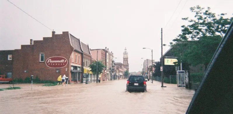
Charlotte Street in downtown Peterborough during the 2004 flood. (City of Peterborough)
To strengthen Peterborough’s climate resilience, an integrated flood model (IFM) was created. The IFM depicts the entire storm sewer system and projects the potential surface flooding that could occur. Highly detailed data is needed to accurately model all the different types of built surfaces and vegetation, so the city enlisted the help of Ecopia AI, a Toronto-based tech company that uses geospatial data and artificial intelligence (AI) to create high-resolution images of landscapes.
AI is used to convert geospatial data from satellites into maps and products that can be used by the city to learn more about Peterborough’s flooding risk. Information that can be gathered includes an understanding of the impacts of land use changes and growing urban sprawl, predicting the water depth and velocity in the event of a flood, and calculating flow resistance over different types of land.
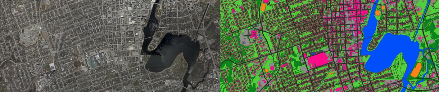
Ecopia AI ingested high-resolution imagery data (left) of Peterborough and digitized it into vector features (right) so hydrologists can develop accurate flood models. (Ecopia AI)
“Pluvial flooding is probably the number one impact for most cities within Canada and happens when there is increased water runoff within cities from increased rain, and existing infrastructure can't handle that,” Brandon Palin, Senior Director, Public Sector & International Development at Ecopia AI told The Weather Network.
“We're seeing a need to improve infrastructure and a need for increased development of green infrastructure, but all of that has to start with a plan, and that's where the data comes into play. It supports decision-making in terms of where to optimize this infrastructure development because these landscapes are evolving so much.”
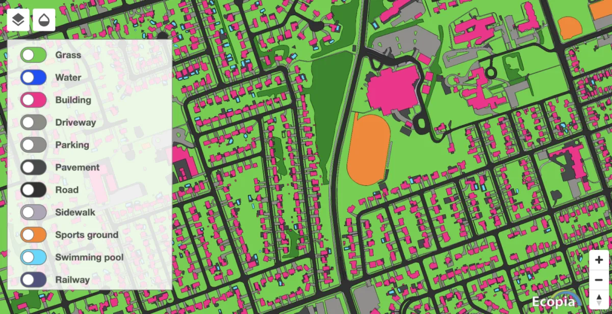
Sample of features extracted for the City of Peterborough. (Ecopia AI)
Many cities are covered with impervious surfaces, such as roads and pavement, which cannot absorb water and increases the risk of urban flooding. On the other hand, vegetation within cities, such as trees planted along streets and green spaces, can help reduce flooding impacts because significant amounts of rainwater can be absorbed by the soil.
“A better understanding of where it's going to flood means that we can better respond in the event of a flood,” said Boland.
Watch below: How do we know when weird weather is caused by climate change?
Some of the essential gaps that were filled by the company include exact information about the impervious surfaces that surround creeks, rivers, and other water bodies, which informs hydrologists about how water can interact with both pervious and impervious surfaces. Previously, the city relied on lower-quality estimations from zoning documents that marked the locations of impervious surfaces.
The AI and machine learning used by the company frequently updates their products when new satellite images are available, which consistently provides the city with new and relevant information.
“We really have a far greater understanding of our flood risks in our community. The goal is to achieve the highest level of flood reduction we can with limited capital funding. Then we can also use it to make better more informed land use planning decisions and inform our emergency management as well,” said Boland.
“We need to continue to fund those types of infrastructure programs, in combination with other more green infrastructure, to change the way we design our communities to be more resilient.”
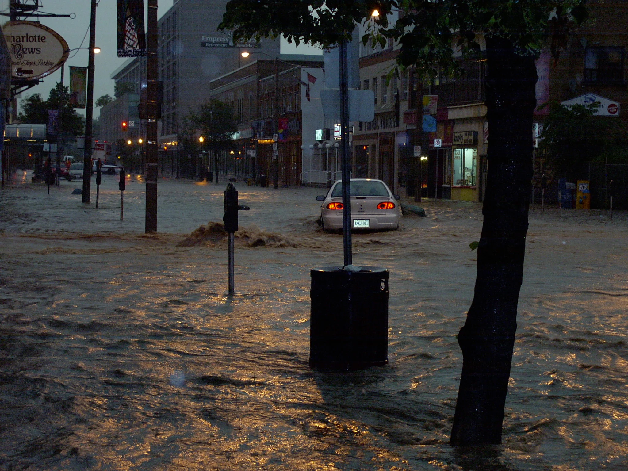
Thumbnail image: Flooding from Bears Creek in Peterborough during the 2004 flood. (City of Peterborough)