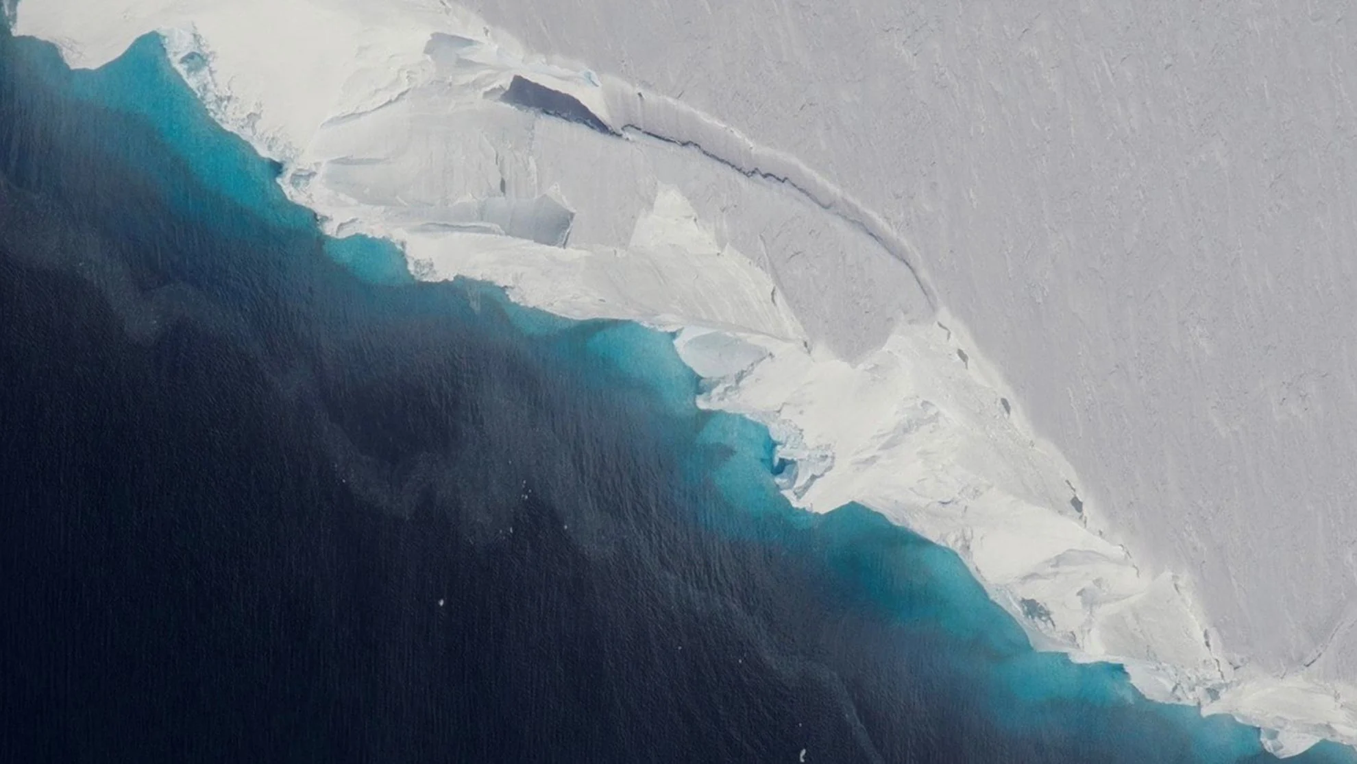
Antarctica's Doomsday Glacier is melting twice as fast as we previously thought

Already considered one of the biggest climate threats in the world, the melting of Thwaites glacier is much worse that we thought.
The collapse of Antarctica's Thwaites Glacier is already a major concern as the world continues to warm, but new research has revealed that ocean water is eating away at the underside of the glacier far faster than we previously thought.
Along Antarctica's west coast, there are a number of glaciers that extend as ice shelves out over the Southern Ocean. Due to its size, one of the most important is Thwaites.
At 120 kilometres across, it is the widest glacier in the world, with a total area close to 200,000 square kilometres. That's big enough to cover all of Nova Scotia, plus the islands of Newfoundland and Prince Edward Island, along with a quarter of New Brunswick, in kilometre-thick ice.
Thwaites, itself, contains so much ice that, in the unlikely event of it completely collapsing into the ocean, global sea levels would rise by around 65 centimetres. Add to this the fact that Thwaites holds back a substantial chunk of the main West Antarctic ice sheet, enough to add another 2.4 metres to ocean levels, and it's easy to see why it has been nicknamed the Doomsday Glacier.
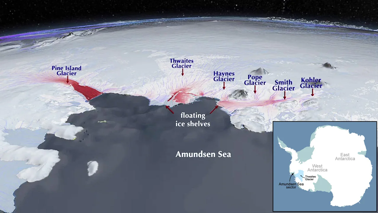
These maps show the location of Thwaites Glacier, pinned between the West Antarctic Ice Sheet and the Amundsen Sea. (NASA)
READ MORE: Antarctica's Doomsday Glacier 'really holding on today by its fingernails'
With the current rate of warming due to human-caused climate change, Thwaites has contributed about 4 per cent of the 10-11 centimetres of sea level rise we've seen so far. Projections up until now have it adding another 15 millimetres to the total by the year 2100.
Now, though, a new study published last week in the journal Nature Communications has doubled that amount.
According to the researchers, previous computer models used to estimate ice loss have not been able to capture the true rate of ice flow in Thwaites, as recorded by satellites. Compared to reality, the rate of flow in the models has always been too slow.
The problem, it seems, is that these past models all assumed a glacier's 'grounding line' was relatively stable. The grounding line is the location along the glacier's underside where it leaves contact with the continental shelf and begins to float on the water.
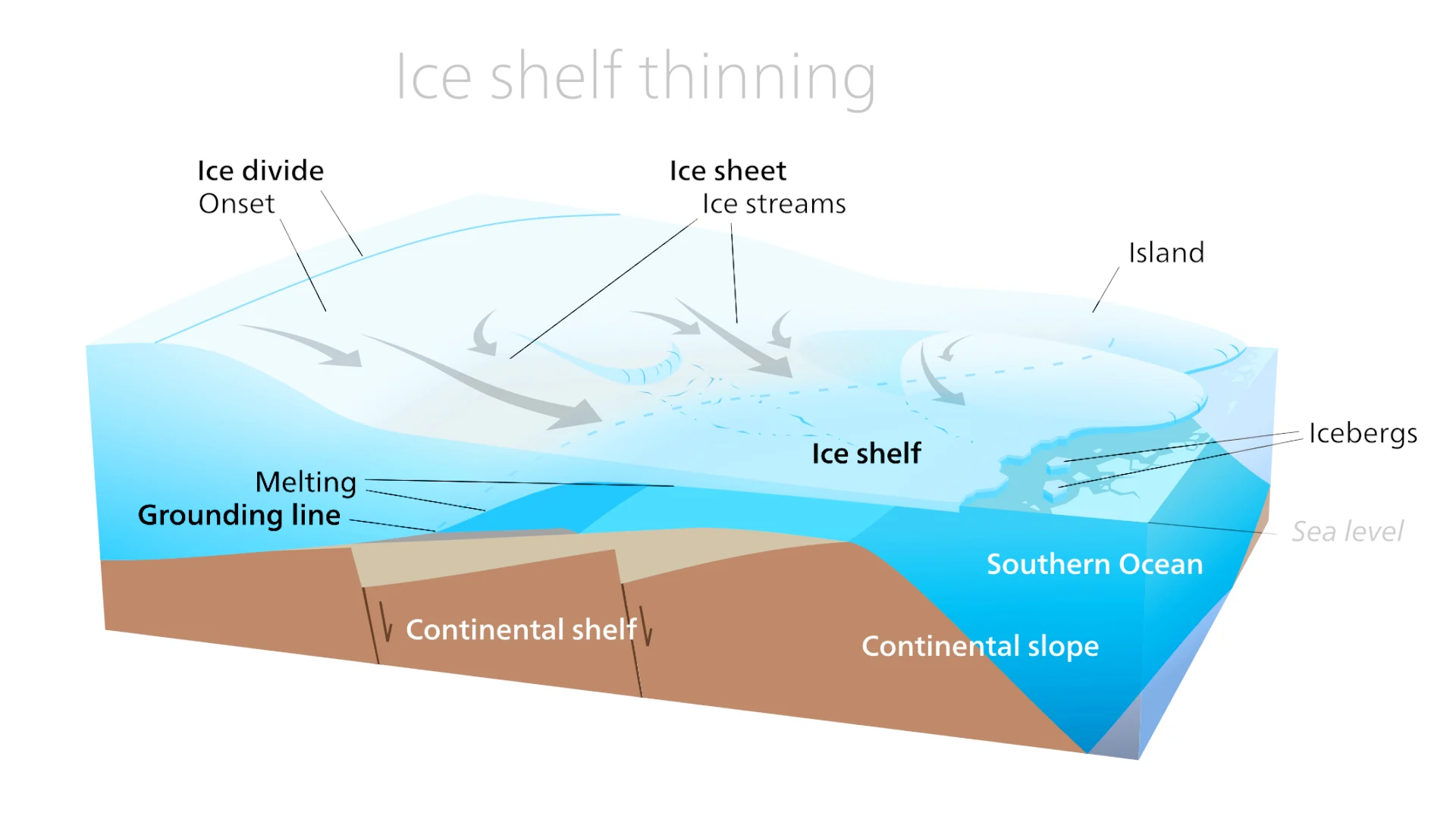
A cross-section diagram of an Antarctic glacier and ice shelf shows the location of the grounding line, where the ice leaves contact with the ground and begins to float on the water. (Kelvinsong/Wikimedia Commons (CC BY-SA 3.0))
READ MORE: Antarctica is crumbling at its edges, says NASA scientist
Given a stable grounding line, ocean water under the glacier's leading edge can only reach so far back, and only pushes deeper as the grounding line slowly retreats with melting.
However, satellite data has shown that Thwaites' grounding line actually shifts backwards and forwards under the glacier along with the tides.
As the tide rises, seawater is pushed against the grounding line, causing it to force its way deeper under the ice at high pressure. Then, when the tide drops, the water retreats. The result is a grounding zone, which can be up to several kilometres wide at some points.
"Glaciologists have long based their assumptions of ice sheet dynamics on the 'grounding line', a discreet, narrow, and mostly stable demarcation where ice leaves the land and begins floating on water," lead author Mattia Poinelli, from the University of California and NASA's Jet Propulsion Lab, said in a press release.
"We have come to acknowledge a different arrangement beneath Earth's major ocean-terminating glaciers. Satellite observations demonstrate the existence of a 'grounding zone', sometimes kilometers wide, where warm ocean water is reaching deep underneath the ice sheets and causing vigorous melting."
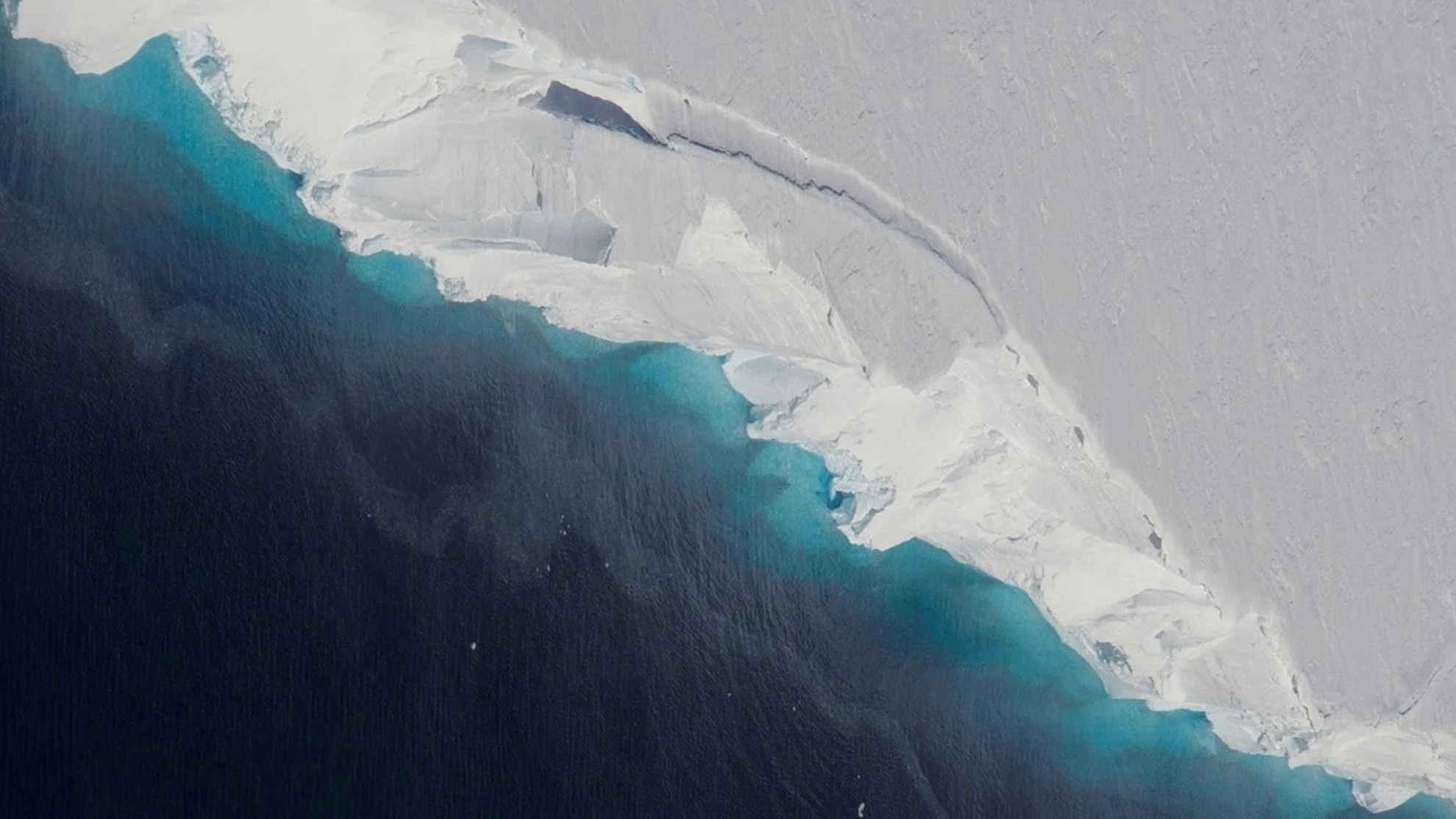
The leading edge of Thwaites glacier's ice shelf meets the open waters of the Amundsen Sea. (NASA/OIB/Jeremy Harbeck)
READ MORE: Why Antarctica's 'Doomsday Glacier' could partially collapse within 5 years
Based on this new model, the impacts of this grounding zone increase the rate of ice loss along the base of the glacier, roughly doubling Thwaites' contribution to sea level rise to around 30 millimetres by 2100.
Furthermore, this is projected to happen even without any further rise in ocean temperatures.
"We have documented and quantified the impacts of climate change on our planet's sensitive ice sheets for decades, but a mounting realization gained in recent years of what is happening on the undersides of glaciers like Thwaites is leading to an even greater sense of alarm," study co-author Eric Rignot, a professor of Earth system science at UC Irvine, said in the press release.
"Most projections up-to-present have struggled to match the rapidity of the mass loss because of missing physics," Rignot explained. "Our new model with more complete physics is able to match the record and then produces projections that are twice larger than before. These results predict greater risk of and exposure for coastal flooding than anticipated in the coming decades."
