Winter will bring Ontario's first cold snap as snow squalls return

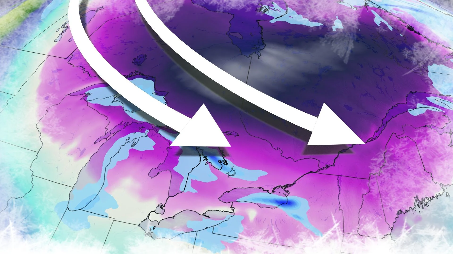
After flooding Western Canada for a prolonged period, Arctic air has its sights set on Ontario in the coming days, with its coldest temperatures of the season so far.
The coldest temperatures of the season so far are on their way to southern Ontario from Western Ontario, and their arrival will be accompanied by some gusty winds that will set the lake-effect snow machine in motion Sunday night into Monday. More on how cold it will get, and for how long, see below.
DON'T MISS: January promises nationwide 'pattern shakeup'
SUNDAY AND BEYOND: SNOW SQUALLS AND COLDEST AIR OF THE SEASON ARRIVE
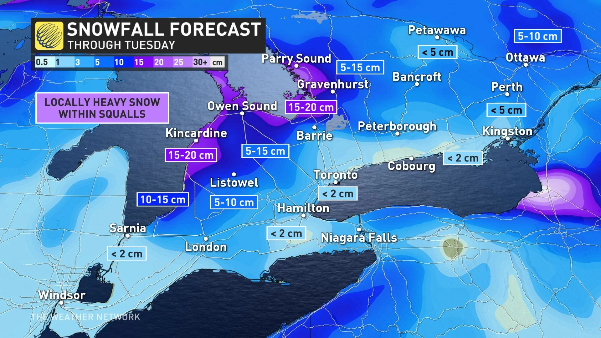
Sunday night will see a strong cold front crossing the region, so will winds will remain blustery into Monday morning – in the 60-70 km/h range along the lake shores – and will work in conjunction with a much cooler, Arctic air mass, allowing for lake-effect snow squalls to develop and continue well into Monday, possibly into Tuesday.
Snow squalls will impact the traditional snowbelt regions with the heaviest amounts of snow and locally low visibilities. However, some of these snow bands may meander into parts of the Golden Horseshoe at times.
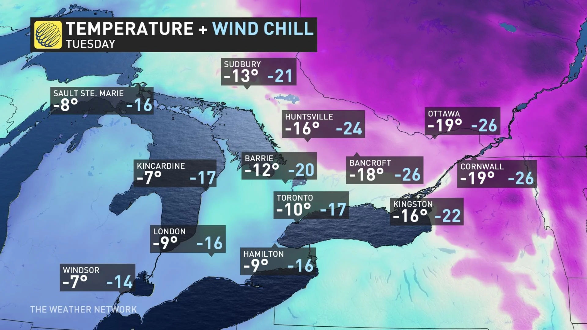
Some of the coldest weather of the season in southern Ontario so far arrives early next week, particularly Monday overnight into Tuesday morning, as we may see a low temperature of -20°C in Toronto. With the wind chills, daytime highs and overnight lows will feel much colder.
High temperatures will only be near the -20s on Tuesday for Ottawa, with overnight lows reaching the -30s outside of urban areas.
"However, this will be a quick shot of frigid weather as temperatures will quickly rebound back to near or above seasonal -- above freezing for southern Ontario -- Wednesday and Thursday," says Dr. Doug Gillham, a meteorologist at The Weather Network.
There's the potential for more consistent winter weather for the third week of January, but a rather mild pattern is expected to return before the end of January once again.
"The quiet pattern will continue through next week. We could see the pattern turn more active/unsettled around next weekend, but it is too early to have confidence in exact storm track and impacts," Gillham adds.
Be sure to check back for the latest weather conditions in Ontario.