January outlook: New year begins with pattern flip-flops across Canada

While December featured a clearly defined (and contrasting) temperature pattern across Canada, that will not be the case for most of January. A few major pattern upheavals are expected through this month.
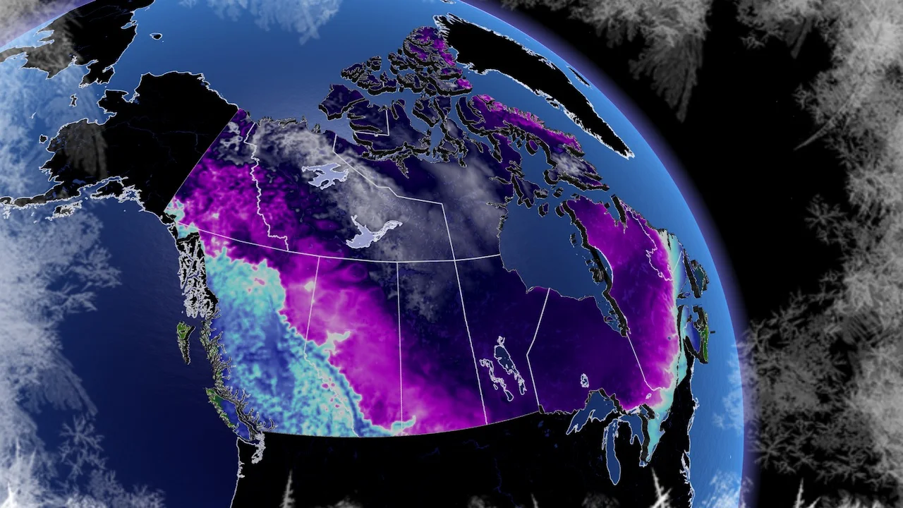
The heart of the winter season is upon us. While the eastern half of Canada is still waiting for consistent winter weather, the western half of the country locked into a classic cold pattern several weeks ago.
What can we expect for the month of January? Please read on!
SEE ALSO: Winter road salting has year-round consequences
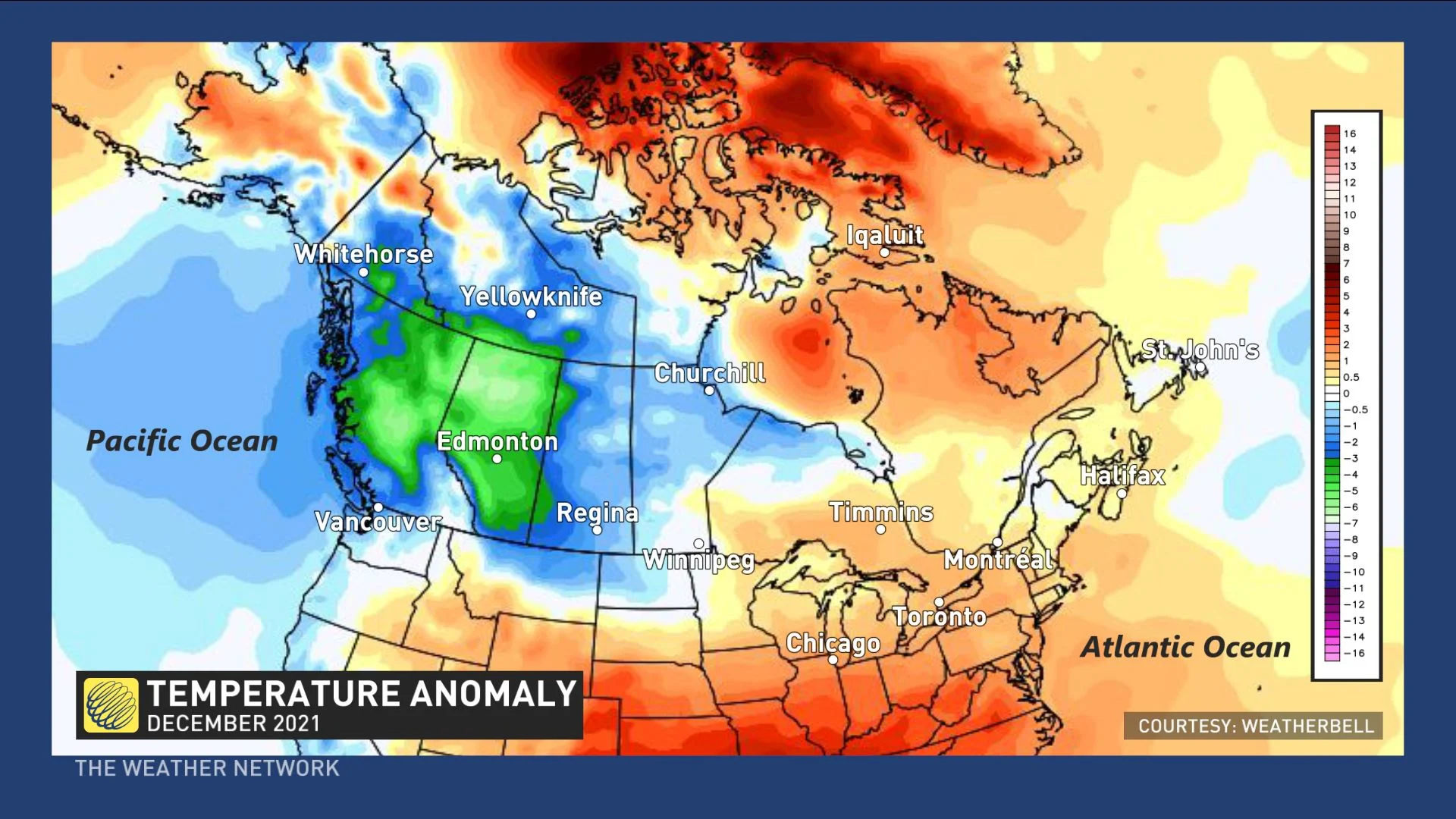
First, here is a quick look back at the month of December. The various shades of blue and green highlight the colder than normal temperatures that were found across Western Canada, while the various shades of orange highlight the warmer than normal temperatures, which dominated across eastern Canada.
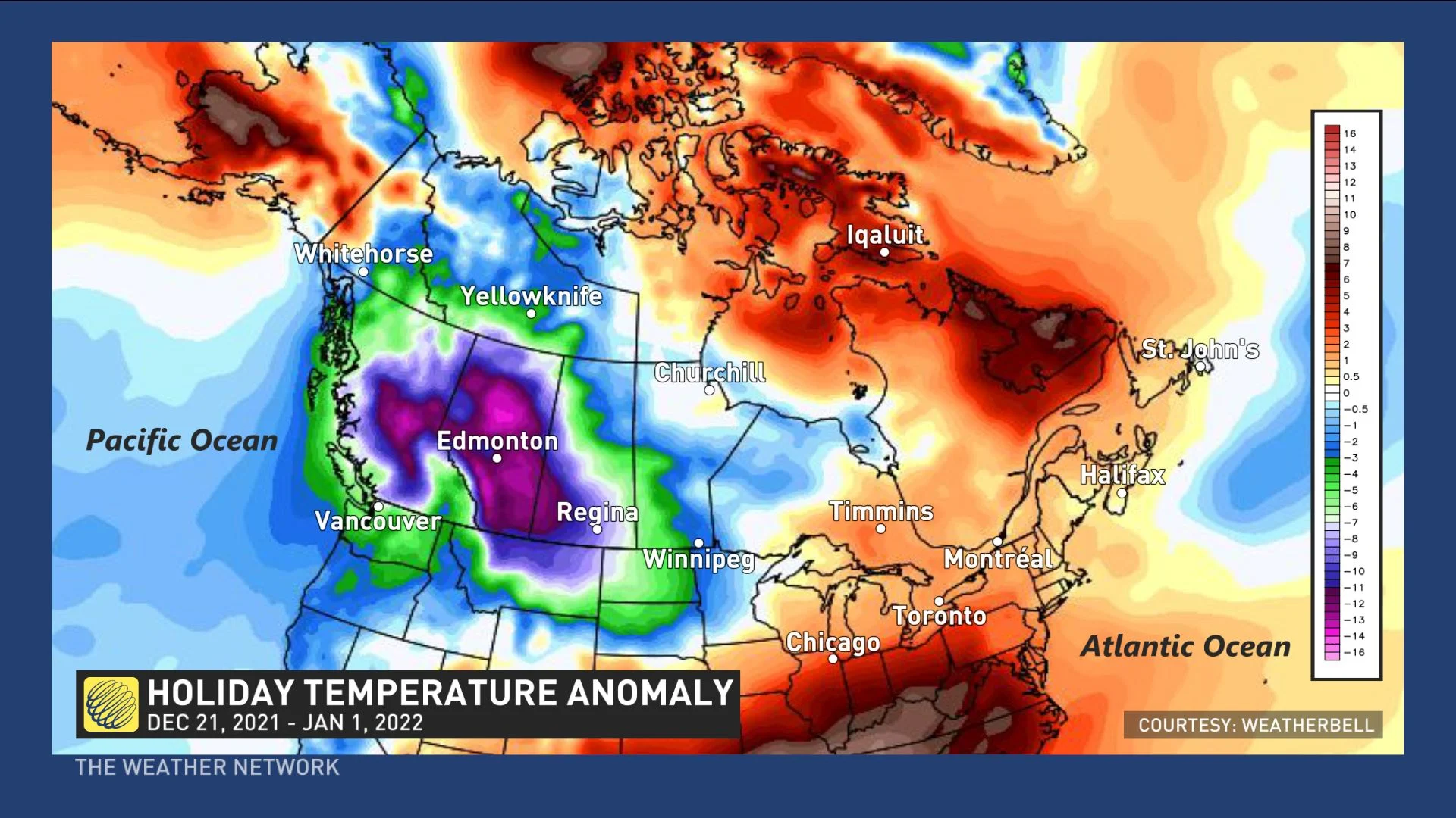
This contrast in temperatures was especially noteworthy during the holidays. Here is a look at the pattern that we saw during the final 10 days of 2021.
While December featured a clearly defined (and contrasting) temperature pattern across Canada, that will not be the case for most of January. A few major pattern upheavals are expected through the month of January.
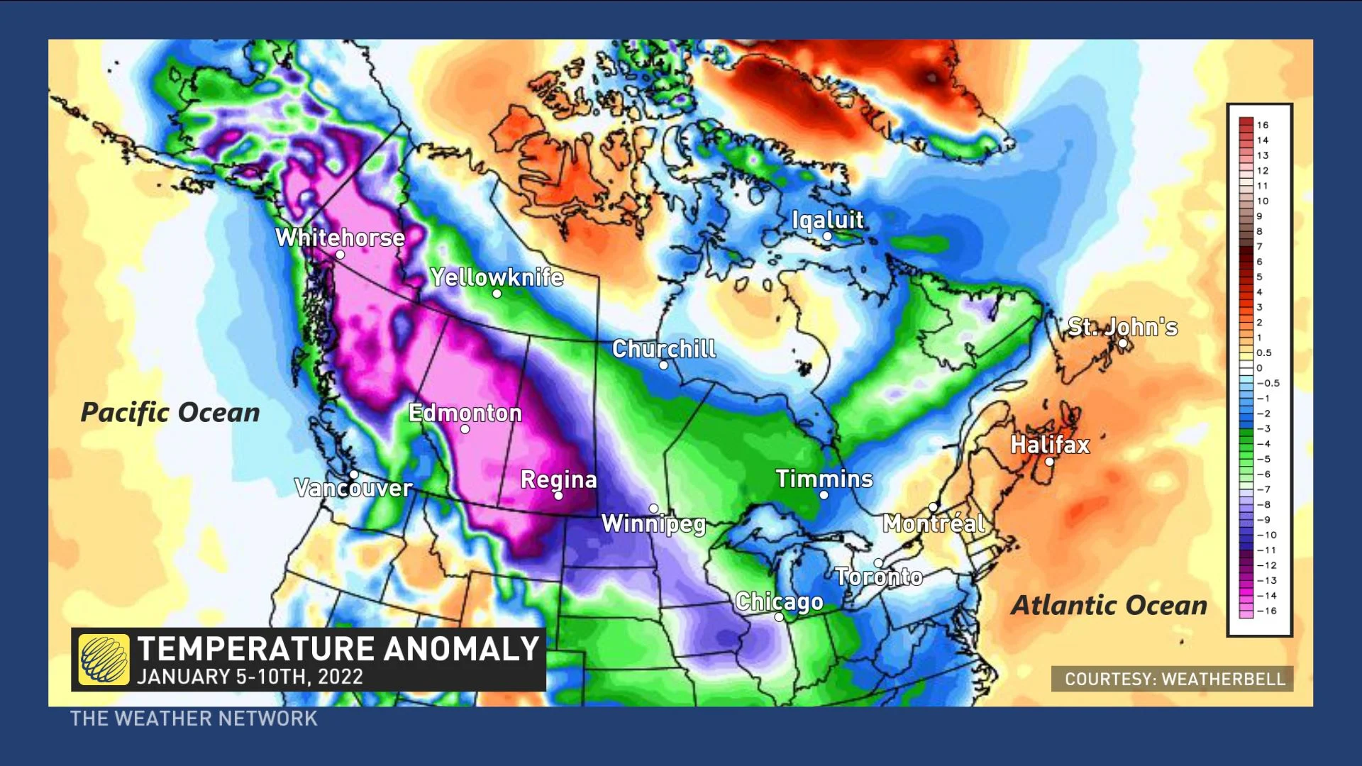
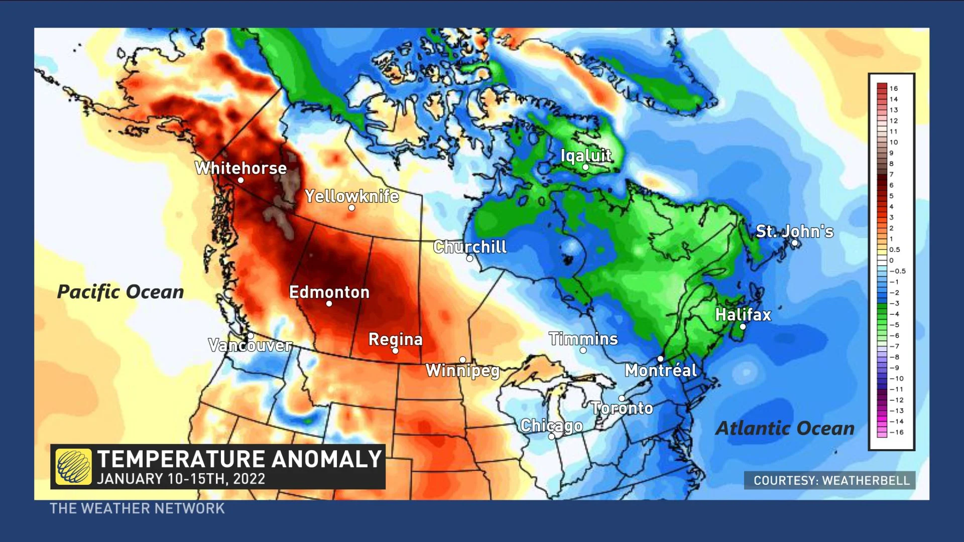
So far, the first few days of January have resembled December with frigid weather across Western Canada, and that pattern will continue for just a few more days. Here is a look at a model forecast for the next five days (Jan. 5-10), with another blast of Arctic air keeping temperatures 10-20 degrees colder than normal across much of Western Canada.
Meanwhile, quick shots of Arctic air will spread east across Ontario, Quebec and into Atlantic Canada, only to be quickly replaced by milder weather. However, a major pattern shakeup is on the way for next week.
For the winter-weary West, relief is in sight as much milder Pacific air will spread across the Yukon, British Columbia, and across the Prairies. Meanwhile, the coldest air of the season thus far will spread into Ontario, Quebec and then into Atlantic Canada early next week. Many places, including Montreal, could see their coldest temperatures in four years.
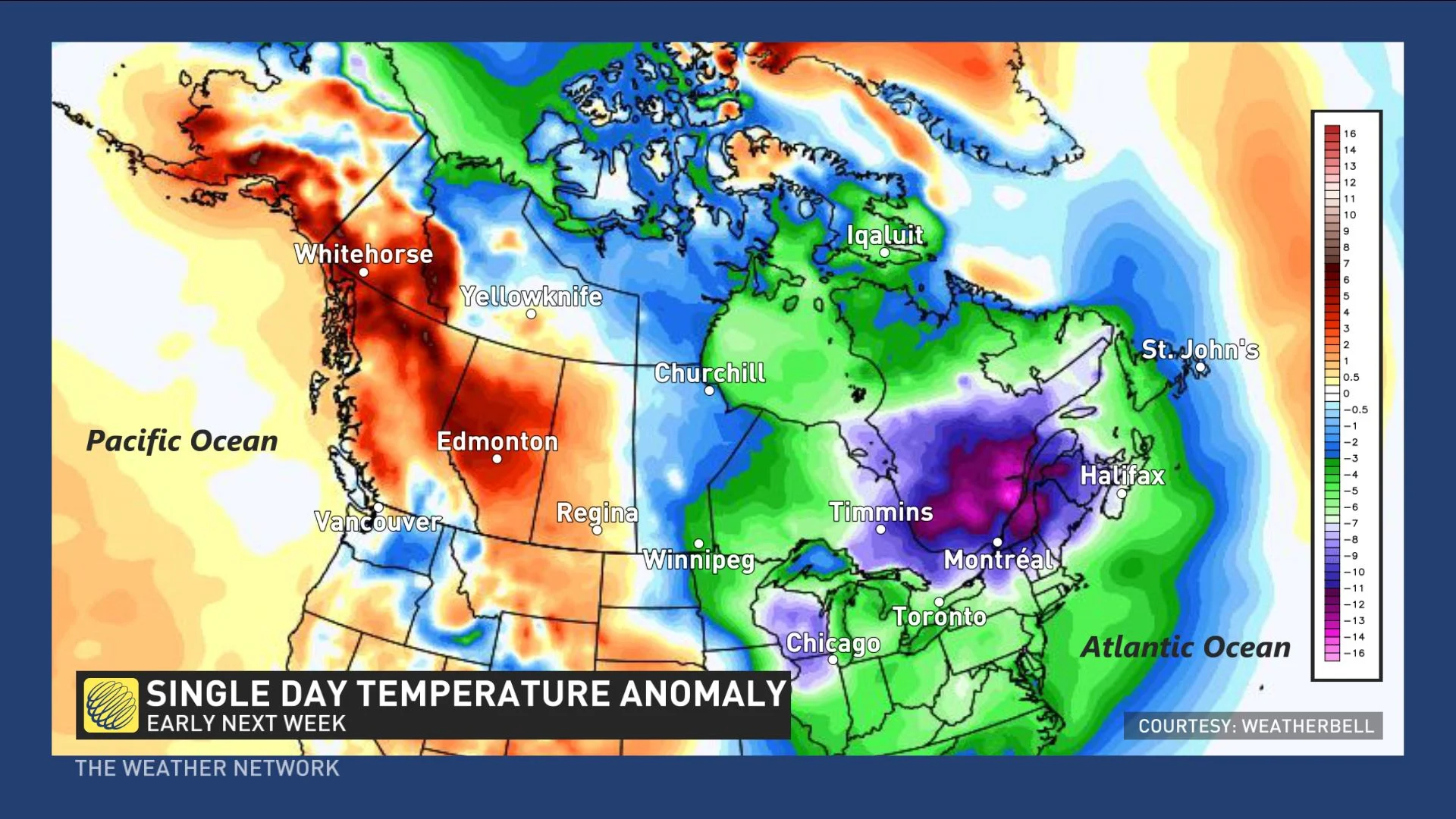
However, this cold snap will be rather short-lived. Milder Pacific will continue to spread east during the second half of next week.
Here is a look at temperature anomalies for the second week of January. Note that this is opposite of what we have seen for the past month with well above seasonal temperatures expected across Western Canada. However, the week as a whole will not be exceptionally cold across eastern Canada as temperatures will recover as the week progresses.
As we look ahead to the third week of January, there are signs that the eastern half of Canada will finally see a period of more consistent winter weather for a couple of weeks with temperatures near seasonal or on the cold side of seasonal.
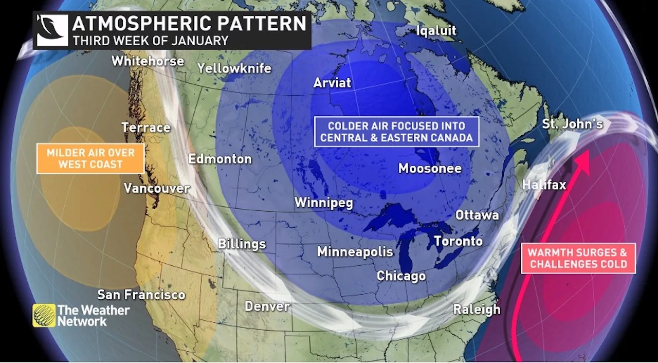
However, at this point confidence is not all that high that this pattern will develop with any staying power. While most of the long-range models are on board with this pattern developing, these models have falsely forecast this pattern numerous times over the past few years.
As we look at the global pattern, though, there is some support for this to actually happen this time, so we will go ahead and put this out as our forecast. However, this is the part of the month that we are the least confident about.
Regardless of how the weather pattern unfolds for the third week of January and into the fourth week of January, we expect that the final days of January and early February will feature a return to a familiar pattern -- the one that has dominated since early December.
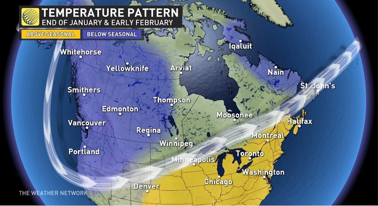
For Western Canada, this means that consistent cold weather will return as we head into the beginning of February. For Eastern Canada, we expect that a mild pattern will dominate as we end January and head into early February.