Why this 'perfect lake-effect storm' could produce 100+ cm of snow

The setup across the Great Lakes heading into this weekend was a red flag for meteorologists that a perfect lake-effect storm could be brewing.
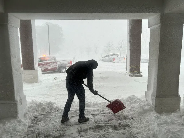
Communities near Buffalo, New York could see more than 100 cm of snow from this weekend’s intense lake-effect snow event setting up across the Great Lakes.
GET THE LATEST: Prepare now for extremely dangerous southern Ontario snow squalls
Southern Ontario’s Niagara region isn’t out of the woods — the same band that’ll bury Buffalo could hit the region with 20-50 cm of snow through Sunday. Folks on the Bruce Peninsula might see thigh-high snow by Sunday, where 70+ cm of snow is possible into the weekend.
It’s going to be a widespread, high-impact event for the region.
Cold winds, unusually warm water temperatures, and high moisture are all lining up just right to allow the lake-effect snow machine to crank at full blast this weekend. It could shape up to be one of the region’s most intense lake-effect events in recent years.
Erie County, which encompasses Buffalo, declared a state of emergency on Thursday. A driving ban starting at 9 p.m. EST was also imposed for all but authorized emergency travel.
The Buffalo Public Schools district, the state's second-largest, announced it was cancelling all their classes and closing its central offices on Friday, impacting more than 32,000 students.
"What we are talking about is a major, major storm," New York Governor Kathy Hochul, said on Thursday, after declaring a state of emergency in the Buffalo area. "This is considered an extreme weather event. That means it is dangerous. It is life threatening."
Watch the video above to see how the lakes and the atmosphere will join forces to create this dramatic snowfall event.
WATCH: Powerful Buffalo squalls put into perspective as car completely buried
Thumbnail image courtesy of the New York State Police.
With files from Reuters