Tropics stir to life, new tropical depression to impact Bermuda

After a quiet couple of weeks, the tropics are showing signs of life once again, in the form of Tropical Depression 5 (TD5), which formed Saturday morning.
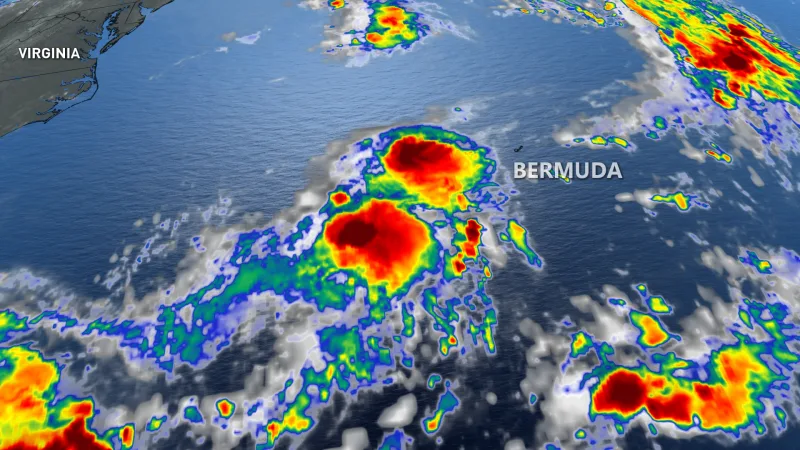
The storm presently looks like it's moving in the general direction of Bermuda, and as of early Saturday afternoon was 390 km west-southwest of the island.
TD5 currently boasts winds of around 55 km/h, and though it may cross the threshold to qualify as a named tropical storm -- taking the moniker Edouard -- the U.S. National Hurricane Centre does not seem to think it will amount to much.
"It is unlikely that the cyclone will get much better organized during the next day or two. That said, some minimal strengthening is possible, even if only due to the expected increase of the cyclone's forward speed," the agency said in a Saturday bulletin.
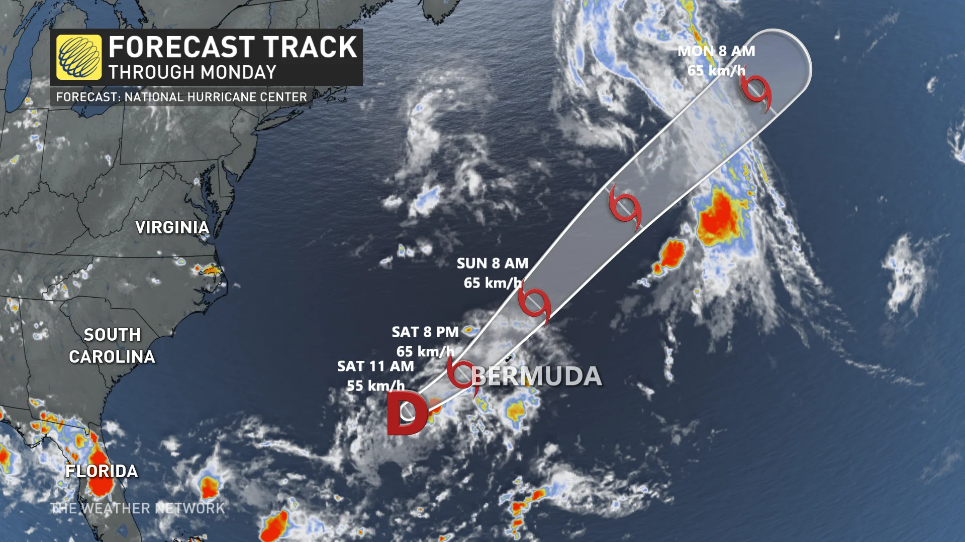
When the system passes north of Bermuda, it's expected to have some impact, limited to some gusty winds overnight as well as rainfall ranging from less than 25 mm, to isolated maximum amounts of 100 mm in and around the island.
Forecasters predict an above-average 2020 hurricane season, with some 13-19 named storms, including 6-10 hurricanes.
The season certainly got off to an early start, with three tropical storms forming even before the "official" June 1 starting date. The last named storm, Dolly, looked initially like it would have some limited Canadian impact, but ultimately did not.


