Forecasters predict active Atlantic hurricane season ahead

The pattern during early June continues to support the development of additional tropical storms and possibly a hurricane.
In developing our Summer Forecast across Canada, we also have to take a close look at the Atlantic hurricane season, which can have an impact on the summer (and fall) weather expected for Eastern Canada.
The tropical season has already gotten off to an early start and a very active season is expected as we continue through the summer and into the fall.
When we look back in history at years that had a similar global pattern to what we have this year, we find that most of those years had a very active or hyperactive hurricane season.
READ: Why hurricane names get retired
The graphic below shows the official forecast from the National Hurricane Center vs. what we see from a typical year.
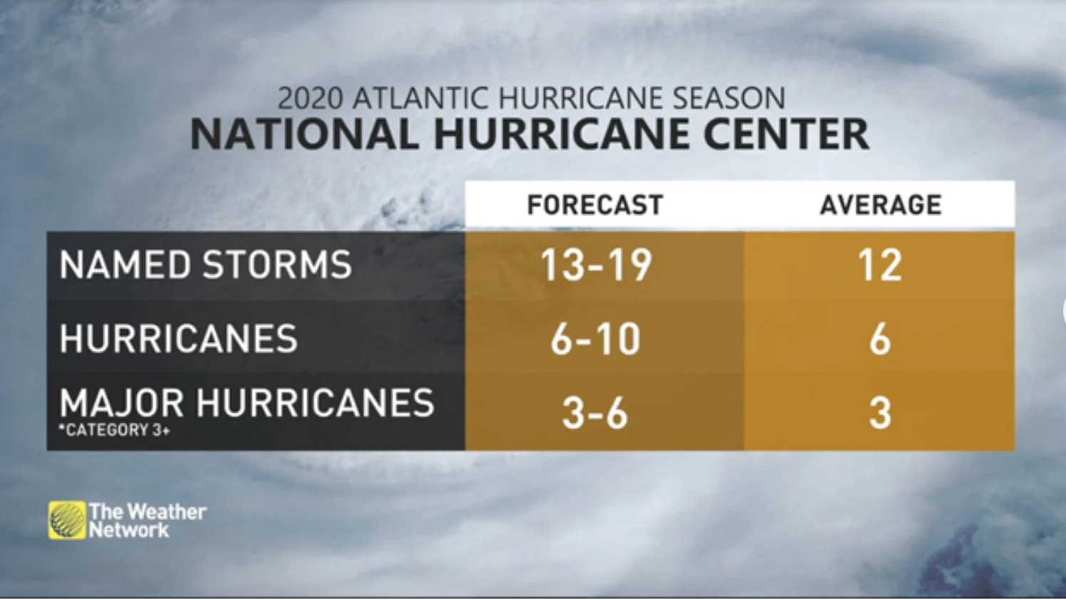
Of course, the final numbers are not nearly as important as the tracks of the storms and whether they have a direct impact on land. Relatively quiet seasons have had storms that produced catastrophic damage, such as 1992 when Hurricane Andrew devestated southern Florida as a Category 5 storm during a season that had only six named storms. On the other hand, there have been very active seasons with minimal impacts to Canada and even to the United States.
Visit our Complete Guide to Summer 2020 for an in-depth look at the Summer Forecast, tips to plan for it and much more
WATCH BELOW: PREPARE AHEAD OF TIME FOR AN ACTIVE ATLANTIC HURRICANE SEASON, EXPERTS SAY
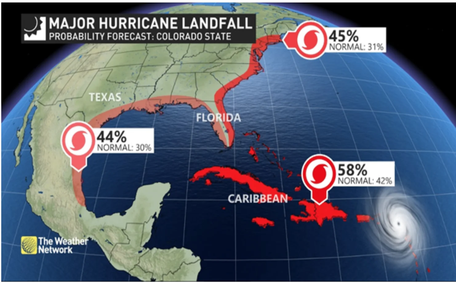
At this point, research meteorologists at Colorado State University are highlighting that the risk of a major hurricane making landfall along the U.S. East Coast this year is nearly 50 per cent higher than the normal risk, and the anticipated pattern also puts Atlantic Canada at risk to be impacted by tropical systems.
The hurricane season runs from June 1 to November 30, but we have already seen two tropical storms (Arthur and Bertha) during the month of May before the official start of the season.
Pre-season storms really are not a good indicator of what the rest of the season will bring. However, we are concerned the pattern over the western Atlantic and Gulf of Mexico during early June will continue to support the development of additional systems.
We are especially watching the Gulf of Mexico during the first week of June where we expect a tropical storm and possibly a hurricane will develop. However, this storm is unlikely to have a direct impact on Canada.
--
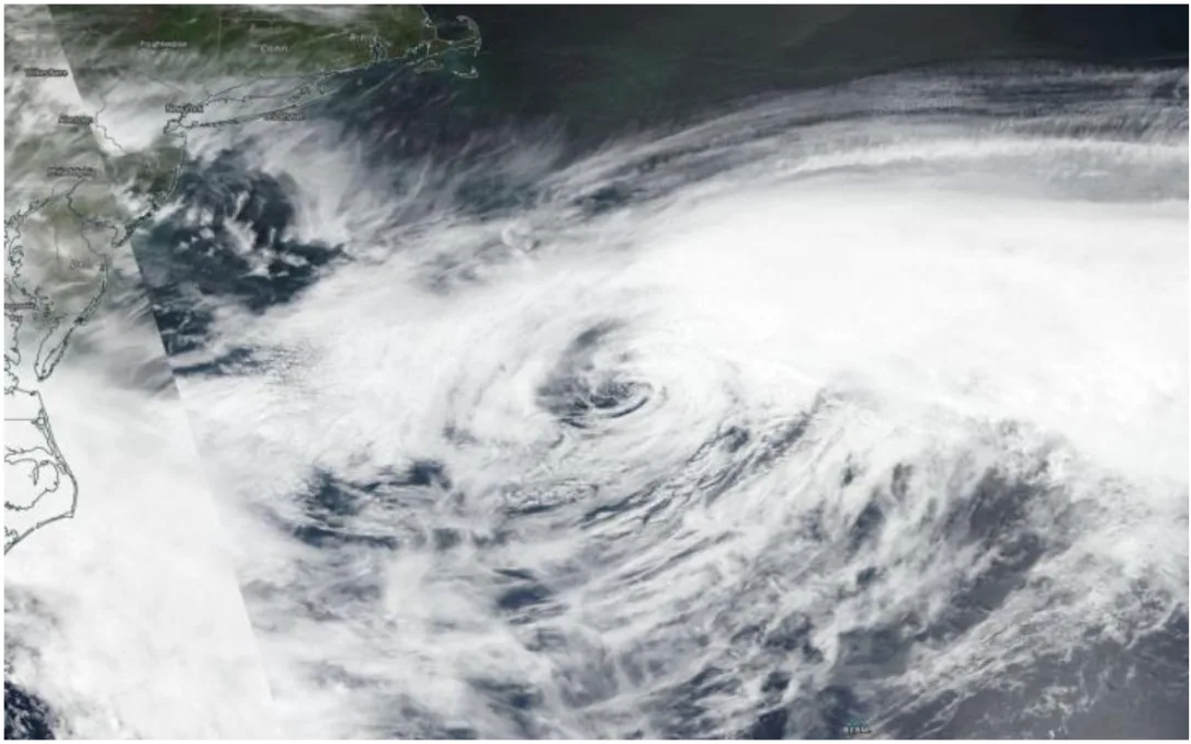
Thumbnail image courtesy: NASA-NOAA's Suomi NPP satellite found post tropical storm Arthur out in the western Atlantic Ocean far from the U.S. and parallel to the Virginia/North Carolina border.