Hurricane Dorian roils Caribbean, tracks toward Florida next week

Dorian officially became a full-fledged hurricane on Wednesday, and forecasters are eyeing a long-term path for the storm which may take it toward the Florida coast by early next week.
There's a chance the storm may be as strong as Category 3 by that point, prompting the Florida government to declare a state of emergency Wednesday afternoon.
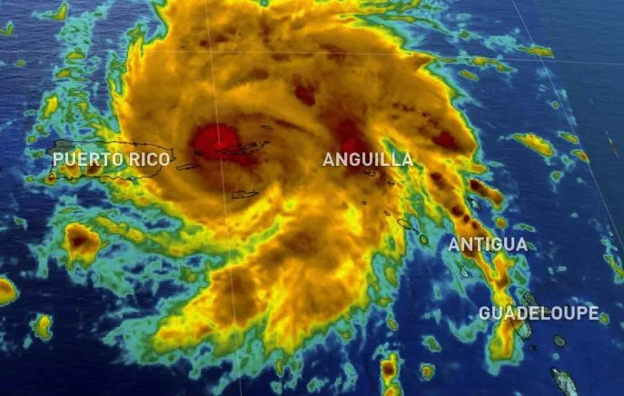
That's already after spending the past few days bringing torrential rains and strong winds to parts of the eastern Caribbean, including the Windward Islands, parts of Puerto Rico, and the U.S. and British Virgin Islands.
DORIAN CONTINUES TO IMPACT PUERTO RICO, VIRGIN ISLANDS
The U.S. National Hurricane Centre's 5 p.m. bulletin put the storm's maximum sustained winds at 130 km/h, slightly higher than when it was formally declared a Category 1 hurricane earlier in the afternoon. It is heading northwest at around 22 km/h.
"On this track, Dorian should move away from the U.S. and British Virgin Islands during the next several hours and then move over the Atlantic well east of the southeastern Bahamas on Thursday and Friday," the centre says, adding: "Dorian is forecast to strengthen and become a powerful hurricane during the next few days over the Atlantic waters."
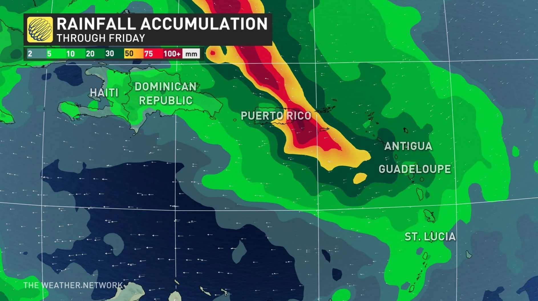
WATCH BELOW: EXPECTED TRACK OF DORIAN
Dorian is not yet done with the eastern Caribbean, having already left power outages and flooded streets behind it as it passed the Windward Islands. It is expected to bring heavy rains to parts of Puerto Rico and the U.S. and British Virgin Islands, potentially triggering landslides and flooding. The government of Canada has issued several travel advisories stating that non-essential travel to Puerto Rico and the U.S. Virgin Islands should be avoided due to the anticipated impacts from Dorian.
SEE ALSO: Tropical Storm Erin set to impact Atlantic Canada
A hurricane warning is in effect for Vieques, Culebra and the U.S. and U.K. Virgin Islands. A hurricane watch is in place for Puerto Rico.
Beyond, the storm is expected to strengthen, potentially reaching Florida on Monday as a major hurricane, which is to say, a hurricane of Category 3 strength of more.
So far, only one death has been reported in relation to this storm: NBC reports an 80-year-old man in Puerto Rico died after falling from a ladder while preparing his home for Dorian's arrival.
The tropics have been relatively quiet for June, July and so far most of August. The climatological peak of the Atlantic hurricane season falls on about September 10, so the span from late August to early October tends to be the most active time of the year. The season runs from June 1 to November 30. Last year, Hurricane Florence (Category 1 at landfall) and Hurricane Michael (Category 5 at landfall) both occurred in the second half of the season.


