Atlantic Canada: Erin remnants drop 100+ mm of rain, system will depart Friday

What was once Erin weakened to a post-tropical system and brought in excess of 100 mm of rain, along with strong winds, to parts of Nova Scotia Thursday. Rain has since tapered off for the Maritimes as the system has now moved out and will bring precipitation to Newfoundland Friday, but amounts will be considerably lower than what was dumped on Nova Scotia due to it merging with a cold front.
It is expected to depart Newfoundland by Friday evening.
WATCH BELOW: WHEN TO EXPECT ERIN REMNANTS TO MOVE OUT
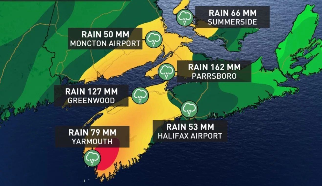
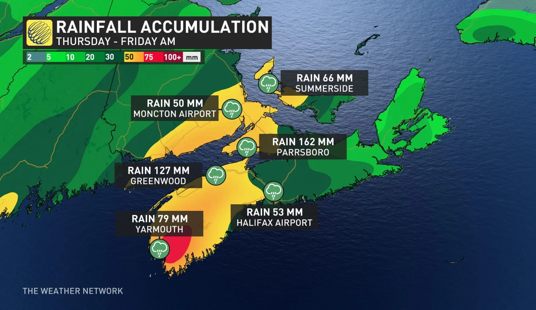
Several places in Nova Scotia received more than 100 mm of rain with the system, including Parrsboro, which had 162 mm fall through Thursday night. Port Maitland received 155 mm, Scots Bay had 152 mm, Greenwood saw 127 mm and 121 mm and 115 mm fell in Nappan and Kentville, respectively. Wind gusts reached more than 75 km/h in Beaver Island.
Widespread rainfall amounts of 50 to 100 mm was dropped throughout the province, as well as in New Brunswick and P.E.I.
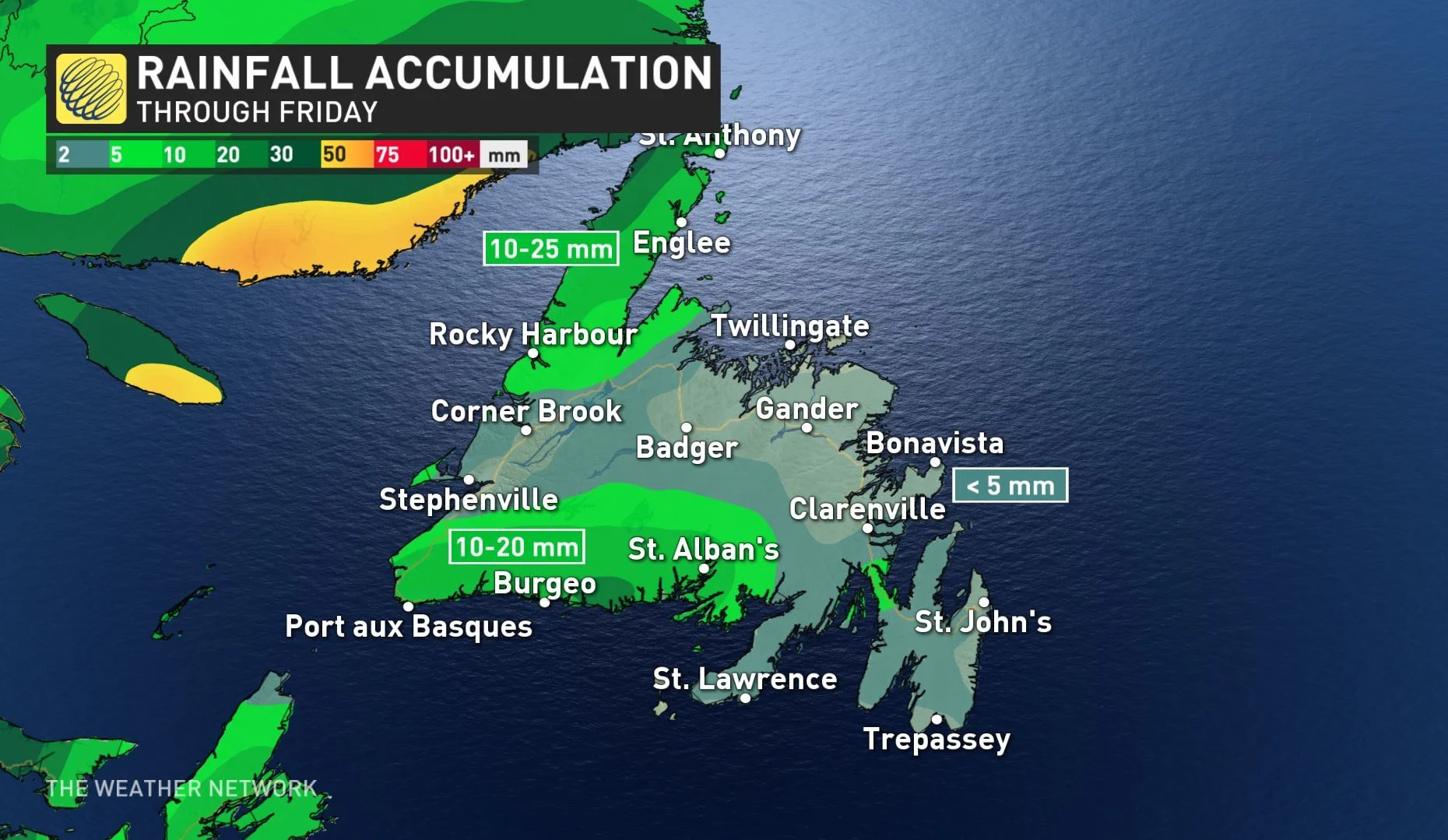
For Newfoundland, rainfall amounts will be greatly reduced and should remain in the 10 to 25 mm range for western areas, while eastern portions should only see 5 mm of rain or less.
On Friday morning, a wind warning was issued for Channel-Port aux Basques and area, but was dropped shortly after as winds are expected to diminish this afternoon. Widespread gusts of 50 to 70 km/h are expected for the rest of the province.
"Be prepared to adjust your driving with changing road conditions due to high winds. Wreckhouse wind warnings are issued when there is a significant risk of damaging winds," warns Environment Canada.
SEE ALSO: Hurricane Dorian sets its sights on Florida
TROPICAL OR SUBTROPICAL -- WHAT'S THE DIFFERENCE?
A subtropical storm is sort of a hybrid between the average storm system we would see moving across Canada (officially known as an extratropical cyclone), and a tropical cyclone.
Subtropical storms tend to form over cooler sea surface temperatures than full-fledged tropical systems. When it comes to impacts to land, the main difference between tropical and subtropical systems is that the subtropical ones tend to have weaker maximum winds, spread over a wider area.


