
Track 37 years of climate change with Google’s new Earth Timelapse

"As far as we know, Timelapse in Google Earth is the largest video on the planet, of our planet," said Google's Rebecca Moore.
Compiling decades worth of satellite imagery, Google Earth has introduced a new feature that allows us to see the long-term impacts of climate change around the world.
Climate change is slowly altering the environment of our planet. Glaciers, ice sheets, and sea ice are melting away. Oceans are rising, forests are burning, and lakes are drying up. Due to the pace of these impacts, it is sometimes difficult to see their full extent during our day-to-day lives. However, through a new feature of Google Earth, called Earth Timelapse, we can now see 37 years of climate change in mere seconds.
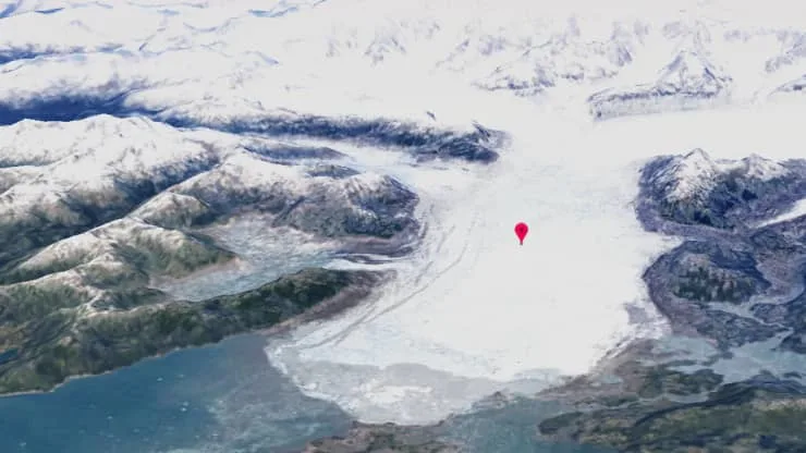
Alaska’s Columbia Glacier in 1984. Credit: Google
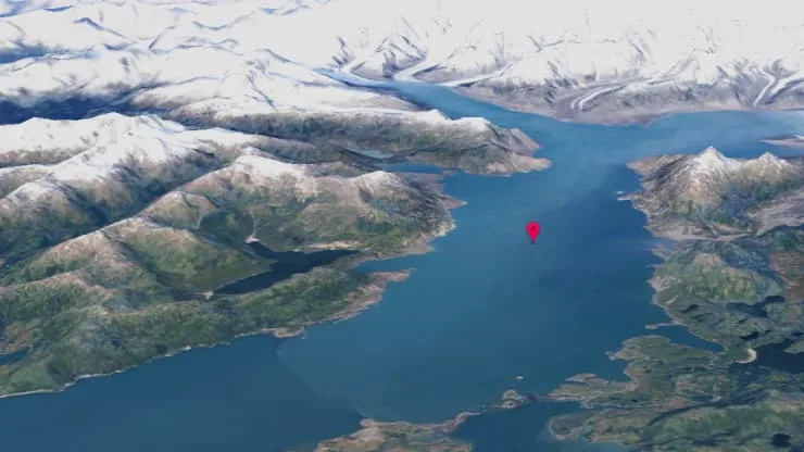
Columbia Glacier in 2020. Credit: Google
Earth Timelapse combines satellite imagery from two different Earth-observing programs — NASA and the U.S. Geological Survey's Landsat program and the ESA's Copernicus program. The first Landsat satellite was launched in 1972, and the program has two satellites (Landsats 7 and 8) operating today. That makes it the longest-running civilian Earth-observing program in existence. Copernicus' first satellite, Sentinel 1A, was launched in 2014 and the program currently has six satellites in orbit.
Using imagery captured by all of these satellites, together, developers were able to sample each location on Earth over multiple days of the year, at different times of the day. This gave them the ability to remove cloud layers, dust, and smoke, to provide one clear, unobstructed view of our planet's surface for each year, from 1984 to 2020.
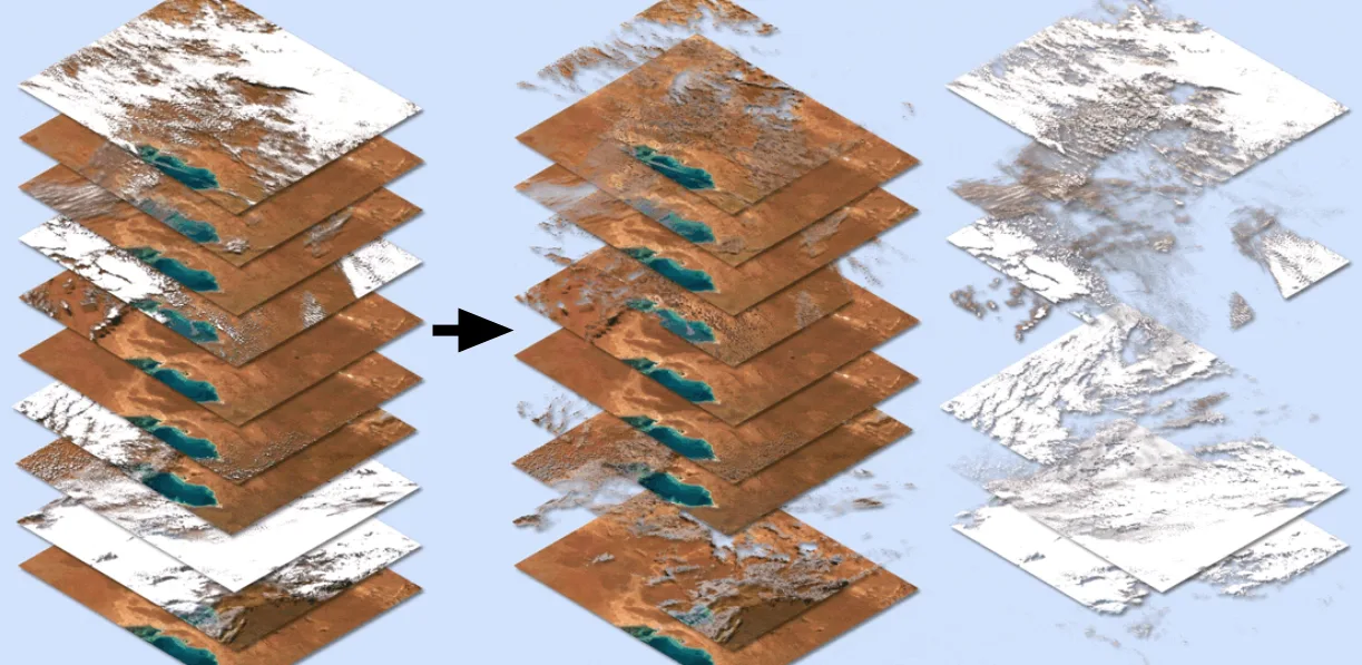
Processing of the satellite images allowed the removal of any obstructions, such as clouds. Credit: Google/Scott Sutherland
"As far as we know, Timelapse in Google Earth is the largest video on the planet, of our planet," Rebecca Moore, the director and founder of Google Earth Outreach and Google Earth Engine, wrote in a blog post on the company’s website..
Anyone can explore Earth Timelapse on their own, viewing any location on Earth they wish.
According to Google: "With mountains, valleys, buildings and more, Timelapse videos are draped over our planet using advanced 3D graphics rendering techniques. At any given moment, the correct videos for your location, view angle, and zoom-level are seamlessly stitched together on the fly to compose Timelapse in Google Earth, updated as you pan, zoom and explore."
Not sure where to look first?
Timelapse offers interactive tours of featured sites in five categories: Changing Forests, Fragile Beauty, Sources of Energy, Urban Expansion, and Warming Planet. There is also a database of 800 downloadable videos available, showing locations in both 2D and 3D view that highlight different types of planetary change, from urban and agricultural expansion, to the impacts of mining and deforestation, and the consequences of a warming world.