Severe storms fire up in eastern Ontario, Quebec, tornado risk with setup

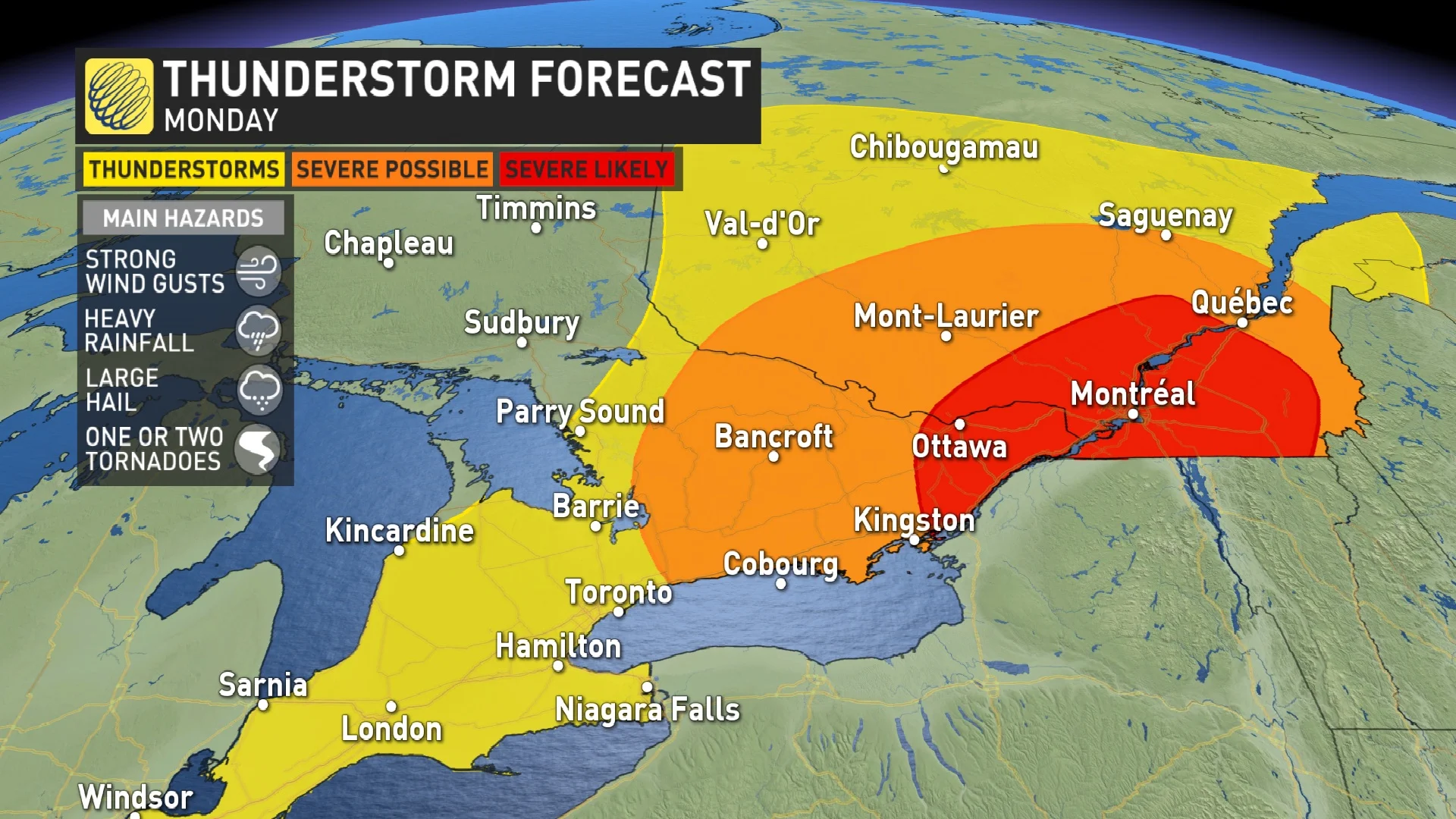
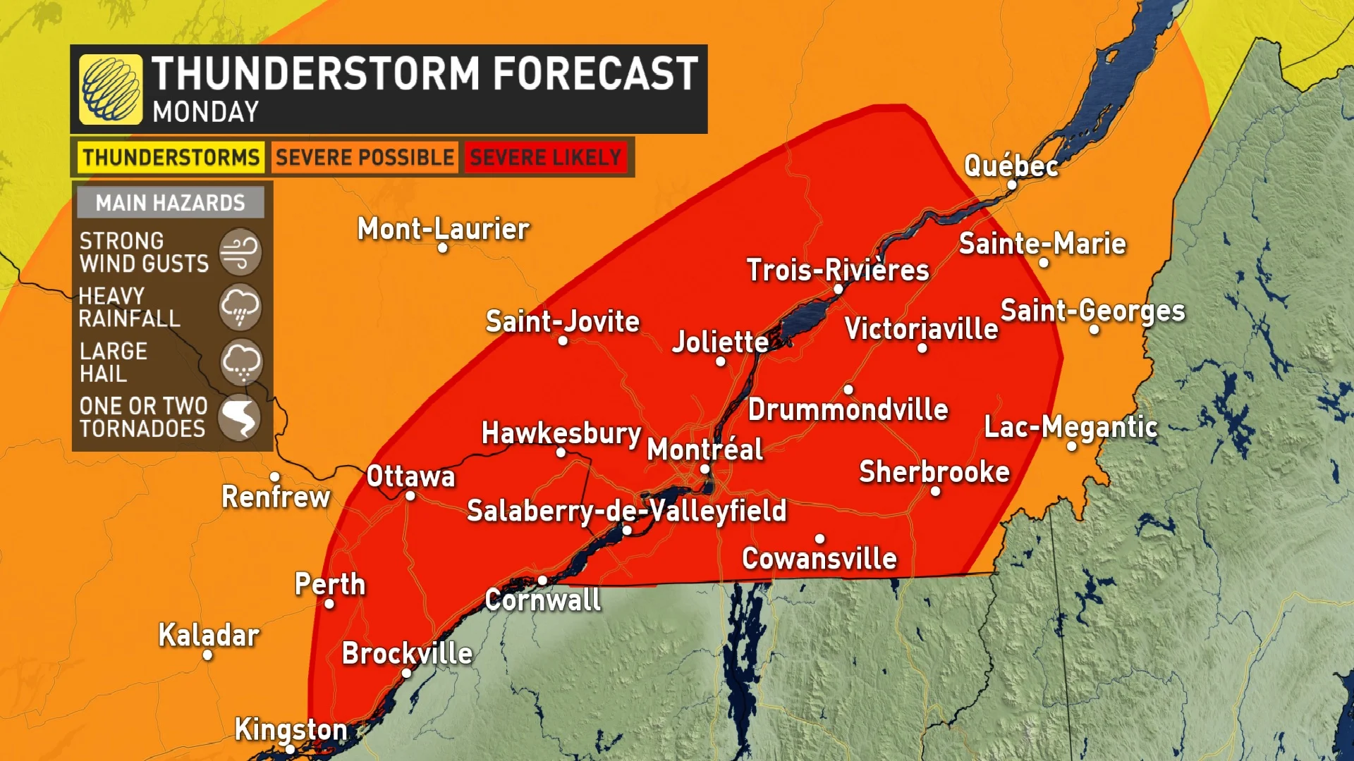
Severe thunderstorms developed in eastern Ontario and southern Quebec Monday afternoon. Special attention is focused in on an area from just west of Ottawa to Montreal, north and south of the St. Lawrence to just west of Quebec City, as there is a tornadic risk involved. Residents are advised to take shelter immediately when severe weather strikes.
Editor's note: This article is no longer being updated. Please click here for updates on the severe weather potential in Quebec, Eastern Ontario on Monday.
--
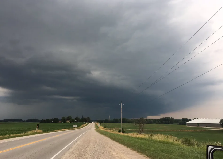
Father's Day ended with a bang for some in Ontario, with severe thunderstorms marching through the southwest Sunday night -- with frequent lightning and heavy rains reported. The nocturnal storms even prompted a tornado warning across the Windsor area, though no twisters have been confirmed. More severe thunderstorms have been sparked Monday afternoon, but in the eastern sections and into southern Quebec. Warnings are currently in place for the latter. Some of the storms may become rotating, so there is a tornadic risk stretching from just west of Ottawa extending into the Eastern Townships in Quebec. More on the timing and impacts below, plus a look at some of the coolest weather in months that will follow, below.
MONDAY: SEVERE THUNDERSTORM THREAT SHIFTS EASTWARDS
Stateside storms that tracked into southern Ontario late Sunday reached severe criteria across the southwest, prompting a tornado warning in the Windsor area through the overnight hours. While no tornadoes have been confirmed, frequent lightning, powerful winds and heavy rains were reported during the night.
After some early-morning thunderstorms in the south, the risk for severe thunderstorms shifted into central and eastern Ontario, as well as southern Quebec. Severe thunderstorms started firing up Monday afternoon, prompting Environment Canada to issue warnings in southern Quebec and eastern Ontario, but have since been expired in the latter.
RELATED: Watch? Warning? How we communicate severe weather in Canada
They have been sparked ahead of a cold front that is expected to push through in the evening hours.
With how much spin the atmosphere has, there is the risk for rotating storms today, however, not all rotating storms produce tornadoes. Residents in the risk zones are encouraged to stay up-to-date with the forecast and any watches or warnings that may be issued as the storms develop.
WATCH: SEVERE STORMS BRING WIND, LIGHTNING, AND TORNADO THREAT FOR ONTARIO AND QUEBEC
"This setup has all the makings of a severe weather day with lots of energy in the atmosphere," says Matt Grinter, a meteorologist at The Weather Network. "These storms have the potential to bring all risks of severe weather from strong wind gusts, heavy rain, large hail, and even the risk of a tornado."
Temperatures will still be very warm ahead of the front, with daytime highs remaining above normal through Monday. By Monday night however, temperatures will start to tumble, as the cold front moves through and a gusty northwest wind picks up.
TUESDAY AND BEYOND: COOLEST WEATHER SINCE MAY, GRADUAL WARM-UP LATE WEEK
By Tuesday, daytime highs will sit in the mid-teens across much of the region, temperatures more typical of early May.
A couple of days of below-seasonal temperatures are expected to continue through Wednesday before warming up again later in the week.
The thunderstorm threat doesn't look to return until Friday, as temperatures sit much closer to seasonal values. Periods of rain and thunderstorms are expected for Saturday and Sunday, but the weekend will not be a total washout, with dry weather likely at times, as well.
Stay tuned to The Weather Network for the latest updates.