
Strong storm threat persists on the Prairies after multiple tornado warnings

Another day with a strong thunderstorm threat across the Prairies Wednesday after numerous tornado watches and warnings were issued Tuesday night. Stay alert!
--
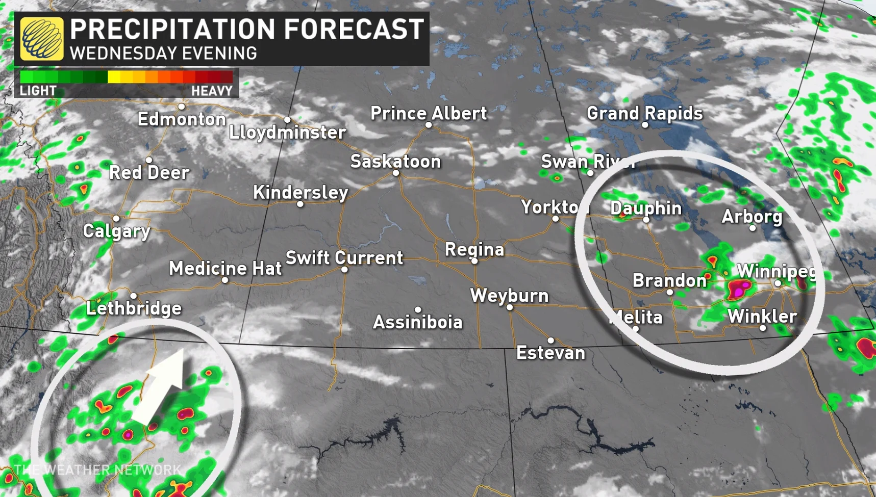
A stormy week on the Prairies continues Wednesday as severe thunderstorms fire up across parts of the region. We already saw one tornado warning in Manitoba earlier Wednesday afternoon. The threat for large hail, damaging winds, and possibly an isolated tornado will continue through the day. More severe weather is possible on Thursday and Friday. More on the storm timing and impacts, below.
MUST-SEE: Tornado-warned storms pummel Alberta, Saskatchewan
WEDNESDAY: TWO AREAS OF CONCERN FOR SEVERE THUNDERSTORMS ACROSS THE PRAIRIES
There will be two main areas of concern for severe thunderstorms across the Prairies on Wednesday. The first risk area will be southern Manitoba and the Interlake region.
Thunderstorms are expected to develop through the late afternoon hours, continuing into the evening, with a low pressure system acting as the main trigger for the storms.
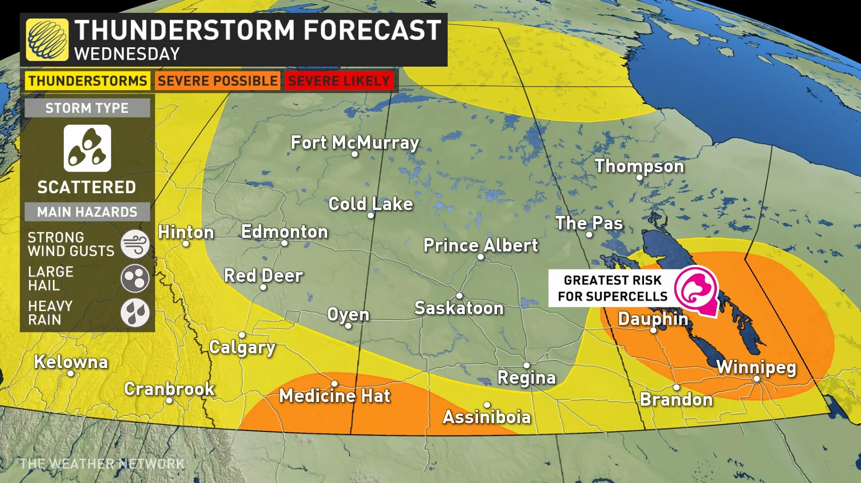
"Strong storms that develop may be long lasting and be able to sustain themselves due to a favourable atmospheric environment for thunderstorms," says Kelly Sonnenburg, a meteorologist at The Weather Network. "Significant speed and directional wind shear could enhance storm strength and supercell development is possible."
Large hail and potentially damaging winds would be the primary threats with storms that develop, however an isolated tornado cannot be ruled out.
MUST READ: Everyone needs a home emergency kit. Here’s how to stock yours
The other risk area for Wednesday will be across southern Alberta and southwestern Saskatchewan.
Storms are forecast to develop in Montana and track north across the border late Wednesday evening and into the overnight hours.
Large hail will be the main threat, with up to ping pong ball or golf ball-sized hail possible -- much like the large hail that hit parts of the region on Tuesday.
THURSDAY: MORE WIDESPREAD THUNDERSTORM THREAT
The thunderstorm risk becomes much more widespread across Alberta for Thursday.
"Looking at the upper levels of the atmosphere, the jet stream will shift to orient itself southwest to northeast over the Rocky Mountains and Alberta," Sonnenburg says. "An associated upper level trough and developing surface low will help to initiate storms widespread along the foothills that will then track east into the evening hours."
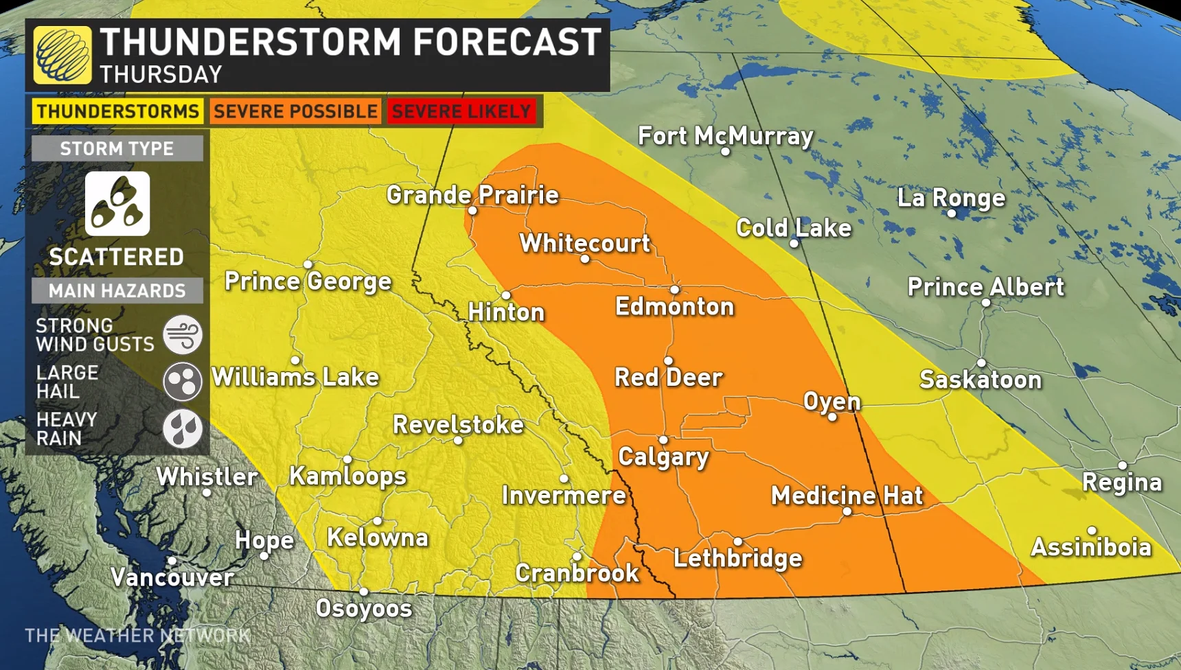
Supercells producing large hail are likely to develop through the early evening hours.
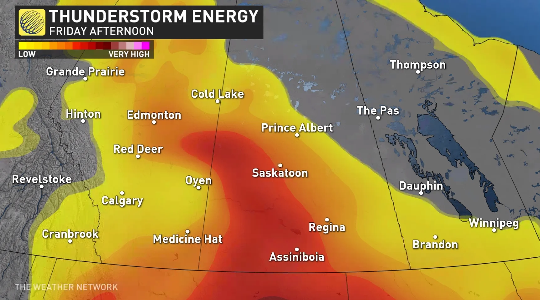
The storm risk will slowly shift east Friday as the surface low tracks into Saskatchewan, targeting eastern Alberta and Saskatchewan with a thunderstorm threat once again.
Warmer temperatures are forecast across the region this week, with a couple of days in the mid to upper 20s to lower 30s late week and weekend. Above seasonal temperatures are expected for next week, but no extreme heat is in sight.
Forecasters are also watching the potential for a significant system this weekend as a developing low pressure system could track into the region with widespread rain and storms possible, especially for parts of Saskatchewan and Manitoba.
--
Be sure to check back for the latest updates on the weather and storm threats across the Prairies.