This mammoth ‘block’ could spell wintry trouble for Eastern Canada

A huge upper-level ridge over Greenland could make for an interesting stretch of rocky mid-month weather for Eastern Canada.
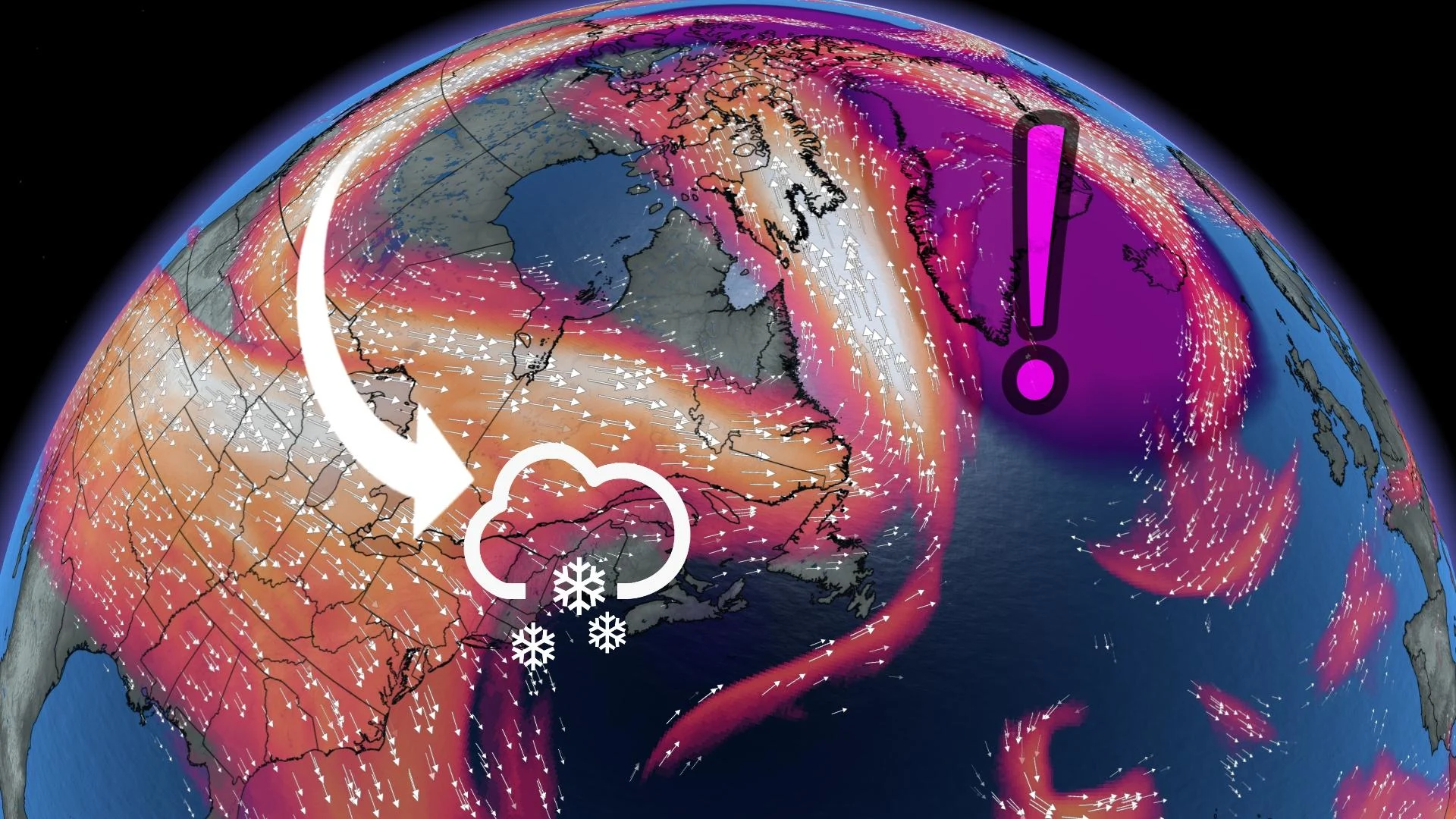
A colossal ridge of high pressure building over Greenland could have a big impact on our weather here in Canada by the middle of the month.
If the ridge grows anywhere near as strong as models are suggesting, this upper-level feature will act like a barrier that throws the pattern over North America into upheaval, potentially leading to one or more significant storms trekking across Eastern Canada.
Visit our Complete Guide to Winter 2022/23 for an in-depth look at the Winter Forecast, tips to plan for it, and much more!
Greenland’s weather really is linked to Canada’s forecast fortunes
On its face, the weather over Greenland hardly seems like it could affect places like Toronto, Montreal, and Halifax.
But that critical link is one of the best examples of how our atmosphere is an interconnected wonder, always pulsing and rippling in ways that deeply influence every other part of the fragile bubble that sustains life on our beautiful planet.

That relationship is called a teleconnection. We’re all familiar with the world’s most famous teleconnection: ENSO, or the pattern that drives El Niños and La Niñas in the eastern Pacific Ocean.
MUST SEE: The curious case of a 'triple-dip' La Niña in a warming world
Upper-level ridges and troughs around Greenland contribute to a teleconnection called the North Atlantic Oscillation (NAO). Meteorologists track the strength of the NAO using a number that climbs above or below zero.
A positive NAO means that there’s strong troughing over Greenland, which in turn contributes to warmer-than-normal conditions across eastern North America.
A negative NAO occurs when a strong ridge builds over the region instead, blocking the pattern and making stormy conditions more favourable across the Canadian and U.S. east coasts.
Watching a mid-month storm potential
This all leads up to the pattern meteorologists are monitoring for later this month.

Weather models strongly hint that we’ll not only see a negative NAO heading into the middle of the month, but that it could be one of the strongest such patterns ever recorded during the month of December.
If that scenario plays out, we could see multiple chances for rollicking low-pressure systems to swirl across Eastern Canada, potentially bringing windy, rainy, and even wintry weather to communities along its path.
While the signal is strong enough that meteorologists can confidently sniff out the likelihood of this bombshell of a blocking pattern, it’s far too early to say exactly where, what type, and how much foul weather we could expect toward the middle of December.

Precise weather forecasting is possible out to about a week in advance; after that point, the randomness of the atmosphere is too great to predict more than just general patterns.
DON'T MISS: Why does your long-range forecast change so often?
Think of it like driving down the highway toward a construction zone. You can easily spot the orange signs from a kilometre away that tell you there’s potential danger ahead, but you have to drive much closer before you can actually read what the sign is telling you.
Stay tuned to The Weather Network heading into next week as forecasters monitor the pattern and pinpoint the impacts of this potentially wintry setup.