This giant ‘omega block’ over B.C. is a skier's worst nightmare

An atmospheric traffic jam over the West Coast will starve B.C. for any rain or snow over the next week or two—but not all hope is lost.
It’s a skier’s worst nightmare: The skies are going to clear out and a blocking pattern will prevent snow from falling over British Columbia just in time for the ski season to get underway.
After several weeks of active weather brought much-needed relief—and unwanted damaging winds—to the West Coast, a pattern change is underway that will cause conditions to fall eerily calm across B.C. through the latter half of November.
DON’T MISS: Early snowfall prompts some B.C. ski hills to open sooner than expected
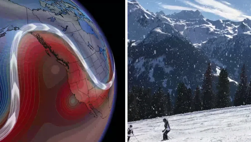
We’re watching the development of an omega block over the Gulf of Alaska. This type of blocking pattern gets its name from its resemblance to the Greek letter omega.

The ridge of high pressure acts like a barrier that blocks just about any active weather from getting through to the other side, keeping conditions relatively calm for anyone caught downstream from this upper-level traffic jam.
This isn’t what folks want to hear when the skiing season is about to get underway, especially when several of B.C.’s ski resorts are tentatively scheduled to open over the next couple of weeks. However, there is a glimmer of hope that could buoy the spirits of anyone hoping to hit the slopes soon.
PHOTOS: Vancouver's early-season snowfall catches city by surprise
While we’re not going to see much in the way of precipitation in the near future, a few things will work in skiers’ favour.

Clear skies and light winds will make for ideal conditions to travel to the open resorts and safely get out on the slopes without worrying about foul weather gumming up any plans.
Lower-than-normal freezing levels will also make it easier for resorts to crank up the snow machines, helping to fill the gap until the pattern flips around once again.
This upper-level blocking won’t stick around forever. We’re likely going to see another pattern flip arrive for the West Coast around the end of the month, which should allow an active storm path to return to B.C. and bring more opportunities for natural snow to blanket the slopes once again.
Stay tuned to The Weather Network for the latest forecasts and conditions across B.C.