Batten down the hatches Atlantic Canada, major storm approaches

Extreme winds threaten widespread power outages across Atlantic Canada through the weekend. Travel is not recommended with howling winds and heavy precipitation.
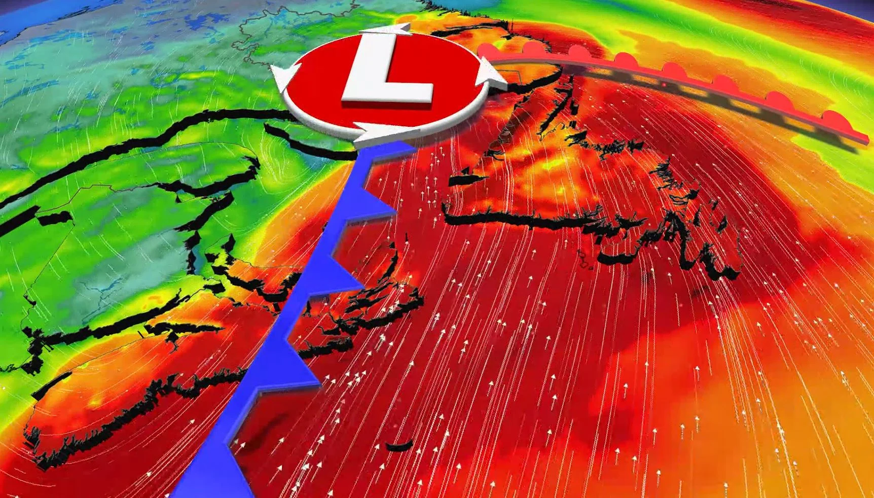
Heavy rain, snow and damaging winds are all on the table this weekend across Atlantic Canada, as an intense low pressure system spans much of the East Coast. The storm will rapidly intensify as it reaches the region on Saturday, potentially setting a nationwide record for the month of March based on its intensity. Widespread warnings are likely to cover much of the area. Residents are being urged to brace for treacherous travel and power outages as the impacts of the storm pick up. More on the timing and what to brace for, below.
Visit our Complete Guide to Spring 2022 for an in-depth look at the Spring Forecast, tips to plan for it and much more!
SATURDAY INTO SUNDAY: INTENSE SYSTEM THREATENS HEAVY RAIN, SNOW AND WIND
Friday will serve as the final calm day before the storm across Atlantic Canada, before a potent weekend system threatens significant impacts across the region starting on Sunday.
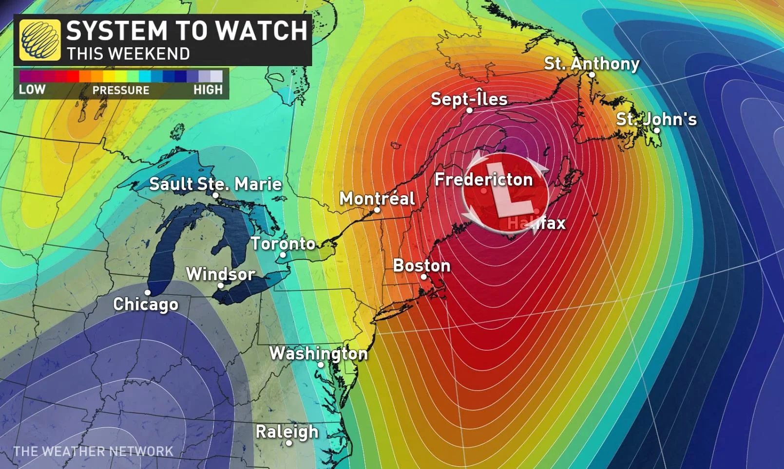
A low-pressure system will develop over the southern United States on Friday and race toward the Maritimes early Saturday. The system will rapidly intensify as it tracks into the region, with its minimum central pressure possibly dropping below 950 millibars as it lifts north into the Gulf of St. Lawrence later Saturday.
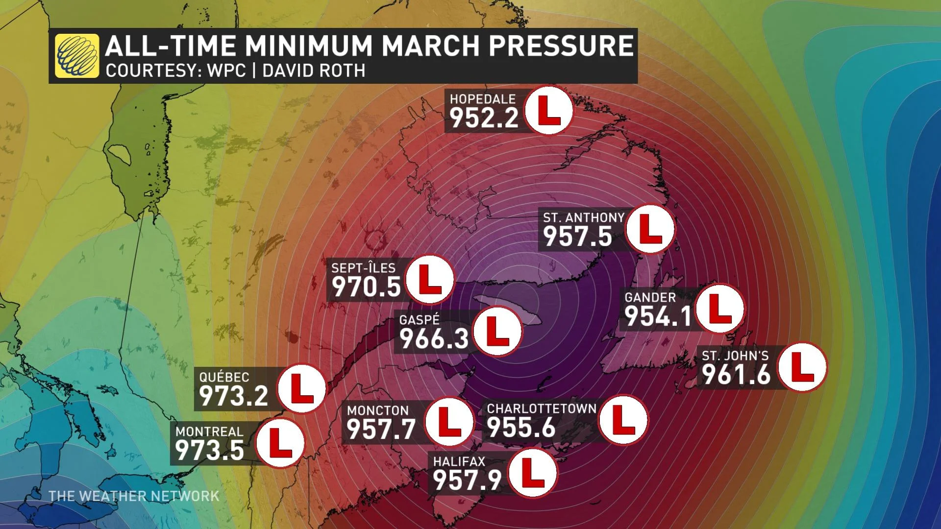
If the centre of the storm happens to pass near any of these weather stations, it would break the record as the deepest low-pressure system recorded in Canada during the month of March, according to Tyler Hamilton, a meteorologist at The Weather Network.
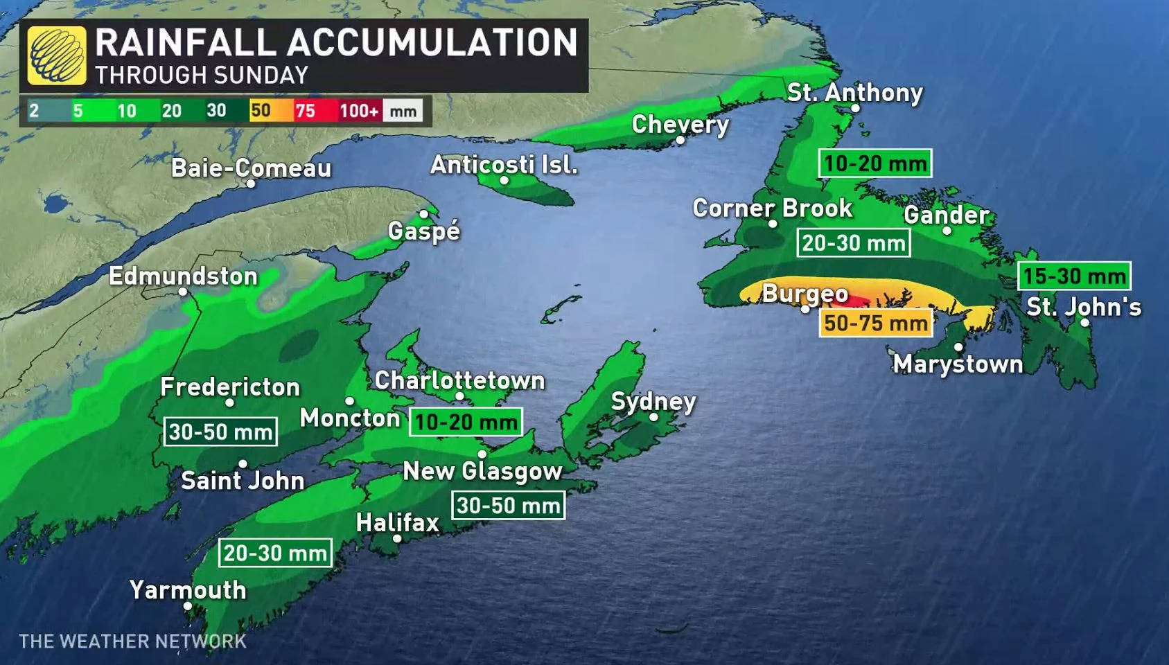
Heavy precipitation will spread across the Maritimes through the day on Saturday and continue into the first half of Sunday.
Currently, it looks like Nova Scotia, Prince Edward Island, and Newfoundland will likely see milder temperatures and periods of heavy rain through the heart of the weekend, which could lead to the threat for flooding in some areas.
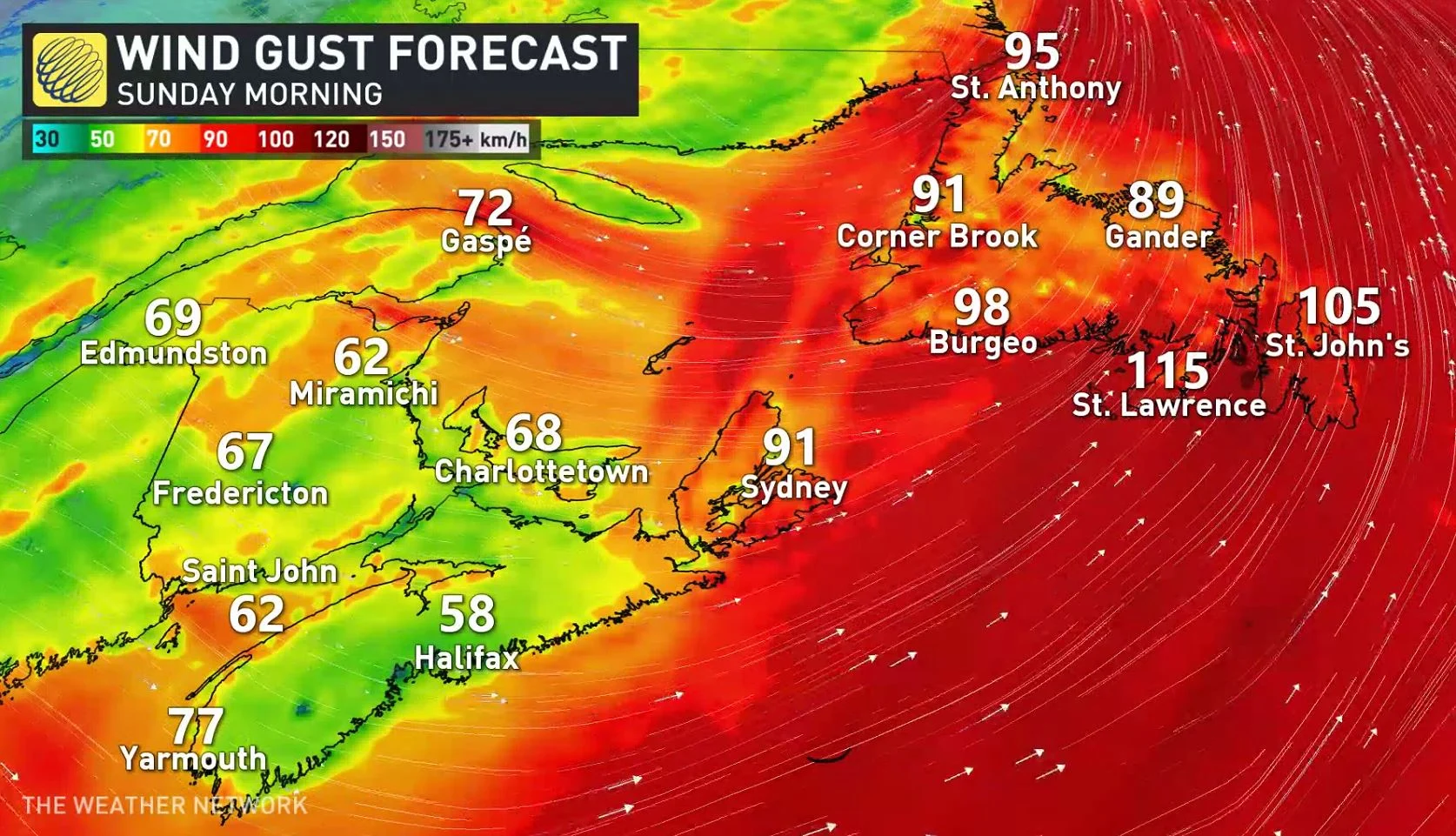
Additionally, this system will have a very large wind field that stretches from The Bahamas to Newfoundland. Whipping winds of 90-100 km/h could lead to power outages across the Maritimes.
Even higher gusts are possible up in Newfoundland. Environment and Climate Change Canada (ECCC) will likely issue wind warnings as we draw closer to the event.
WATCH | CONDITIONS TO CHANGE 'DRASTICALLY' AS GUSTY WINDS AND SNOW TARGET ATLANTIC CANADA
Given the predicted track of the storm, the heaviest snow is likely to fall in northern New Brunswick, the Gaspé Peninsula, and across Labrador.
Widespread totals of 20-30 cm are possible in the far northern Maritimes, while we could see totals of 50-75 cm in Labrador, including Happy Valley-Goose Bay. Blizzard conditions are possible in areas that experience heavy snow.
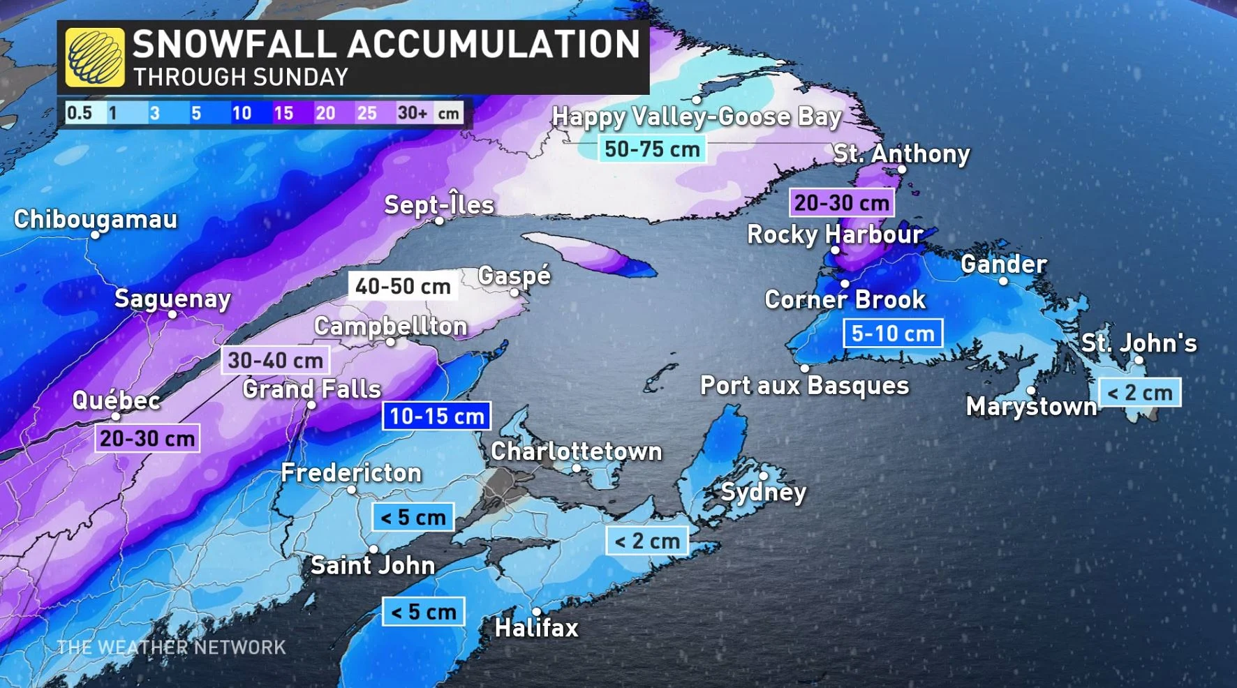
The remainder of the Maritimes should see less than 5 cm of snow by the end of the storm, mostly falling on Sunday as colder air wraps around the back of the storm as it departs the region.
It’s important to note that these predicted snowfall totals are subject to change based on the exact track of the storm.
Make sure to prepare for potential power outages across your area. Leave with extra time and plenty of emergency supplies if you have to venture out during the height of the storm, especially across communities where snow is in the forecast.
Be sure to check back for the latest updates on this storm system as it approaches Atlantic Canada.