Severe weather, tornado threat puts 48 million Americans at risk

The same system that will bring messy weather to Ontario Wednesday is putting millions of Americans under the threat of severe storms and tornadoes, across the same southern states that were hit by twisters last week.
Similar to Ontario getting a mid-week storm that has many characteristics akin to a March 23 storm, the southern U.S. is getting a taste of déjà vu, as well, with the potential for a severe weather outbreak.
In fact, the same system that will bring messy weather to Ontario Wednesday may also spark severe storms and tornadoes across the same southern U.S. states that were hit by twisters last week, including one in New Orleans, La., that resulted in a fatality and considerable damage.
SEE ALSO: Tornado leaves New Orleans neighborhood in ruins, killing one

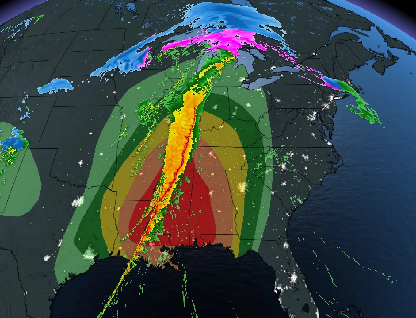
According to the National Weather Service Storm Prediction Center (NWSSPC), a regional outbreak of severe thunderstorms is expected Wednesday across the lower Mississippi Valley and southeastern states. All severe hazards are possible, including widespread damaging winds, possibly exceeding 120 km/h and several tornadoes, some of which could be strong (EF-2 or higher).
Approximately 48 million Americans are under the threat of severe weather, with the highest chance -- a moderate level -- covering Louisiana, Mississippi, Alabama and extreme southeastern Arkansas. However, severe storms could also hit eastern Texas, Tennessee, Florida Panhandle and southeastern Missouri, extending into southern Illinois, Indiana, and western and central Kentucky.
The spring setup for severe storms is quite common for the region, with a sharp southward dip of the jet stream and a low-pressure system tracking from the southwestern U.S. toward the central and eastern regions. The system will absorb a supply of moisture from the Gulf of Mexico, leading to the development of widespread rain and thunderstorms.

A squall line that formed early Wednesday will continue tracking east across the southeastern states into the overnight hours. Isolated supercells ahead of the line could lead to an additional threat for severe weather, as well. At one point on Wednesday, there were nine concurrent tornado warnings covering central Louisiana along the squall line.
The threat in the aforementioned regions is expected to continue into Wednesday overnight, with the chance of severe storms pushing into Georgia and eastern Tennessee by early Thursday morning.
With files from Nathan Howes, a digital reporter at The Weather Network.