Ontario: Humidity finally declines, below seasonal temps move in

Some areas will see below seasonal temperatures at the beginning of the work week
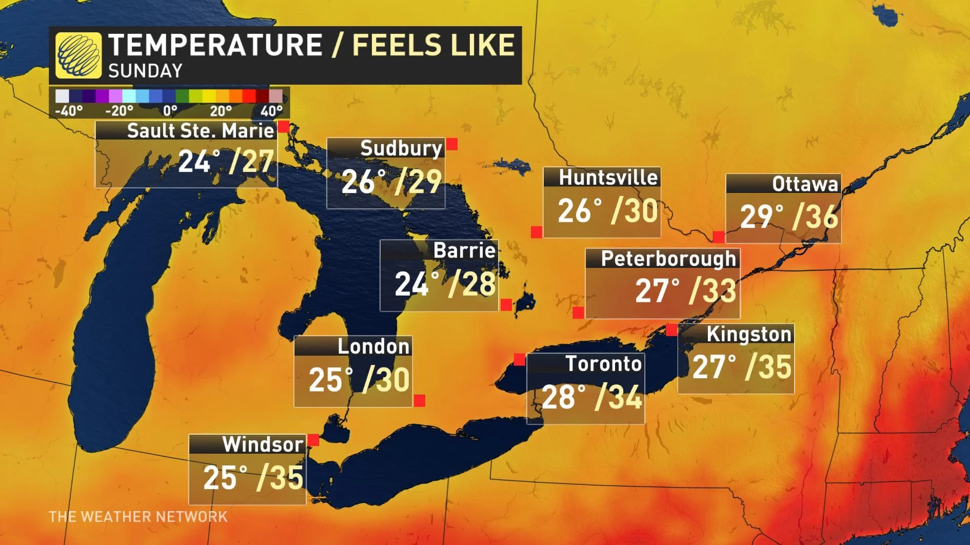
The cold front that brought severe thunderstorms and even a tornado warning for Cornwall on Saturday will help bring down the scorching humidex values. While there will be some showers during the early half of Sunday, the heatwave will finally come to an end as cooler and drier air moves into southern Ontario. For more on the lingering showers and cooling temperatures, below.
WEATHER HIGHLIGHTS:
Lingering showers into Sunday morning
Heat, humidity ease
Stay up-to-date on the ALERTS in your area
WATCH BELOW: TIMING OF LINGERING RAIN ON SUNDAY
Isolated showers could persist into at least the early overnight across southwestern Ontario as the front pushes through, while the risk diminishes after sunset further east.
This cold front will help to cut through some of the humidity, and while Sunday will still feel slightly on the muggy side, humidex values will be significantly lower compared to the previous days.
CHANGE IN WEATHER PATTERN NEXT WEEK, COOLER WEATHER ON THE WAY
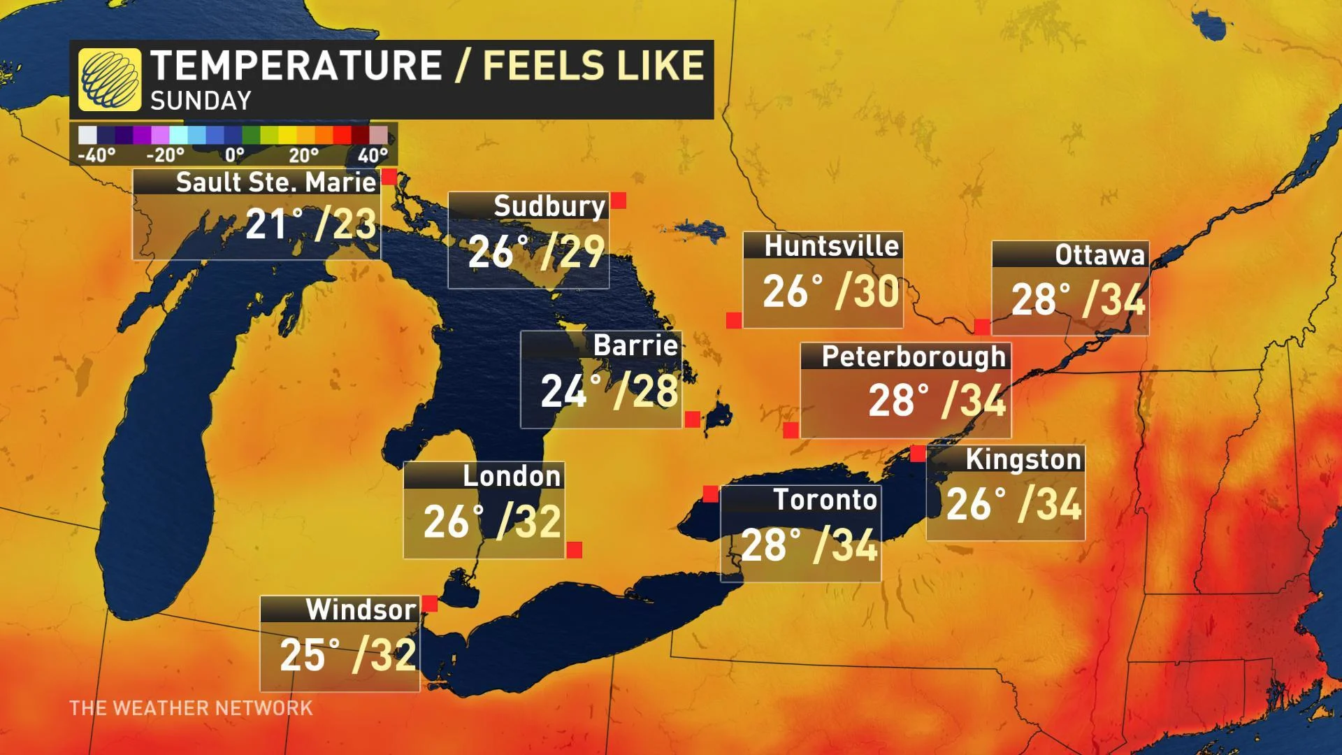
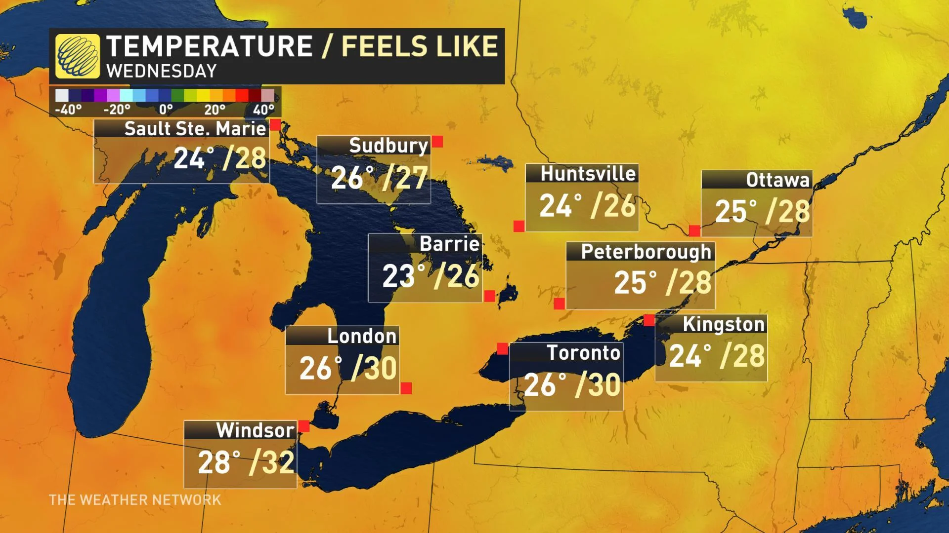
By the start of next week, a pattern change will bring much cooler and less humid weather to the province. Tuesday and Wednesday will continue to be a few degrees cooler than seasonal, but temperatures will return to near seasonal by late next week and possibly a couple of degrees above seasonal by next weekend. However, the warmup will be brief.
"While a couple of days of warmer weather are possible next weekend, overall a cooler pattern (near seasonal) is expected to dominate during the final days of July and into the first few days of August throughout the Great Lakes region, including southern Ontario," adds Gillham.