
BIG weather swap coming to Canada, expect a pattern reversal soon

Get ready, Canada. The great weather swap is coming next week.
Imagine summer as a seesaw, and this year, all the true summer heat has been tilted towards Ontario and Quebec for the first half of July, with parts of Atlantic Canada (cough, Newfoundland) and much of western Canada likely feeling a bit ripped off.
But get ready, the great Canadian weather swap is about to take place.
FIRST HALF OF JULY
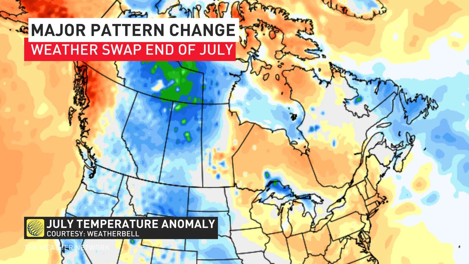
The temperature anomaly map above highlights a wide swath of western Canada feeling the brunt of persistent troughing compliments of an unusually active Pacific jet stream that's been quite uncharacteristic for summer.
That jet stream is responsible for the cooler than normal temperature anomaly, with a shorter wavelength (more smaller ridges and troughs) than the typical sort expected during the summertime.
Alaska has been in a record-breaking persistent high-pressure pattern for several weeks, but they have also been hogging the warmth, with a sharp trough remaining over British Columbia and Alberta.
The main beneficiaries for warmth have been Ontario and Quebec, with transient ridging bringing muggy airmasses north from the U.S. Thankfully there have also been interruptions from the extreme heat, so far avoiding a repeat from the dangerous and deadly hot conditions the plagued the provinces last summer.
CHANGES BREWING
There are signs of changes brewing as early as next week.
The ridging is forecast to relax in eastern Canada, and a more persistent northwest flow is forecast to develop throwing temperatures back into the mid-20s for a wide area in Ontario and Quebec. This weakness in the atmosphere will attempt to dominate the pattern after our significant heat this weekend. A lack of extreme heat and humidity is generally forecast for most of the remainder of the month for eastern Canada.
The visual below will help emphasize the general pattern. Consider this a sketch for the next couple of weeks:
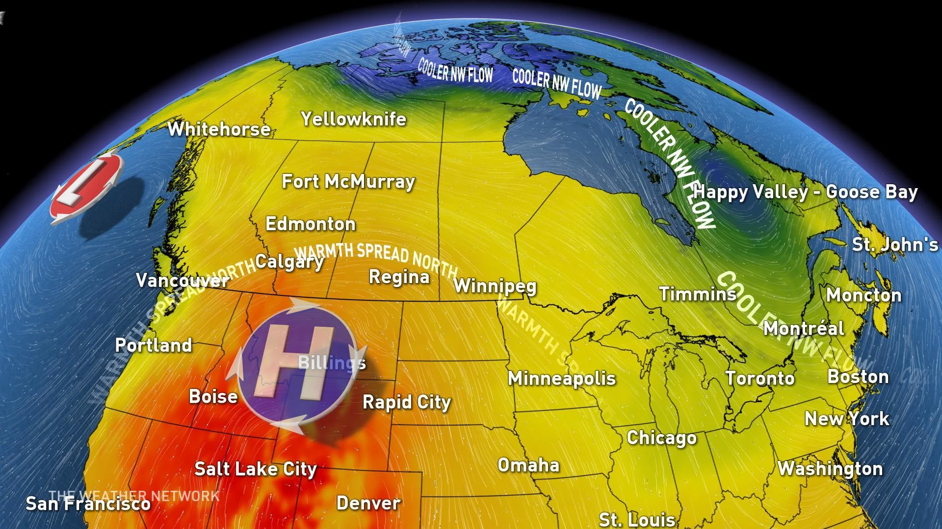
A major upper-level high-pressure system wants to overwhelm the western continental United States; consequently, causing temperatures to soar, and inevitably, that ridge will nose into Canada. It will oscillate at times, but from the Interior of British Columbia, all the way east to Manitoba should likely benefit from bouts of seasonably warm temperatures over the next couple of weeks.
Welcome to summer, western Canada!