B.C.’s week starts with a bang as a risk for storms builds again

An unusually rainy stretch of weather for this time of year will continue across B.C. over the next few days, including a thunderstorm risk in the Interior.
--
An unusually rainy midsummer stretch will continue for portions of British Columbia as we head into the new workweek. Unstable air will foster a risk for thunderstorms across the southern half of the province on Monday. Rain could continue through the middle of the week for some areas. More on what to expect in the days to come, below.
CANADA’S JULY FORECAST: Summer sizzle or does the heat fizzle? Your monthly outlook, here
THROUGH TUESDAY: ABNORMALLY RAINY FOR JULY, BRINGS RISK OF FLOODING
A jammed-up upper-level pattern is to blame for the upcoming stretch of rainy conditions.
We’re seeing a rex block across Western Canada this weekend. This upper-level blocking pattern occurs when an upper-level low gets caught beneath an upper-level ridge, essentially jamming up the jet stream and forcing a stagnant pattern to remain in place for days—and even weeks in extreme cases.
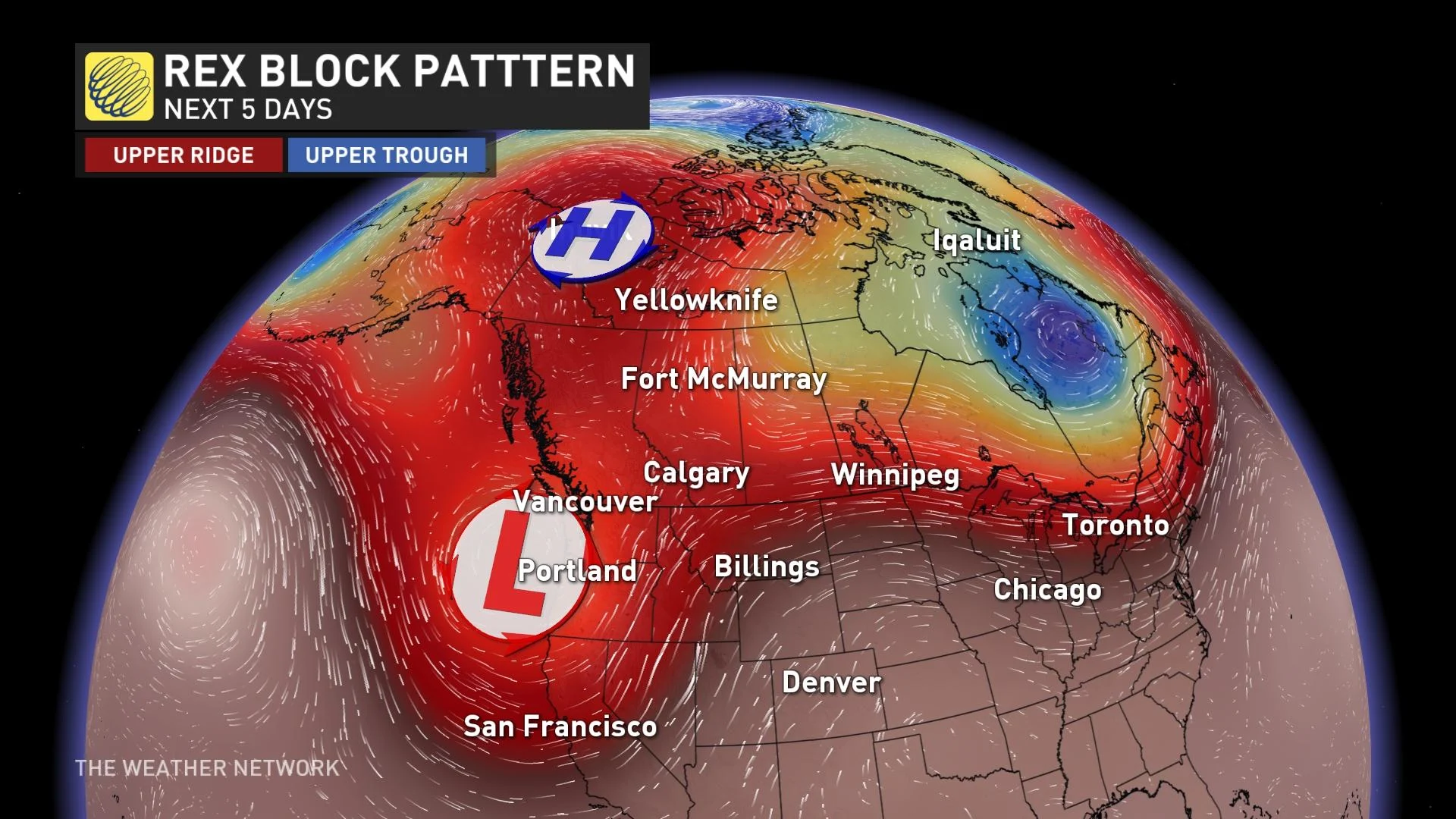
While communities in the Arctic Circle endure an impressive stretch of abnormal heat as a result of that stubborn ridge, B.C. will fall on the unsettled side of the blocking pattern with that upper-level low stuck over the region.
This pattern is responsible for the impending stretch of rain that’ll continue over the next few days. B.C. should expect heavy showers and thunderstorms to parade across the province through the first half of the week.
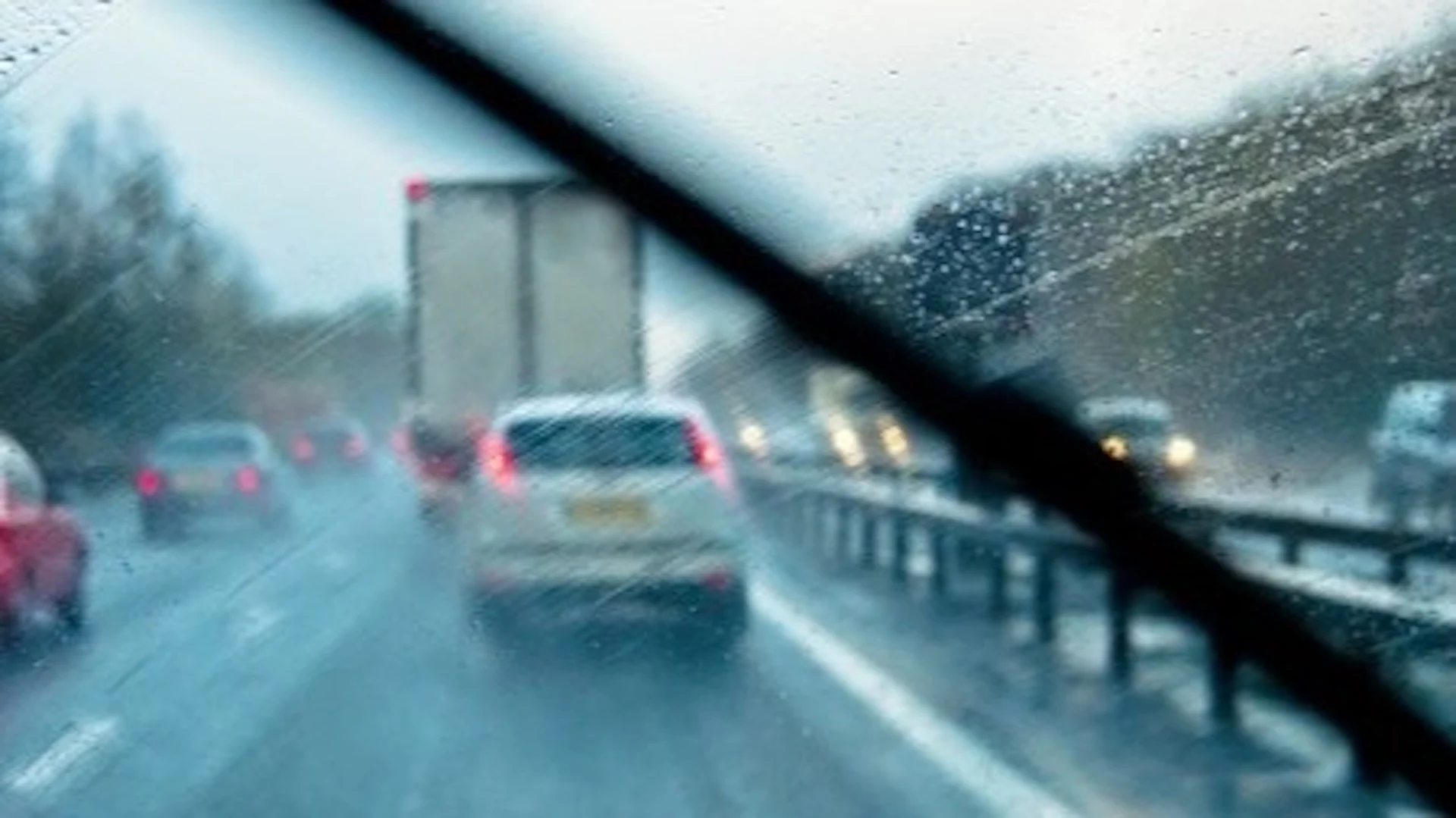
DON'T MISS: Here’s what to stock your vehicle emergency kit with, BEFORE you hit the road
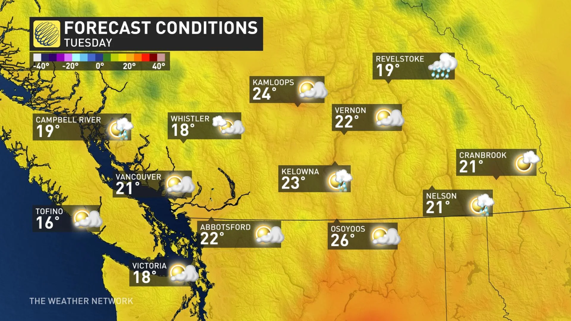
While the rain will start to pull away from the Lower Mainland heading into Monday, instability will remain in place across the Interior and lead to a risk for thunderstorms throughout the day. The greatest chance for thunderstorms will exist over the Okanagan.
Storms should remain below severe limits, but some could produce small hail and localized flooding.
Additional rainfall totals of 10-20 mm are expected for the Lower Mainland, with higher totals likely farther north up the South Coast. Folks in the Interior could see an additional 30-50 mm of rain through Wednesday.
Several watersheds are seeing elevated flow rates from ample runoff from snowmelt, and the heavy bursts of rains are poised to cause additional flood risks during the first week of July.
LOOKING AHEAD: SCATTERED RAIN AT TIMES, AROUND SEASONAL
Rain will start to clear out of southern B.C. on Tuesday, leaving behind a chance for scattered showers and thunderstorms through the remainder of the week.
We’ll escape any summer-like heat across B.C. as we make our way through the first week of the month. Temperatures should come in around or slightly below seasonal over the next seven days, with highs hovering around 20°C for the duration in Vancouver.
Check back for the latest details on the rain heading for British Columbia.