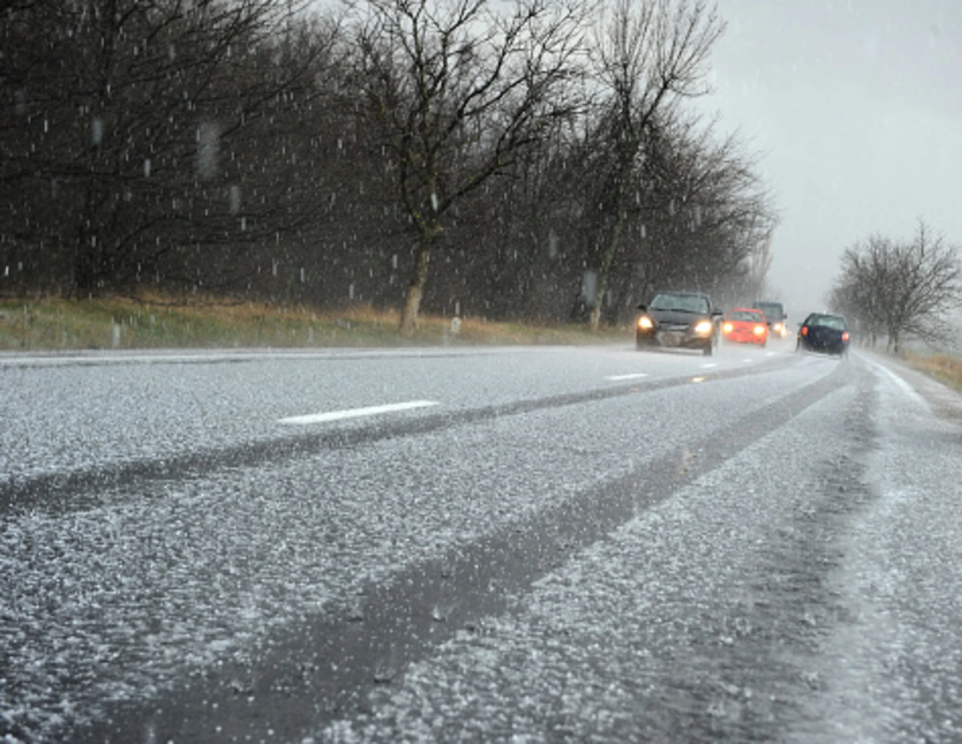
White Easter possible in parts of Atlantic Canada from next messy low

A slow-moving, moisture-fuelled system is loosening its grip on the region, but there won't be much time to take a breath.
Though the current round of heavy downpours for parts of Nova Scotia and Newfoundland, along with freezing rain in parts of New Brunswick, will be on the wane somewhat by Sunday morning, but that won't mean there'll be much of a break. On the heels of this departing low, another looks to march right in Sunday morning, with more wintry impacts that could make for a white Easter in parts of the Maritimes. More on the timing and impact of the next system, below.
WEATHER HIGHLIGHTS:
Heavy rain tapers into Sunday morning for parts of Nova Scotia and the Maritimes
Next system begins bringing snow to much of New Brunswick and parts of Nova Scotia, rain elsewhere
Period of freezing rain and/or ice pellets for a transition zone running through parts of northern Nova Scotia and eastern New Brunswick
THE NEXT ONE: ONE LOW DEPARTS, THE NEXT PREPARES TO MOVE IN
The reason for the extreme rainfall amounts seen in parts of the region in recent days is a blocking pattern that has essentially kept this system from moving on, giving it a longer opportunity to discharge that prodigious moisture on the region.
That very strong blocking pattern over the North Atlantic will endure beyond Saturday, and forecasters are already eyeing the next system's impact on the region.
That system, a secondary low, looks to bring wet snow and gusty winds beginning early Sunday to the Maritimes, continuing through early Monday.
MUST SEE: Will Canada's strong start to spring persist? Exclusive April outlook revealed
There will be a sharp temperature differential from this system, with some parts of the region seeing another round of downpours, and others seeing a short-lived plunge into winter.
The latter will mostly be confined to New Brunswick, another with parts of Nova Scotia away from the Atlantic Coast.
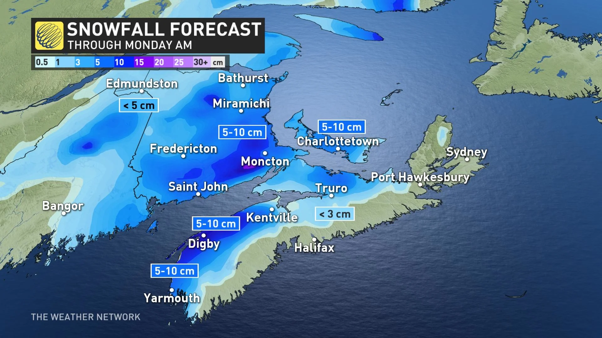
Some wet snow is expected for New Brunswick, northern parts of Nova Scotia and P.E.I. on Easter with widespread totals of 5-10+ cm possible.
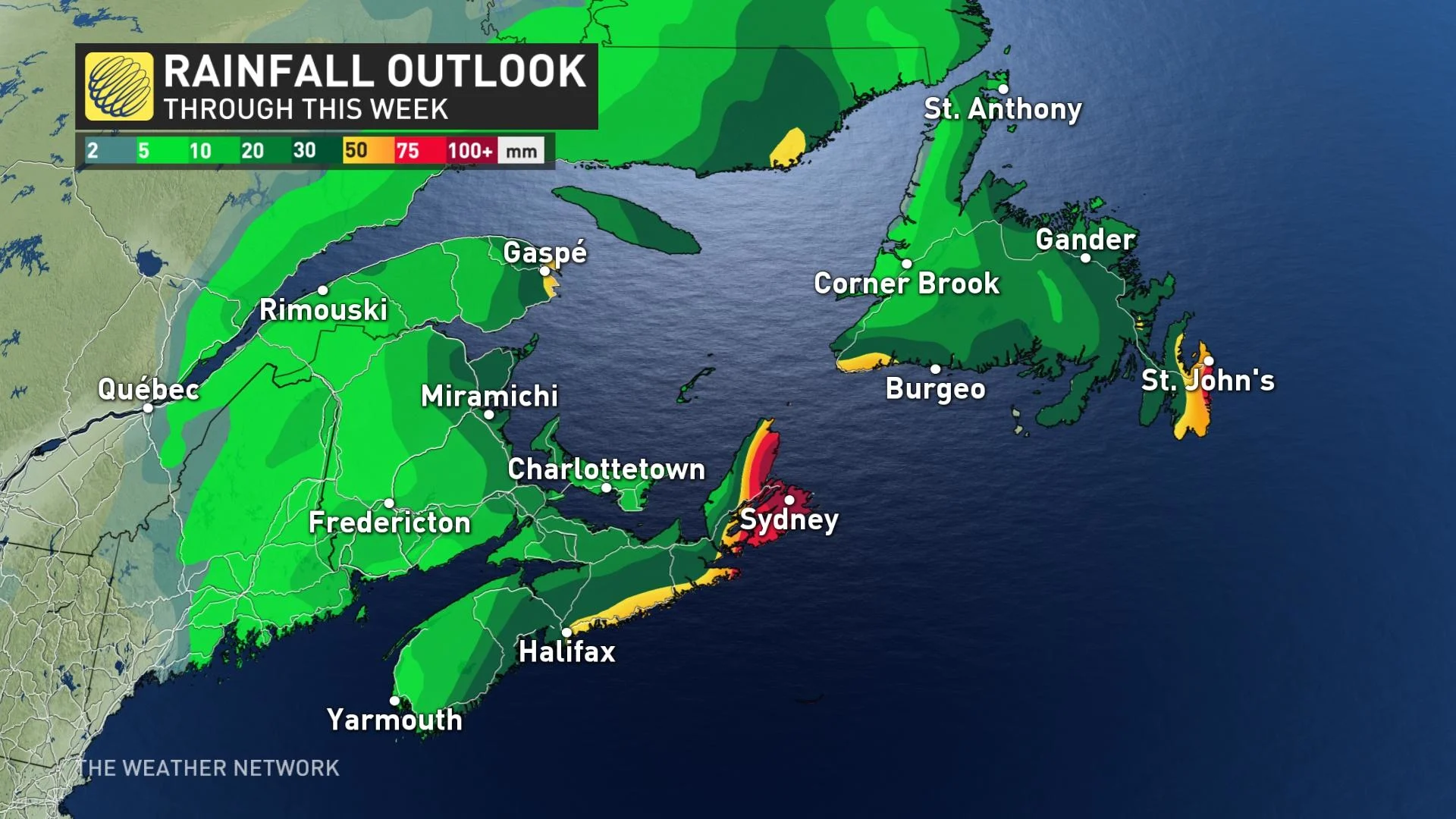
The precipitation looks to stay as mostly rain elsewhere, with totals of 25-50+ mm likely, but locally 50-100+ mm for parts of central and eastern Nova Scotia, P.E.I. and eastern Quebec.
The temperature differential is such that part of the day will be marked by a period of freezing rain or ice pellets for parts of Nova Scotia and New Brunswick.
As for Newfoundland, periods of rain are expected for the island Monday through Thursday, and possibly beyond, with the easterly flow off of the Atlantic.
Be sure to check back for updates on the moisture-filled system for Atlantic Canada.