Quebec: Summer-like heat lingers, may spark severe storms before pattern change

A passing front will bring relief from the heat, humidity Friday, but also the threat of thunderstorms, with some potentially reaching severe limits.
Quebec's first stretch of heat will linger for one more day Friday, along with a thunderstorm potential as conditions remain muggy. Central and southern areas of the province will be at greatest risk of seeing storms reach severe limits. The front will bring a pattern change for Saturday, where daytime highs will drop to the low 20s, with overnight lows that may bring frost. Details and timing, below.
WEATHER HIGHLIGHTS
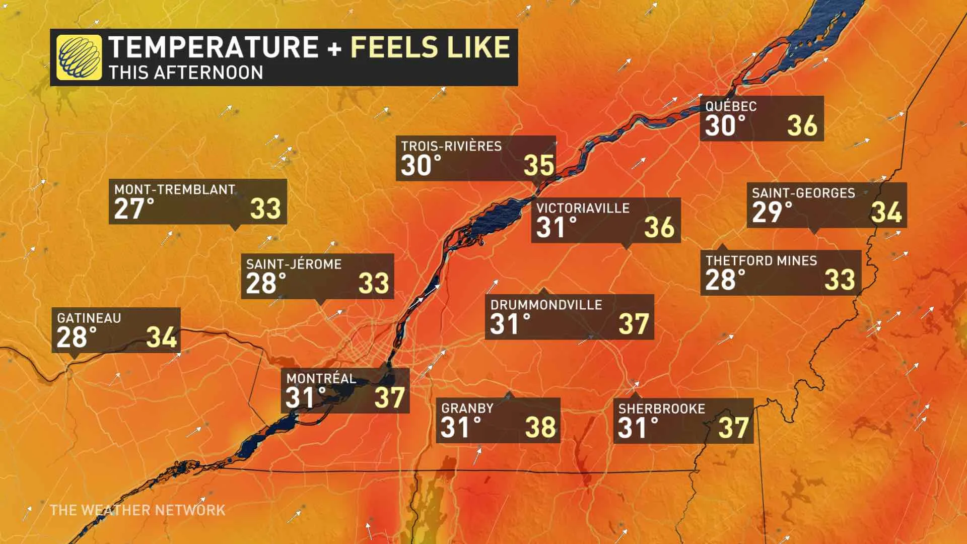
Daytime highs at or above 30°C on Friday; sticky conditions with humidity
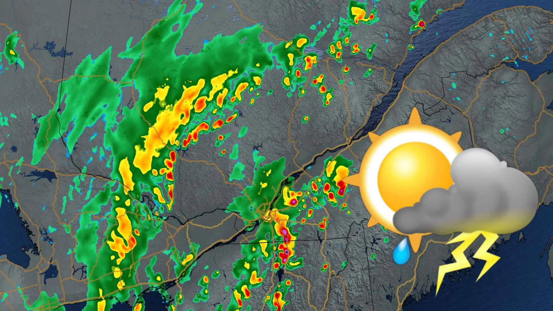
Widespread thunderstorm risk in central and southern areas, some may be severe
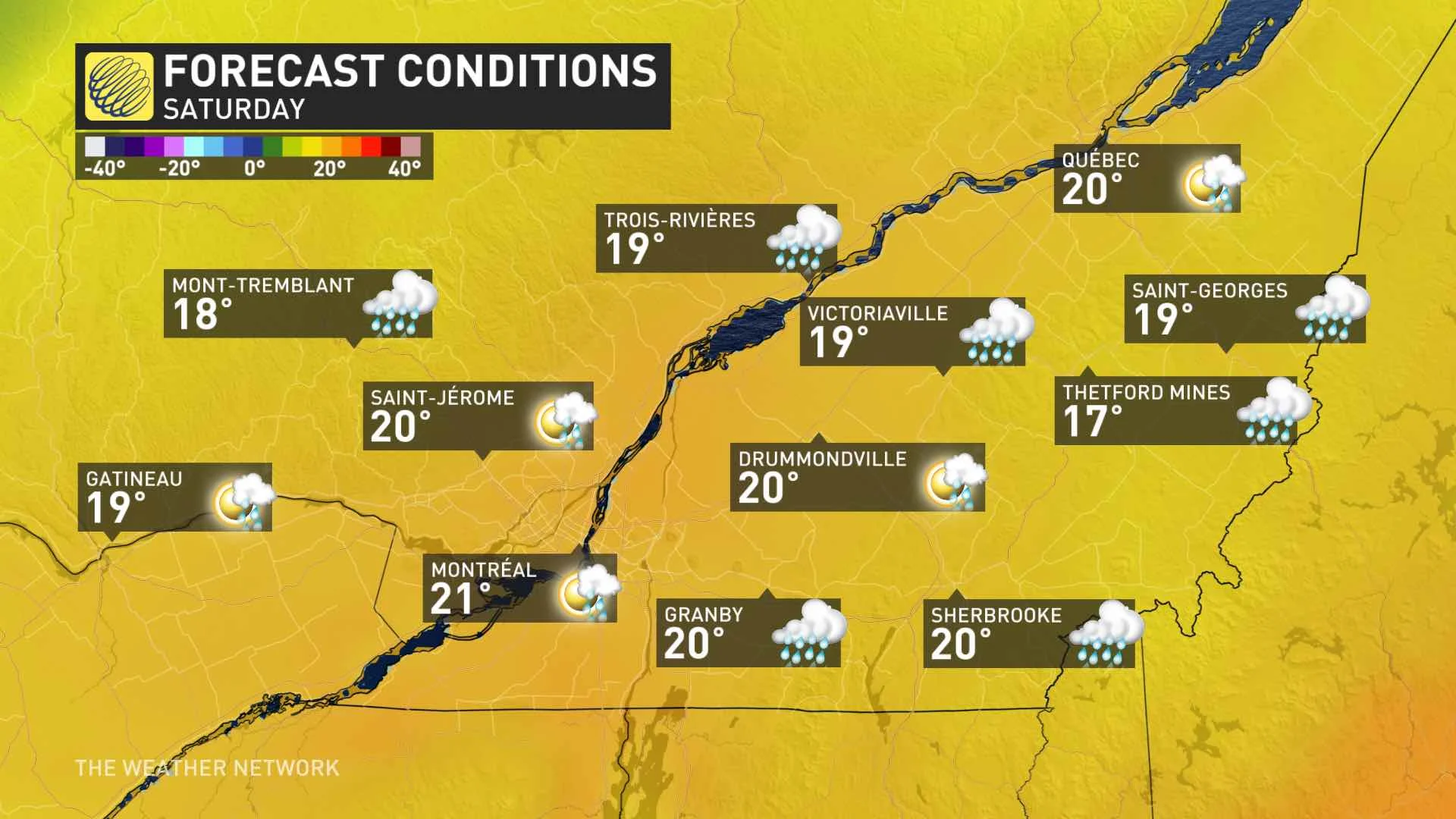
Cooler temperatures return on the weekend
Keep on top of ALERTS in your area.
FRIDAY: HEAT REMAINS, SEVERE STORM RISK
Relief from the summer-like heat is coming, but not until the weekend, as the return of cooler, seasonal temperatures settles in after the passage of a cold front.
Many cities in southern Quebec will still be sweltering under daytime highs at or above 30°C Friday, with the humidity making it feel more like the mid- to upper-30s.
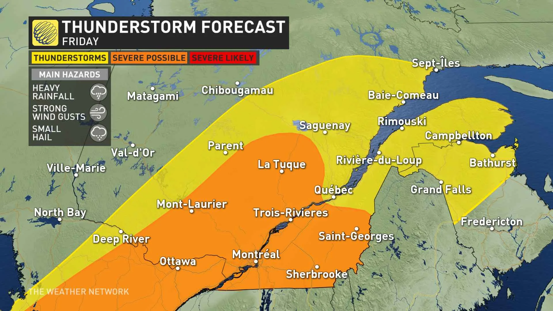
However, along with the muggy and hot conditions comes a thunderstorm threat in the afternoon, with some to potentially become severe, in parts of central and southern Quebec, including Montreal area. The main threats will be heavy rain, strong winds and small hail.
On the weekend, temperatures will drop off considerably Saturday, as the front eliminates the heat and humidity. Frost is likely Saturday and Sunday nights for parts of Quebec, but not Montreal. Even cooler Sunday across southern Quebec with temperatures more typical of mid/late April.
Check back as we continue to monitor the forecast.