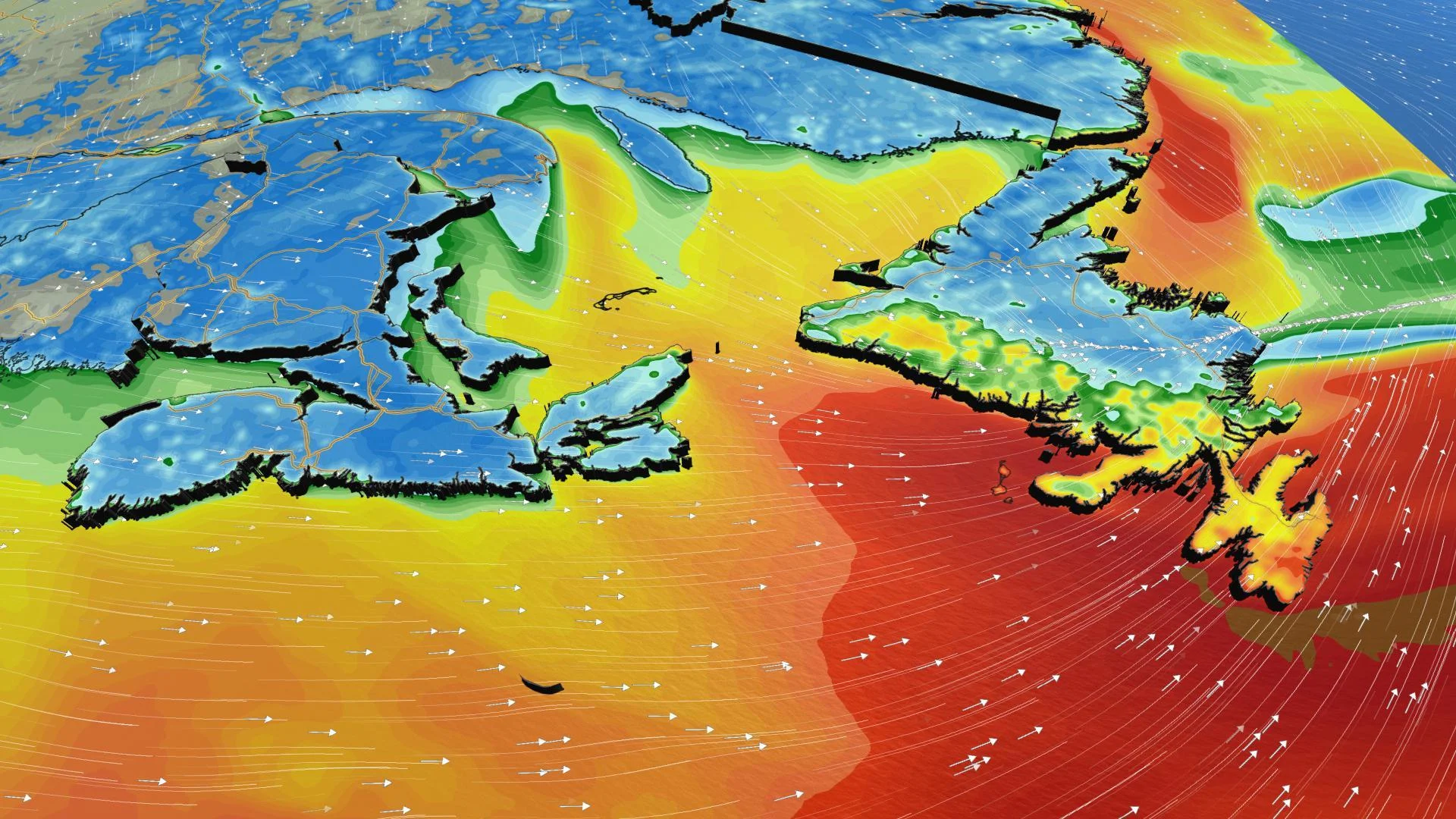
Atlantic: Tens of thousands without power amid vicious wind gusts

Many in Atlantic Canada are in the dark on Saturday
The cold air that was in place across Atlantic Canada earlier this weekend will continue into Sunday morning with temperatures below -10°C for most of the region while New Brunswick will see even colder conditions with temperatures around or below -20°C. Forecasters are closely watching the potential for a system that has the potential to bring another round of snow and up to 15 cm next week. Details and timing, below.
WEATHER HIGHLIGHTS:
Temperature plunge into early Sunday with bitterly cold wind chill values
Next system expected to bring snow, rain, freezing rain on Monday
Stay up-to-date on the ALERTS in your area
SUNDAY: A CLEAR, COLD WINTER DAY
A break in the active weather will make for a calm, but cold, Sunday across Atlantic Canada. High pressure building into the region will bring a well-deserved sunny break for most, though it comes at the cost of some frigid temperatures.
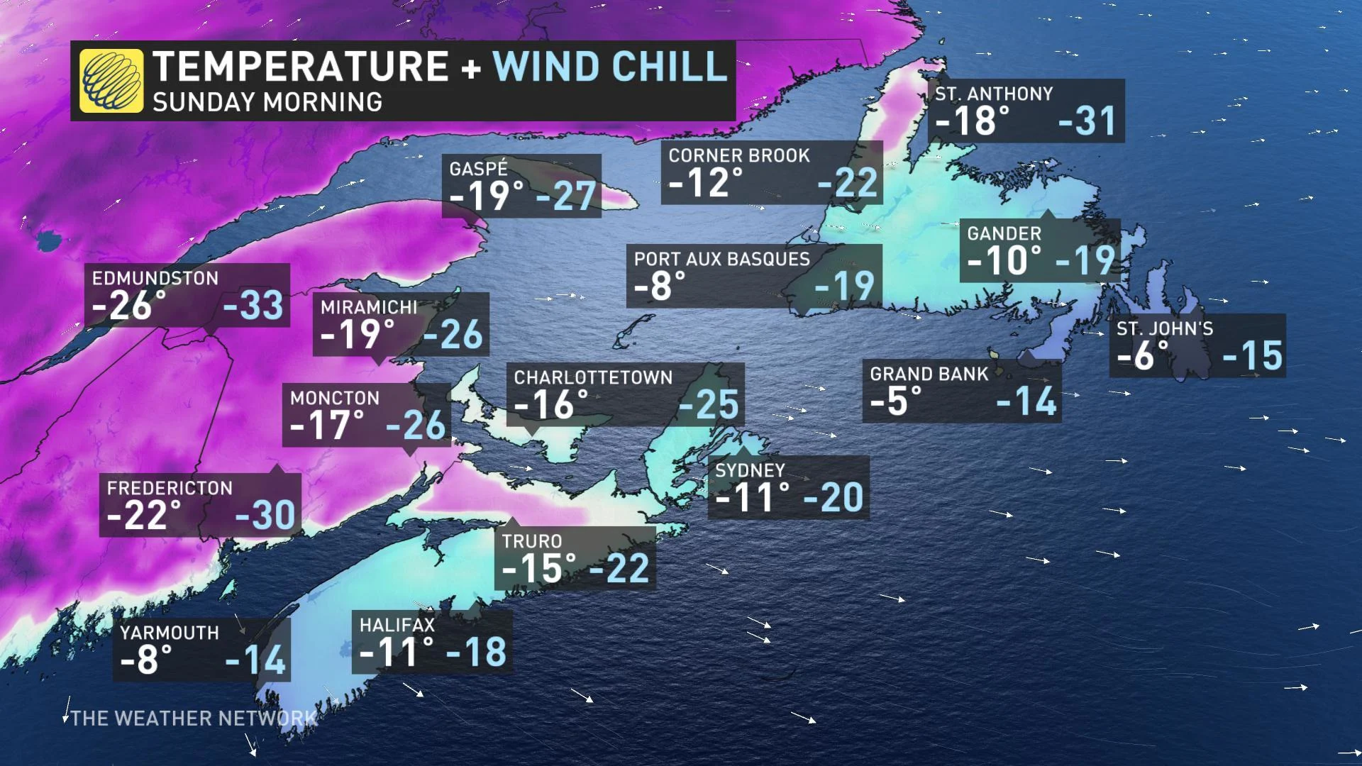
Sunday morning will feature wind chill values in the -20s for most of the region, with some spots dropping into the -30s near dawn.
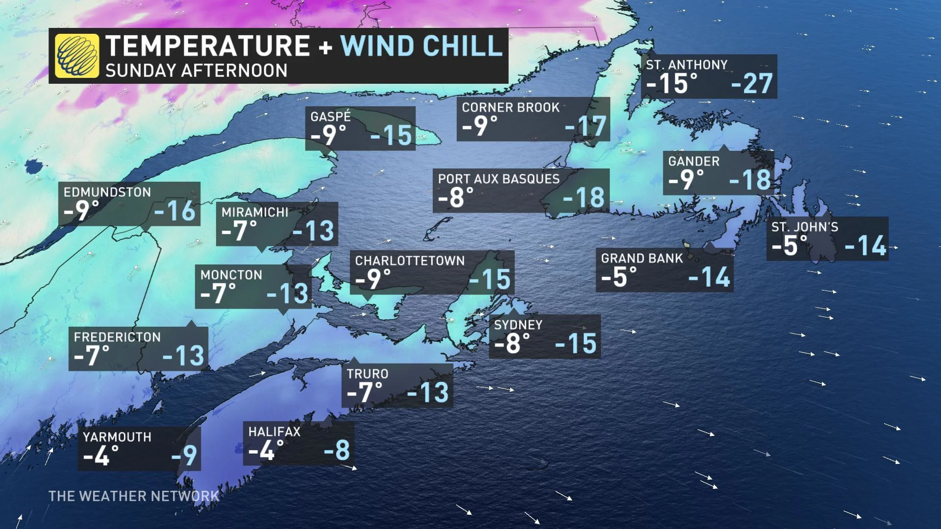
Afternoon temperatures recover somewhat, though highs across the region will struggle to crack the -5ºC mark, and lingering gusty winds will keep it feeling like the minus teens for almost everyone.
MONDAY: UNSETTLED WEATHER RETURNS
Forecasters are keeping a close eye on the next new system expected to track into Atlantic Canada on Monday. While this low looks to start life as a moisture-starved Alberta clipper, it has the potential to tap into Atlantic moisture as it moves into the Maritimes.
This means that there is the potential for another 5 to 15 cm of snow and 5 to 10 mm of rain are on the horizon for some. There is also the chance for freezing rain across the south.

Stay with us here at The Weather Network for all your latest forecast updates.