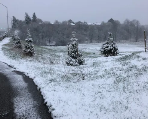
Heavy spring snow threatens slick travel across parts of Quebec

Mother Nature isn't finished delivering snowfall to Quebec, just yet, as a strong stateside low threatens parts of the province with 15-30 cm of the snowfall on Wednesday.
Parts of Quebec have experienced a snowy wallop Wednesday, resulting from the same system impacting southern Ontario as it tracks south of the Great Lakes. While Montreal won't be hit too hard, with about 5-10 cm expected, areas south of the St. Lawrence River -- closest to the low-pressure system could see accumulations of 15-30 cm of snow by the time the system moves out. Snowfall warnings and special weather statements are in effect. For more on timing and impacts, see below.
WEDNESDAY: SNOW INTENSIFIES THROUGH THE DAY, 'MAJOR SLOWDOWNS' FOR SOME
The first of the precipitation pushed into southern Quebec Wednesday morning, with the snow intensifying as the day progressed. By the early evening, there were still special weather statements in effect for eastern parts of the province, including Quebec City.
Accumulations will be greatest south of the St. Lawrence River, where 15-30 cm is possible. North of the river, in the Eastern Townships, 10-20 cm is possible. Areas along the St. Lawrence will be right on the dividing line with 5-10 cm of snow, with Montreal expected to see about 5-10 cm. Between 3-5 cm is anticipated for communities northwest of Montreal.
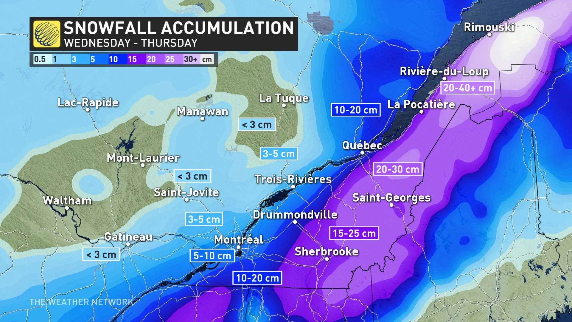
The snow will end for Montreal Wednesday overnight, but will linger Thursday for northeastern sections of the province.
LOOK AHEAD: MORE UNSETTLED WEATHER BY LATE WEEKEND
Abundant sunshine and a dramatic temperature rebound are on tap for Friday. Temperatures could reach the lower teens in Montreal, but will be cooler to the east. Partly sunny conditions and mid-teen daytime highs are expected in southern Quebec on Saturday.
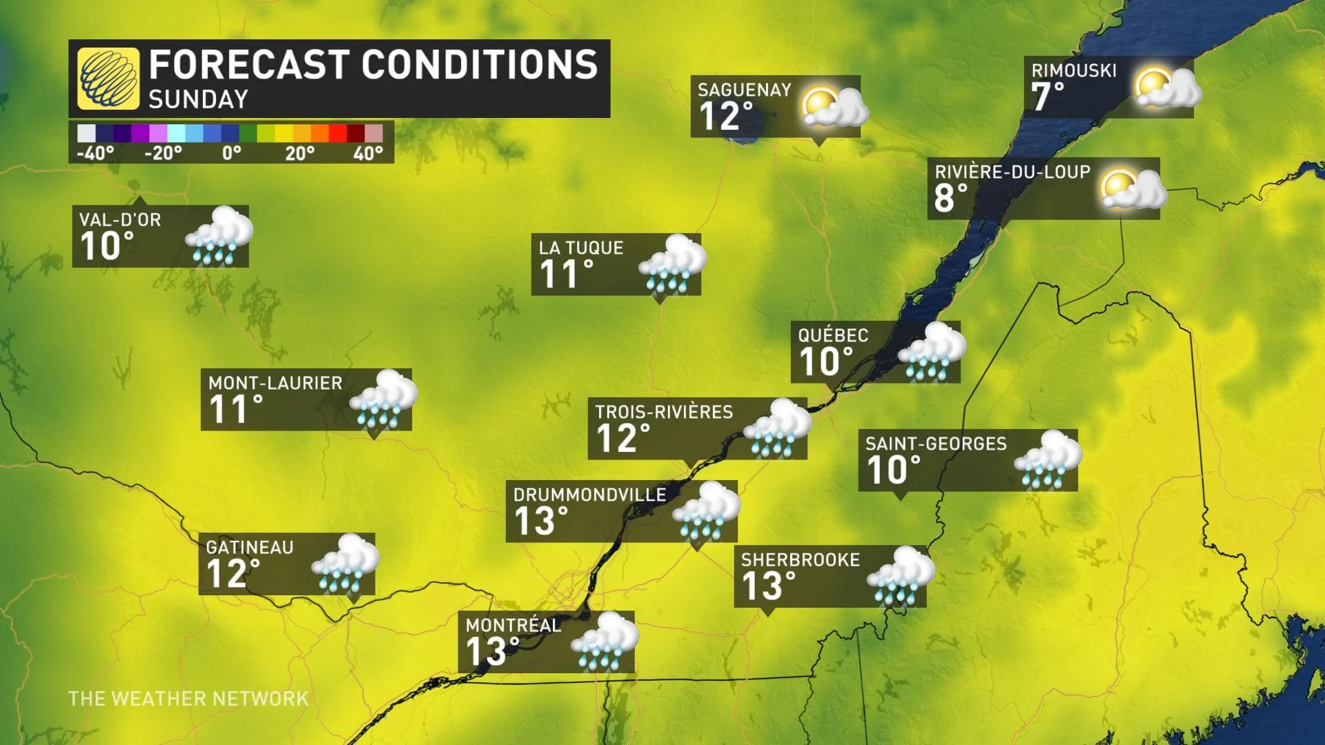
The next system will very slowly track east, with rain developing for southern Quebec on Sunday, possibly lingering into Monday. Colder than seasonal temperatures are expected behind the system into early next week.
A couple of days of much warmer weather is possible for the middle of next week, but forecasters are also watching the potential for another period of colder weather to return late week.
Stay tuned to the Weather Network as we continue to track the storm's progress and its impacts on Quebec.