PHOTOS: Days of lake-effect snow bring wintry feel to Ontario

Parts of southern Ontario were hit with lake-effect snow, rain and even graupel Tuesday, making for slippery commutes in some locales through the day.
Many in southern Ontario may not be ready for the snow just yet, but Mother Nature wasn't going to wait, as the start of the new month has brought a much more wintry feel.
Many woke up to the sights of some flakes flying on Tuesday, which swept through the higher terrain and areas near Lake Huron and Georgian Bay, catching some off guard. For other areas with warmer temperatures, particularly near the lakeshores, precipitation manifested as rain, while some communities reported seeing a decent helping of graupel.
SEE ALSO: Why snow squalls are one of the hardest events to forecast
The lake-effect snow was enough to cause slippery roads in parts of the province Tuesday, with that threat lingering through the day on Wednesday, prompting some of the first winter weather travel advisories of the season.
What's behind the early November snowfall?
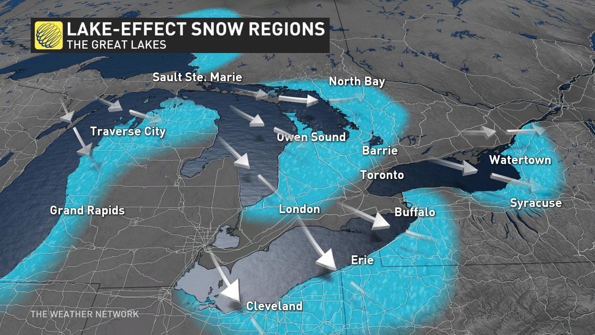
A deep trough brought the coldest air of the season to southern Ontario Tuesday. The Great Lakes water temperature continues to be the warmest in more than 25 years for this time of the year as a result of the prolonged warmth through October. This large temperature difference between the water and air two kilometres above it creates a very unstable atmosphere over the water.
Coupled with a northwesterly wind direction over the lakes, lake-effect squalls developed along Lake Huron and Georgian Bay shores. These narrow, stubborn bands of precipitation rely on smaller-scale local factors, which must be considered in regards to who sees rain, snow or bright sunny skies.
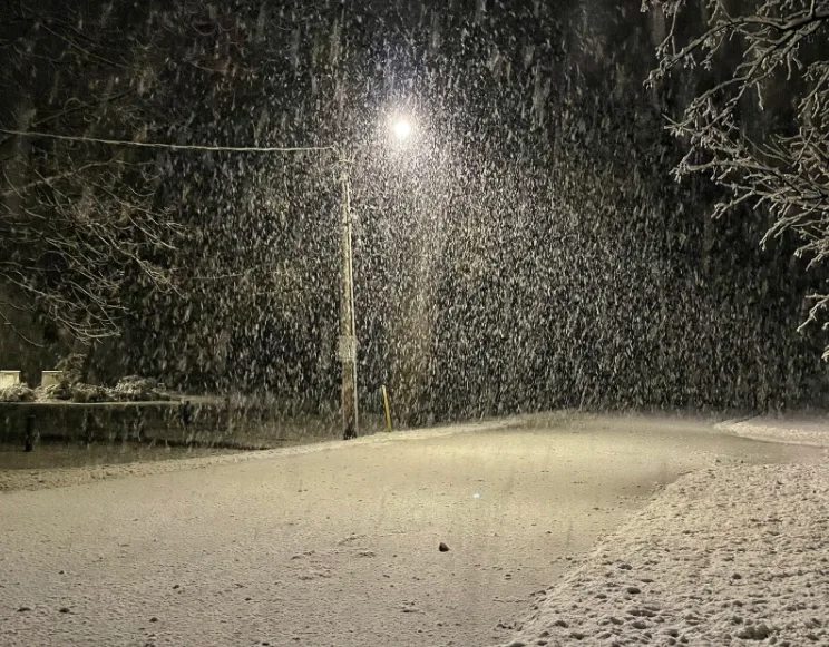
Below is a selection of visuals of the lake-effect precipitation currently making the rounds on social media.
Thumbnail courtesy of Justin M/Twitter, taken in Brussels, Ont.