Arctic air pushes lake-effect snow across 1,500-km stretch in Canada

The lake-effect snow machine will be in full force in parts of Manitoba and Ontario as we kick off November.
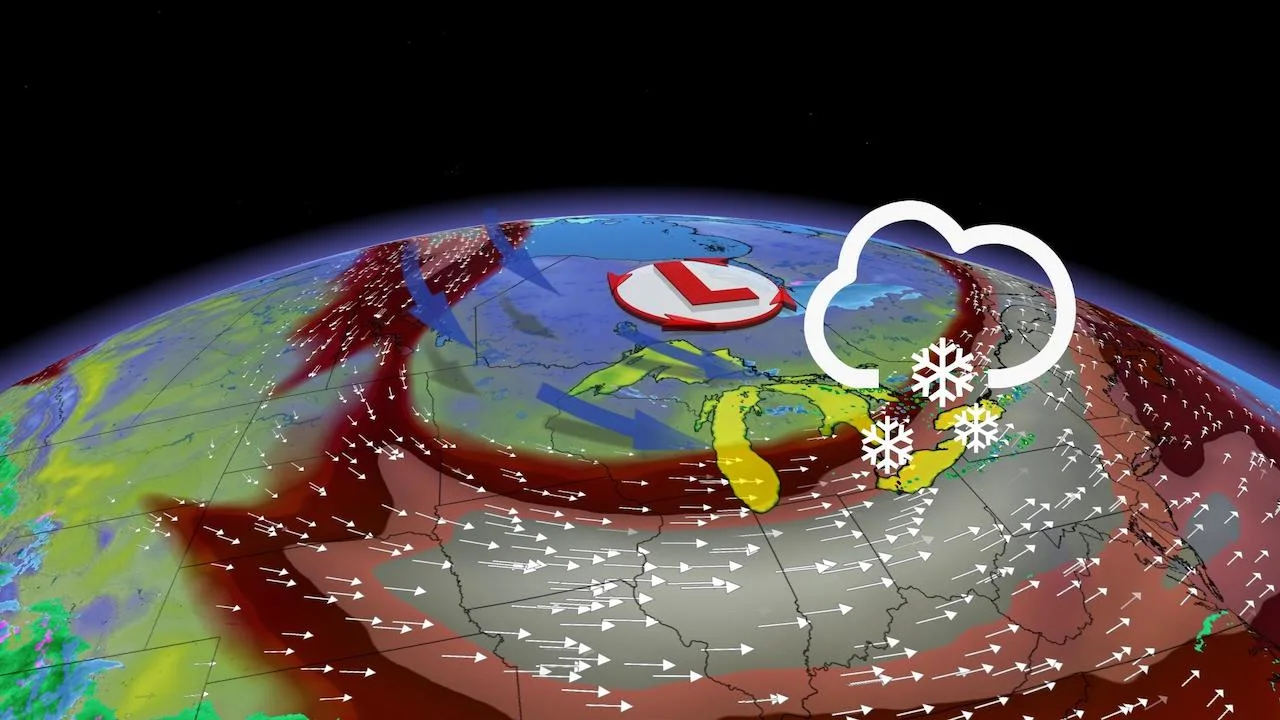
Arctic air spilling into parts of Western and Central Canada will initiate lake-effect snow on Monday and areas from Manitoba to Lake Ontario will be impacted. The extent of the lake-effect bands will reach over 1,500 km and is due to the Arctic air filling an upper trough combined with many bodies of water having temperatures of 10°C or greater. See below for details and timing.
Visit our Complete Guide to Fall 2021 for an in-depth look at the Fall Forecast, tips to plan for it and much more!
LAKE-EFFECT SNOW COVERS TWO PROVINCES THIS WEEK
A ridge over Alberta has joined forces with a broad upper-level trough over Eastern Canada to funnel Arctic air into Manitoba and northern Ontario. Additionally, temperatures of -10°C to -15°C at roughly two kilometres altitude is drawing ample moisture from the relatively warm waters of central Manitoba and northern Ontario.
This means that parts of Manitoba and northwestern Ontario will see lake-effect squalls on Monday. The eastern shores of Lake Superior will see mixing along Highway 17, while the heaviest snow will be confined to higher elevations away from the lake.

Most areas will see just 1-2 cm of snow, but the southeastern shores of lakes Winnipeg, Manitoba, Seul, Nipigon and Lake of the Woods could see 5-10 cm locally.
The upper level trough will bring windy conditions to much of southern Ontario on Monday in the 40-60 km/h range.
The same Arctic air will then trickle south into central Ontario during the overnight hours on Monday with lake-effect showers beginning to transition to snow primarily east of Muskoka and the Dundalk Highlands.
This pattern will linger over the Great Lakes for the first week of November, keeping temperatures below seasonal, as well as keeping significant systems at bay.

"Associated with this is a pool of Arctic air, we have all that heavy rain in Eastern Canada, [which will] be moving north. This cold air is going to be replacing it," says Kevin MacKay, a meteorologist at The Weather Network.
For the traditional snowbelt areas east and southeast of the Great Lakes, the first measurable snowfall of the season is expected with the more persistent bands, especially across the higher terrain later on in the week.
Stay tuned to The Weather Network as we monitor the forecast in Manitoba and Ontario this week.