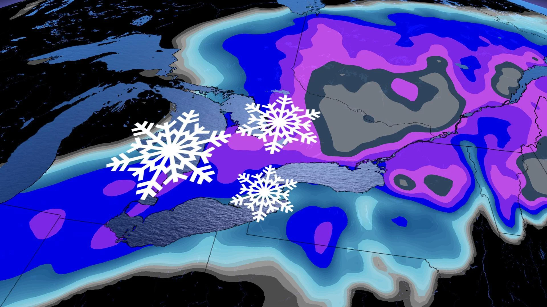
Ontario: Snowstorm will complicate travel, up to 25 cm possible in Ottawa

The relatively calm conditions will come to an end by Tuesday as a potent low pressure system will track into the region and will bring widespread snow.
The light snow that fell across southern Ontario overnight Monday will be a warmup for the incoming winter storm that could bring up to 25 cm to parts of the region. Widespread special weather statements warn of the incoming snow and also state that wind gusts could significantly reduce visibility on the roads and could complicate travel. What you need to know about the unsettled weather, below.
SPRING FORECAST: The Weather Network will release its seasonal outlook on Wednesday, February 26. Be sure to check back to see what Spring 2020 has in store!
WEATHER HIGHLIGHTS
Accumulating snow on Tuesday night and into early Wednesday
Wide range in snow accumulations, but heavy totals likely for central and eastern Ontario, including Ottawa
Mild temperatures return early next week
Keep track of active weather alerts in your area
TUESDAY/WEDNESDAY: MORE PERIODS OF SNOW
The light rain and snow will end during the early hours of Tuesday and temperatures will later peak slightly above zero.
The relatively calm conditions will then come to an end as a potent low pressure system will track into Ontario and will bring widespread snow across the region.
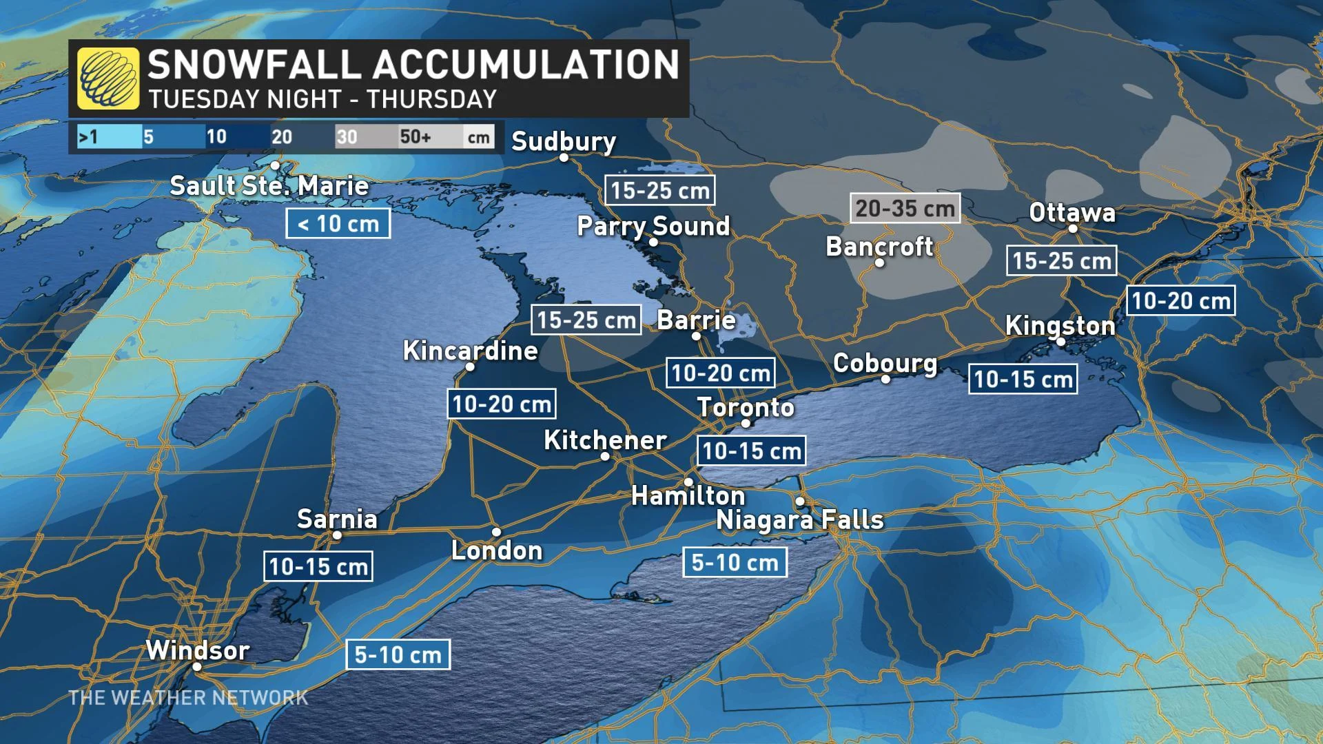
"A wide range in snowfall totals is expected across southern Ontario through Wednesday," Gillham says. "At this point we expect 10-20 cm along and south of the 401, but totals will increase to the north and east with 15 to 30+ cm of snow extending from central and northeastern Ontario to southern Quebec, including Muskoka, Ottawa and Montreal."
HIGH SNOWFALL RATES FOR AREAS NEAR AND AROUND OTTAWA
THURSDAY INTO THE WEEKEND: MUCH COLDER TEMPERATURES WITH SIGNIFICANT LAKE-EFFECT SNOW
Temperatures will fall significantly by Thursday as daytime highs remain below the freezing mark.
The combination of tumbling temperatures and gusty winds will help to stir up lake-effect snow for the traditional snow belt areas, but with bursts of heavier snow also likely to extend into parts of the GTA as well.
"In a season that hasn't really had a lot of impactful lake-effect snow, this will likely be one of the most significant lake-effect snow events for the region," says Gillham.
The colder weather will last well into the weekend making for a much more wintry end to the month of February. Occasional flurries and lake-effect snow will also continue for parts of Saturday.
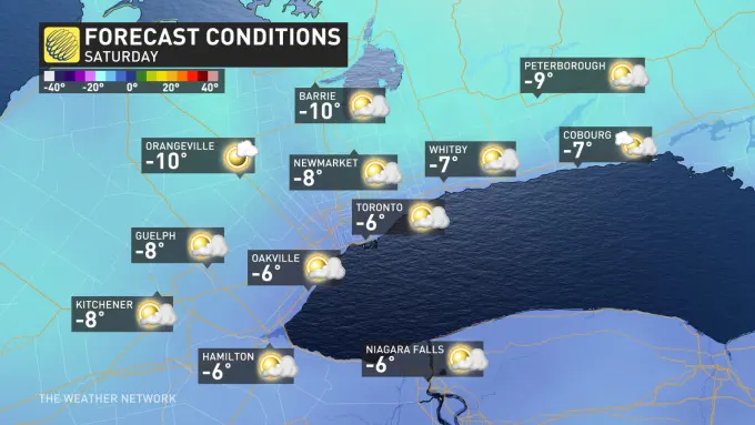
As we kick of the official month of spring however, milder weather looks to return as temperatures crack out of the freezing zone through early March next week.
READ: Say goodbye to salt stains with this game-changing trick
Check back as we continue to monitor the forecast across southern Ontario.